Aliso Viejo, California
Looking for the best photography in Aliso Viejo? We've got you covered with the top trails, trips, hiking, backpacking, camping and more around Aliso Viejo. The detailed guides, photos, and reviews are all submitted by the Outbound community.
Top Photography Spots in and near Aliso Viejo
-
Mount Baldy, California
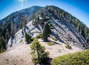
Sunset Peak via South Trailhead
4.07.16 mi / 1493 ft gainIn order to get to the Sunset Peak Trailhead, utilize Google Maps to take you to the location provided. There is very little parking (only a small pull off along Glendora Ridge Road), but this trail is rarely traveled, so there should be enough space regardless of the time you decide to hike! Jus...Read more -
La Verne, California
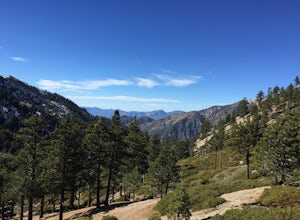
Cattle Canyon Trail
6.7 mi / 1066 ft gainWithin the San Gabriel Mountains from Highway 39 and along East Fork Road is Cattle Canyon. To go through Cattle Canyon, you can access the trail head just south of the Bridge to Nowhere trail head along East Fork Road right after it intersects with Glendora Mountain Road. There is a small parkin...Read more -
Los Angeles, California
Secret Swing in Elysian Park
4.20.16 mi / 360 ft gainFor the most direct directions to the swing, plug in "Swing on top of Elysian Park" into google maps, which will take you directly to the trailhead. If you want to do it the more old fashion way, the swing is on top of a hill at the intersection of Angels Point Drive and Park Row Drive in Elysian...Read more -
Los Angeles, California
Echo Park Lake
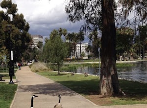
3.00.98 mi / 0 ft gainEcho Park Lake in Los Angeles has a loop that is about 1 mile around. It’s a pretty busy park, that has ducks and geese everywhere. Beautiful lotus blossoms and iris flowers in the lake. Generally flat and one tiny incline that can easily be avoided. You can also rent swan paddleboats that light ...Read more -
Mount Baldy, California
Summit Mt. Baldy
4.812.12 mi / 5958 ft gainLocated only an hour’s drive from Los Angeles is the top of highest mountain in LA County—at 10,064 feet. Bear Flat Trail (also called the Old Mt. Baldy Trail) offers some of the finest scenery and most rewarding views in the San Gabriel Mountains high country. With nearly 6000 ft of elevation g...Read more -
Arcadia, California
Hermit Falls Trail
4.82.49 mi / 1014 ft gainNote: Hermit Falls is Temporarily Closed From Roberts Camp, many hikers will head to Sturtevant Falls, which is an amazing 60-foot waterfall. But, if you choose to head in the opposite direction on First Water Trail, you’ll be rewarded with a fresh water swimming hole at this 35-foot tumbling wa...Read more -
Arcadia, California
Mt. Wilson Loop from Chantry Flat
5.012.74 mi / 4852 ft gainMt. Wilson is one of the more difficult mountains in the San Gabriel to hike, making this adventure Intermediate. While 5,700 feet doesn't seem that tall, the mountain has a prominence of almost 5,300 feet, meaning that hike is steeper and longer than some of the other popular mountains that star...Read more -
Solana Beach, California
Annie’s Canyon Trailhead
4.72 mi / 100 ft gainIf you're looking for a super short hike, this 10 minute flat walk couldn't be more ideal. Start at 840 N Rios Avenue, Solana beach and walk east towards the FWY 5 where you will see Annie’s Canyon on your right. There is only one way to go up the canyons and it gets pretty tight in places, but y...Read more -
Pasadena, California
Lower Arroyo Seco Loop
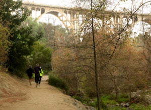
4.02.88 mi / 230 ft gainNestled next to the CA-134, this trail presents a relaxing atmosphere while only a 30 minute drive from Downtown Los Angeles and a 5 minute drive from Old Town Pasadena. From bird-watching to archery, this trail provides a peaceful atmosphere with no lapse in beauty. The trail which is around 1....Read more -
Escondido, California
Lake Hodges Overlook
4.66.73 mi / 1407 ft gainElfin Forest is one of the most beautiful and unique trails in all of San Diego, CA. The parking is free as well as the overflow parking area. There is an Interpretive Center located in the staging area where you can speak to park rangers, learn about the wildlife and trail locations. The parking...Read more -
Pasadena, California
Eaton Canyon Falls via Eaton Canyon Trailhead
4.23.54 mi / 528 ft gainThe hidden forty-foot-tall Eaton Canyon Falls fills an amphitheater at the top of Eaton Canyon Trail, tumbling into a wide pool that you can rest alongside or wade in. Normally the water is waist deep, but during this recent trip, we found the water only to stop at our ankles as it tends to fluct...Read more -
Mount Baldy, California
Cucamonga Peak via Icehouse Canyon
4.611.13 mi / 4157 ft gainStart hiking early, before the sun rises so you can maximize the day out of the heat and to give yourself plenty of time for the hike. As you get to higher elevations, it will be a little cooler and there might be snow on the ground, so be sure to pack layers. This hike requires a permit. If yo...Read more -
Mount Baldy, California
Icehouse Saddle via Icehouse Canyon Trail
3.86.62 mi / 2562 ft gainThe hike is accessible in all seasons, but in winter there can be snow and ice so special equipment may be useful, but not required. In mid-January there were patches of ice on the trail but were easily crossed in boots and trainers. You can take the trail and end at Ice house Saddle or continue ...Read more -
Los Angeles, California
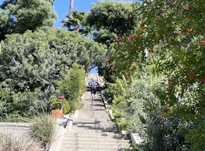
Mattachine Steps
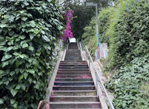
5.00.09 mi / 52 ft gainThe Mattachine Steps, also known as the Cove Avenue stairway, is dedicated to the Mattachine Society (The name was taken from a medieval French secret society that set out to right wrongs.) in 2012 in memory of Harry Hay, who cofounded the gay rights group. Right along this stairway is a small ho...Read more -
Los Angeles, California
Piano Mural Staircase aka “Murray Staircase”
5.00.08 mi / 69 ft gainThe “Piano Stairs” is a stair mural in Silver Lake neighborhood section of LA. Not to be confused with the “Music Box” staircase that is close by. These 90 steps were painted to look like the piano keyboard by the artist Carrey. Great for a cardio workout and not as creepy as some of the stairs h...Read more -
Los Angeles, California
Micheltorena Stairs
3.00.19 mi / 75 ft gainI preferred the steps, before anything was painted on them. Whoever thought it would be a great idea to do that was wrong. No upkeep and these stairs have been heavily vandalized. The steps are a series of stairways you will find throughout Silver Lake and neighboring areas. They facilitated peo...Read more


