Mount Judea, Arkansas
Top Spots in and near Mount Judea
-
Compton, Arkansas
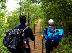
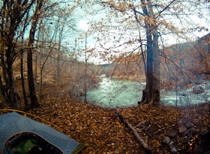
Backpacking Along the Buffalo River
5.012 miPark at the Centerpoint Trailhead and follow the Centerpoint trail as it heads about 3 miles downhill towards Big Bluff. You’ll know you’ve reached the trail junction for Big Bluff when you come to a clearing that has a large firepit in the middle and a small unmaintained trail heading off to the...Read more -
Compton, Arkansas
Centerpoint to Goat Trail
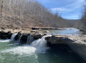
5.82 mi / 1001 ft gainCenterpoint to Goat Trail is an out-and-back trail that takes you by a river located near Ponca, Arkansas.Read more -
Compton, Arkansas
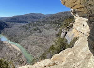
Big Bluff via the Centerpoint Trailhead
4.96.21 mi / 991 ft gainThis adventure begins at the Counterpoint Trailhead just north of Ponca, AR. Follow the trail downhill for about 2.7 miles until you reach a split in the trail. Take the trail off to the right and follow it for another .5 miles until you reach the Big Bluff area. There is a lot of area to expl...Read more -
Compton, Arkansas
Hike to Scenic Big Bluff
5.06 miThe hike starts at the Centerpoint Trailhead and follows a clearly defined trail for 3 miles (approximately one hour) with mostly downhill or flat terrain and views through the trees of the rolling Ozark landscape. When you are almost to Big Bluff, the trail opens up into a large round area with ...Read more -
Jefferson Township, Arkansas
Hike the Glory Hole Falls Trail
4.42 mi / 345 ft gainThis trail and waterfall is located 13.8 miles south of Boxley, AR or 5.7 miles east of Fallsville, AR. The easiest way to get to the trailhead is to locate the Cassville Baptist Church on your GPS system. If you are headed east, the church is 0.7 miles east of the trail. If you are headed west, ...Read more -
Hagarville, Arkansas
Pam's Grotto Trail
4.00.92 mi / 384 ft gainGetting to this trailhead is the most difficult part. The small parking area/campground is located about a half mile east of the Haw Creek Falls Campground. You will see a pull off on the east side of the road where you can park your car. Once you are ready to hit the trail you will cross the ro...Read more -
Hagarville, Arkansas
Haw Creek Falls Trail
5.00.18 mi / 33 ft gainHaw Creek Falls Trail is an out-and-back trail that takes you by a waterfall located near Hagarville, Arkansas.Read more -
Kingston, Arkansas
Hike to Sweden Creek Falls
4.01.5 miProceed to Sweden Creek Falls Natural Area near Kingston, Arkansas. Find somewhere to park near the gate along the dirt road. The trailhead is located beside the gate. Follow the old jeep path and continue past the old abandoned house on the right. Once the path ends, look for the blue trail m...Read more -
Kingston, Arkansas
Backpack Along Whitaker Creek
5 miAfter arriving at the Whitaker Point/Hawksbill Crag trailhead, start going down the path for about 1/8th of a mile. You’ll cross a small stream, and here is where you’ll turn off the trail. Using Whitaker Creek as your guide, follow it like a handrail as it descends down into the confluence with ...Read more -
Kingston, Arkansas
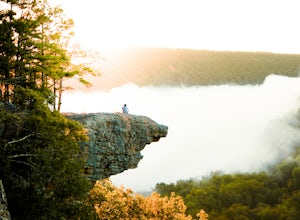
Hawksbill Crag via Whitaker Point Trail
4.52.68 mi / 594 ft gainHawksbill Crag aka Whitaker Point is one of the most popular hiking spots in all of Arkansas and only ~60 miles from Fayetteville. However, doing the hike early in the morning provides one of the best places of all time to watch a sunrise. You begin at the trail marker which is straight across ...Read more -
Kingston, Arkansas
Neil Compton's Double Falls
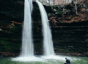
4.02.15 mi / 404 ft gainThe parking area for Neil Compton’s Double Falls is approximately 1.1 miles past the trailhead for Hawksbill Crag on Cave Mountain Road. Cave Mountain Road is steep and can get pretty muddy after a good rain. A vehicle with 4WD is recommended although plenty of people make it up in small cars. ...Read more -
Witter, Arkansas
Kings River Falls Trail
5.01.89 mi / 141 ft gainKings River Falls Trail is an out-and-back trail that takes you by a waterfall located near Witter, Arkansas.Read more -
Huntsville, Arkansas
Kings River Overlook
5.01.2 mi / 145 ft gainThis is a great family hike short enough for little ones but with enough features to keep little ones engaged. From the parking area, it's about .6 miles on a relatively flat, well-marked trial to the overlook. (Plenty of room to step off trail for social distancing) We went in April with thre...Read more -
Flippin, Arkansas
Fly Fish the White River
5.0Spend a week or weekend trout fishing on the world famous White River, located in north central Arkansas.The White River is a tailwater of Bull Shoals Lake, and is known worldwide as the “Capital of Trout Fishing.” Its beautiful banks are lined with fishing resorts that offer cabins, boat rentals...Read more -
Huntsville, Arkansas
Tea Kettle Falls Trail
3.22.97 mi / 289 ft gainFinding Tea Kettle Falls is the most challenging part of this adventure. The trailhead is located in the McIlroy-Madison County Wildlife Management Area in northwest Arkansas. From Forum, travel 6.5 miles north on Hwy 23 to gravel road #447. It is approximately 13 miles south of Eureka Springs ...Read more -
Dardanelle Township, Arkansas
Camp at Mount Nebo SP
4.0Mount Nebo State Park is just 12 miles southwest of Russellville, AR, home of Arkansas Tech University. With its proximity to the university and other large cities, it makes visiting Mount Nebo an easy trip. The last few miles on Country Road 155 takes you through switch backs up the mountain, an...Read more

