Hagarville, Arkansas
Looking for the best hiking in Hagarville? We've got you covered with the top trails, trips, hiking, backpacking, camping and more around Hagarville. The detailed guides, photos, and reviews are all submitted by the Outbound community.
Top Hiking Spots in and near Hagarville
-
Harrison, Arkansas
Backpacking Cecil Creek
5.08 miFrom Tulsa, head out east along US-412 until you reach HWY 103. Take a right (south) on HWY 103 and follow it toward Compton, Arkansas. Shortly before reaching Compton, take the dirt road on the right (before the road starts to head north), and follow the road south. Keep on it as it bends to the...Read more -
Harrison, Arkansas
Hike to Hideout Hollow
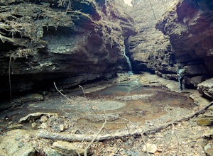
4.02 miAfter parking at the trailhead, head down the well-trodden path and follow it the 0.85 miles downhill to the overlook. Once you are at the overlook, go left and follow the path as it loops around the top of the overhang. You’ll arrive at a small creek (which creates the waterfall that flows into ...Read more -
Compton, Arkansas
Centerpoint to Goat Trail
5.82 mi / 1001 ft gainCenterpoint to Goat Trail is an out-and-back trail that takes you by a river located near Ponca, Arkansas.Read more -
Compton, Arkansas
Backpacking Along the Buffalo River
5.012 miPark at the Centerpoint Trailhead and follow the Centerpoint trail as it heads about 3 miles downhill towards Big Bluff. You’ll know you’ve reached the trail junction for Big Bluff when you come to a clearing that has a large firepit in the middle and a small unmaintained trail heading off to the...Read more -
Compton, Arkansas
Big Bluff via the Centerpoint Trailhead
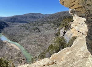
4.96.21 mi / 991 ft gainThis adventure begins at the Counterpoint Trailhead just north of Ponca, AR. Follow the trail downhill for about 2.7 miles until you reach a split in the trail. Take the trail off to the right and follow it for another .5 miles until you reach the Big Bluff area. There is a lot of area to expl...Read more -
Compton, Arkansas
Hike to Scenic Big Bluff
5.06 miThe hike starts at the Centerpoint Trailhead and follows a clearly defined trail for 3 miles (approximately one hour) with mostly downhill or flat terrain and views through the trees of the rolling Ozark landscape. When you are almost to Big Bluff, the trail opens up into a large round area with ...Read more -
Compton, Arkansas
Hemmed In Hollow Falls via Hemmed In Hollow Trail
5.05.78 mi / 1572 ft gainAfter parking at the Hemmed In Hollow Falls Trailhead, follow the path down as it descends into the valley. As you approach one of the vistas, you’ll be able to spot the emerald green waters of the Buffalo River, as well as the bluffs to your east where the waterfall hides. After reaching the va...Read more -
Harrison, Arkansas
Hike to Paige Falls and Broadwater Hollow Falls
5.00.5 mi / 100 ft gainAlthough there is no official trailhead, Paige and Broadwater Hollow Falls can be accessed off of NC 2660 in Compton, Arkansas. Once on NC 2660, head straight down this rugged gravel road for approximately 2 miles. Soon you’ll reach a sharp bend to the left with a small parking area just before...Read more -
Dardanelle Township, Arkansas
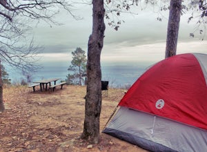
Camp at Mount Nebo SP
4.0Mount Nebo State Park is just 12 miles southwest of Russellville, AR, home of Arkansas Tech University. With its proximity to the university and other large cities, it makes visiting Mount Nebo an easy trip. The last few miles on Country Road 155 takes you through switch backs up the mountain, an...Read more -
Dardanelle Township, Arkansas
Rim Trail and Bench Trails Loop
7.6 mi / 702 ft gainI did two loop trails (Rim Trail and Bench Trail). Mileage reflects combination of both trails plus the distance hiking between the two near sunset point. Cost to camp in a hike-in site is ~$13/night. You can't reserve a hike-in spot in advance, but they are very under utilized. I'm pretty sure ...Read more -
Dardanelle, Arkansas
Hike the Rim Trail at Mount Nebo SP
3.03.57 mi / 226 ft gainThe official trailhead for the Rim Trail can be found on the north side of Country Rd 92, but it seems to be much easier to start the hike right behind the visitors center. There is more parking spaces and you can purchase any last minute items you may have forgotten before you start. To find the...Read more -
Winslow, Arkansas
White Rock Rim Trail
5.02.08 mi / 335 ft gainThe trail around the Rim of White Rock Mountain is one of the best trails for vantage points. Nestled in the beautiful Boston Mountains in north central area of Arkansas. The White Rock Rim trail is an easy 2 mile loop trail that is moderately hiked year round. Start at the parking area and he...Read more -
Mulberry, Arkansas
Backpack along Hurricane Creek
6 miAfter arriving at the trailhead near the Shores Lake Campground (there is a $3 parking fee, so bring cash), head along the path and go west at the T-junction. Continue going west/northwest and you’ll cross over a forest road. Stay on the trail as it gradually descends, then veer off-trail to the ...Read more -
Morrilton, Arkansas
Camp at Petit Jean SP
Located between Ft. Smith and Little Rock, just south of Interstate 40, you will find the state treasure that is Petit Jean State Park. Its central location makes it very easy for any one to visit. The main hub of the State Park is the beautiful Mather Lodge, which has a rooms to rent, a restaura...Read more -
Morrilton, Arkansas
Cedar Falls
4.82.01 mi / 305 ft gainWhen I did this hike it was unbelievable. This entire valley looks like something out of a painting. If at all possible, I recommend that you plan your trip around the rain, because after a heavy rain the valley is full of waterfalls.Getting there: Cedar Falls is located in Petit Jean State Park ...Read more -
Morrilton, Arkansas
Hike the Seven Hollows Trail at Petit Jean SP
5.04.5 miStart the trail at the marked Seven Hollows Trailhead just off of Petit Jean Mountain Road- there's a small parking lot and signage board. The path is dog-friendly, with lots of springtime stream crossings and swimming opportunities. You can choose to take the 4-mile loop trail in either directi...Read more

