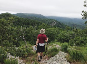
The Best Camping in Caddo Gap
Looking for the best camping in Caddo Gap? We've got you covered with the top trails, trips, hiking, backpacking, camping and more around Caddo Gap. The detailed guides, photos, and reviews are all submitted by the Outbound community.
Top camping spots in and near Caddo Gap
-
Mount Ida, Arkansas
Lake Ouachita Vista Trail: Homestead Trailhead to Shangri La Drive
4.39 mi / 781 ft gainLake Ouachita Vista Trail: Homestead Trailhead to Shangri La Drive is an out-and-back trail that takes you by a river located near Mount Ida, Arkansas.Read more -
Umpire, Arkansas
Viles Branch Equestrian Trail
25.79 mi / 2290 ft gainViles Branch Equestrian Trail is a loop trail that takes you by a waterfall located near Umpire, Arkansas.Read more -
Caddo Gap, Arkansas
Backpack the Eagle Rock Loop
5.026 miLocated in Ouachita National Forest, Eagle Rock Loop is Arkansas' longest loop, perfect for a 3-4 day backpack. There are multiple places to begin this trip, as there are 4 trailheads along the route; (1) Albert Pike Recreation Area, (2) Little Missouri Falls on Forest Road 25, (3) 4 miles west o...Read more -
Umpire, Arkansas
Winding Stairs Trail
4.5 mi / 446 ft gainWinding Stairs Trail is an out-and-back trail that takes you by a waterfall located near Caddo Gap, Arkansas.Read more -
Caddo Gap, Arkansas
Little Missouri Trail
11.35 mi / 945 ft gainLittle Missouri Trail is an out-and-back trail that takes you by a waterfall located near Caddo Gap, Arkansas.Read more -
Umpire, Arkansas
Athens-Big Fork Trail
17.95 mi / 4692 ft gainAthens-Big Fork Trail is an out-and-back trail that takes you by a waterfall located near Mena, Arkansas.Read more -
Murfreesboro, Arkansas
Little Missouri River Trail
2.12 mi / 138 ft gainLittle Missouri River Trail is a loop trail that takes you by a river located near Murfreesboro, Arkansas.Read more -
Royal, Arkansas
Ouachita Geo-Float Trail
13 mi / 200 ft gainOuachita Geo-Float Trail is a point-to-point trail that takes you by a lake located near Royal, Arkansas.Read more -
Bismarck, Arkansas
DeGray Lake Island Trail
1.07 mi / 131 ft gainDeGray Lake Island Trail is a loop trail that takes you by a lake located near Arkadelphia, Arkansas.Read more -
Arkadelphia, Arkansas
Iron Mountain Blue Trail
2.93 mi / 436 ft gainIron Mountain Blue Trail is a loop trail that takes you by a lake located near Arkadelphia, Arkansas.Read more -
Hot Springs, Arkansas
Hot Springs Sunset Trail Full Circle
12.68 mi / 1821 ft gainHot Springs Sunset Trail Full Circle is a loop trail where you may see local wildlife located near Hot Springs National Park, Arkansas.Read more -
Jessieville, Arkansas
Hunt's Loop Trail
4.17 mi / 741 ft gainHunt's Loop Trail is a loop trail that takes you by a river located near Jessieville, Arkansas.Read more -
Fenter Township, Arkansas
Camp at Lake Catherine State Park
Lake Catherine State Park offers fully-equipped cabins, over 60 tent and RV campsites, and a small marina selling everything you need for a perfect day on the lake. The beautiful tree covered campground offers a swimming beach, picnic sites, playgrounds and hiking trails. The park also offers int...Read more