Bellah Mine
Book this listing through our partner Recreation Gov
About Bellah Mine
Overview
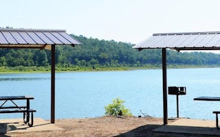
Bellah Mine Campground sits along the shores of DeQueen Lake in southwest Arkansas.Recreation
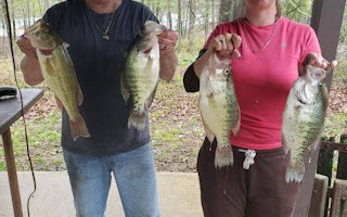
Boating and water sports top the list of recreational activities at the lake, and several boat ramps are provided for campers.Fishing is also a popular pastime, with large mouth bass, small mouth bass, spotted pass, black and white crappie, channel and flathead catfish and various species of sunfish available in abundance. The Arkansas Game and Fish Commission have also stocked hybrid striped bass in the lake.
There are plenty of opportunities for hunting on the lands around the lake. Except for developed recreation areas and lands in the vicinity of the dam, all project lands are open to the public for hunting. Game species include bobwhite quail, mourning dove, turkey, fox squirrel, gray squirrel, cottontail rabbit and deer.
Although DeQueen Lake does not have a designated hiking trail, the vast expanse of land is open to the public and hiking activities are welcomed anywhere on project lands.
Facilities
Bellah Mine Campground offers 24 spacious campsites, along with one large reservable group picnic shelter. Campsites include modern amenities like flush toilets, showers and drinking water.Natural Features
DeQueen Lake is part of a dam project located on the Rolling Fork River. The dam, completed in 1977, was built for flood control and water supply, and now provides a recreational oasis for thousands of campers each year.The lake boasts 32 miles of shoreline to its visitors, along with 8,700 acres of rolling green landscape.
Nearby Attractions
The nearby town of DeQueen, Arkansas, offers gas, grocery and medical services.Bellah Mine Reviews
Have you stayed here? Be the first to leave a review!
Top Spots in or near De Queen
Cedar Bluff Nature Trail
Broken Bow, Oklahoma
5.0
0.83 mi
/ 138 ft gain
Cedar Bluff Nature Trail is a loop trail that takes you by a river located near Broken Bow, Oklahoma.
Explore the Lower Mountain Fork River, Beavers Bend SP
Broken Bow, Oklahoma
5.0
Beavers Bend State Park in Broken Bow, Oklahoma is known for its captivating foliage in the fall; however, another distinct feature that it offers is the Lower Mountain Fork River. The Mountain Fork River is accessible via Highway 259-A off of U.S. 259. The lower part of the river winds through Beavers Bend State Park for about 5 miles with Presbyterian Falls in the southern portion and flowing...
Camp at Reasoner Point
Broken Bow, OklahomaReasoner Point is located in Hochatown State Park along the shoreline of Broken Bow Lake. Hochatown was originally part of Beaver's Bend State Park but later separated to meet the growing needs of people who wish to use Lake. In addition to being on the lake, it's also situated in Ouachita National Forest and offers an amazing place for fall foliage camping.There are many campsites within the s...
Backpack the Eagle Rock Loop
Caddo Gap, Arkansas
5.0
26 mi
Located in Ouachita National Forest, Eagle Rock Loop is Arkansas' longest loop, perfect for a 3-4 day backpack. There are multiple places to begin this trip, as there are 4 trailheads along the route; (1) Albert Pike Recreation Area, (2) Little Missouri Falls on Forest Road 25, (3) 4 miles west of Little Missouri Falls on Forest Road 25, (4) East of Bard Springs Recreation Area on Forest Road 1...
Hike to Little Missouri Falls
Mena, Arkansas
4.0
0.25 mi
This beautiful waterfall in the Ouachita National Forest is only a short distance along Little Missouri Trail. There is a picnic area by the parking lot, as well.
Add on the nearby Crooked Creek Falls to your day for another photo-worthy stop.
Drive the Talimena Scenic Byway
Mena, Arkansas
4.3
The Talimena Scenic Byway is one of the highlights of the Ouachita National Forest. Running 54 miles along the crest of the Rich and Winding Stair Mountains, the drive is surprisingly easy and never boring. The whole drive is worth taking, but the Arkansas portion arguably has the most scenic portion(and much less arguably the smoothest roads).There are 17 vistas along the route and almost all ...
Camping and Lodging in De Queen
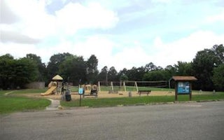
De Queen, Arkansas
Oak Grove
Overview
Oak Grove Campground sits along the shores of DeQueen Lake in southwest Arkansas. Recreation
Boating and water sports top the li...
De Queen, Arkansas
Pine Ridge
Overview
Pine Ridge Campground sits along the shores of DeQueen Lake in southwest Arkansas. Recreation
Boating and water sports top the l...
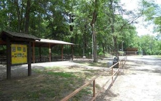
Gillham, Arkansas
Cossatot Reefs
Overview
Cossatot Reefs Campground sits along the lush banks of Gillham Lake in southwest Arkansas.Nicknamed the "Bright Spot on the Coss...
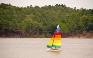
Gillham, Arkansas
Big Coon Creek
Overview
Big Coon Creek Campground sits along the lush banks of Gillham Lake in southwest Arkansas.Nicknamed the "Bright Spot on the Coss...
Grannis, Arkansas
Little Coon Creek Park
Overview
Little Coon Creek Campground is located on Gillham Lake in southwestern Arkansas on the Cossatot River. The rugged terrain aroun...
Dierks, Arkansas
Jefferson Ridge
Overview
Jefferson Ridge Campground is located on Dierks Lake in southwestern Arkansas. Rugged ridges bordering the lake create stunning ...
Unfortunately, we don't have up-to date pricing data for this listing, but you can check pricing through Recreation Gov.
Book NowAdd your business today to reach The Outbound's audience of adventurous travelers.
Community
© 2024 The Outbound Collective - Terms of Use - Privacy Policy


