Oracle, Arizona
Top Spots in and near Oracle
-
Tucson, Arizona
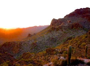
Catch a Sunset on "A" Mountain
4.00.3 mi / 250 ft gainIn 1910 a group of University of Arizona students took local basalt rock and constructed a 160' block "A" on the east face of Sentinel Peak overlooking Tucson, giving the prominent peak its most commonly known name. Now the area is part of the 272 acre Sentinel Peak Park, and features a great net...Read more -
Tucson, Arizona
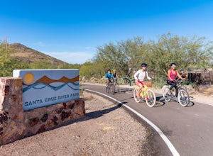
Bike The Loop at The Santa Cruz River Park
22 mi / 500 ft gainThe Loop is an in-development series of shared-use, hard-surface paths meant to connect all of Tucson by following the Santa Cruz River and its major tributaries. The Santa Cruz River Park contains 22 miles of The Loop (with another 40 in development) that runs along the western shore of the Sant...Read more -
Tucson, Arizona
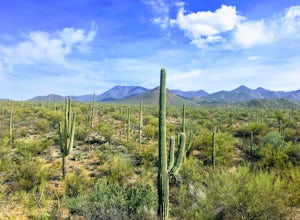
Hike to the Bowen Stone House via Bowen Trail
2.4 mi / 300 ft gainThe Tucson Mountains are home to Saguaro National Park and the Tucson Mountain Park, the latter of which is a massive 20,000 acre park that is home to huge forests of giant saguaro cacti, a wide diversity of desert wildlife, and several long-abandoned farms and ranches like the Bowen Homestead, c...Read more -
Tucson, Arizona
Catch The Sunset on Gates Pass
4.0Get on E Speedway Blvd, and follow it West until it turns into W Gates Pass rd. Follow this for 3 miles and the parking lot will be at the top of the pass. There are a few viewing platforms that offer shade from the desert heat. There are numerous trails that you can follow to get whatever view y...Read more -
Tucson, Arizona
Hike Signal Hill Trail
0.6 mi / 46 ft gainA popular trail in the Tucson Mountain District of Saguaro National Park, Signal Hill is a highlight of the park with a small summit to a boulder field with many petroglyphs and views for several miles. The petroglyphs date to the 13th and 14th centuries and were created by the Hohokam people. ...Read more -
Tucson, Arizona
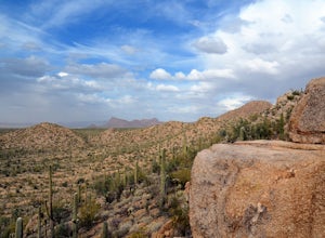
Hike the Valley View Overlook Trail in Saguaro National Park
5.00.8 miThe Valley View Overlook Trail is located in the Tucson Mountain District (which west of Tucson) of Saguaro National Park. The access to this trail is about 3 miles north from the Red Hills Visitor Center. From the visitor center travel 1.5 miles north on N. Kinney Road, then take a right on Hoh...Read more -
Tucson, Arizona
Summit Wasson Peak
5.07.4 miThis hike starts at the King Canyon Trailhead. You'll follow the King Canyon Trail along the wash then down into the wash near the picnic area. You won't be in the wash for long before the trail will turn off to the right out of the wash. This trail is very well signed. You'll continue along King...Read more -
Tucson, Arizona
Hike the Brown Mountain Trail
4.04.2 mi / 500 ft gainI really enjoyed this hike. I recommend doing the hike as an out and back from the Kinney Road parking area. Also, the best time to hike is just before sunset. The hike is just over 4 miles total out and back with only about 500 feet of elevation gain. It has a climb at the beginning then rolls a...Read more -
Tucson, Arizona
Hike the Hugh Norris Trail, Saguaro National Park
4.09.5 mi / 2000 ft gainNamed for a Native American police chief, the Hugh Norris trail takes you from lush (by desert standards) Saguaro and cholla forests to the top of rugged Wasson Peak. On top of the peak, you'll have sweeping views of the city of Tucson, as well as the surrounding mountain ranges. Depending on y...Read more -
Picacho, Arizona
Hike Picacho Peak's Hunter Trail
5.04 mi / 1400 ft gainIf you've ever done the drive on highway10 from Phoenix to Tucson, you've definitely noticed an intriguing looking mountain peak about an hour into the drive. It broadly rises from the earth and tapers off into a point at the top, appearing like an illustration straight out of a Dr. Seuss book. ...Read more -
Picacho, Arizona
Photograph the Wildflowers at Picacho Peak State Park
4.0If Arizona is lucky enough to have a rainy winter, we will most certainly have a beautiful bloom come spring. One of the best places to see the beautiful golden blooms is on a hike in Picacho Peak State Park. Blooming season typically begins in mid/late February. Length depends on temperature –...Read more -
Campground Loop B, Arizona
Camp at Picacho Peak State Park
3.1 mi / 800 ft gainDrive about 30 minutes west on I-10 from Tucson, AZ to the Picacho Peak Rd. Exit and follow the signs south to the park entrance. The campgrounds are about a half mile inside the main gate to the right.You can either make a reservation at Pichacho Peak State Park or arrive the day of and pay. Eve...Read more


