Mayer, Arizona
Top Spots in and near Mayer
-
Cordes Lakes, Arizona
Crown King OHV Trail
4.024.85 mi / 3497 ft gainCrown King OHV Trail is a point-to-point trail that takes you past scenic surroundings located near Mayer, Arizona.Read more -
Prescott, Arizona
Hike Lynx Lake
4.83.52 mi / 182 ft gainStarting at the parking lot, you will have to pay your dues prior to beginning your hike. You will immediately be met with fresh air and refreshing summer temperatures. A short decent down will lead you to the first trail marker, which the 55-acre lake becomes the centerpiece of your view. At thi...Read more -
Black Canyon City, Arizona
Hike the Badger Spring Wash Trail
3.54 miBadger Spring Wash is a dry stream bed most of the year. This trail starts from the Badger Spring Trailhead just off Route 17 north from Phoenix. The trail follows the stream bed, sometimes in or along side for 1.5 miles. At about one mile, you reach the spring and a good amount of water which is...Read more -
Black Canyon City, Arizona
Badger Springs Wash Trail
5.01.48 mi / 98 ft gainBadger Springs Wash Trail is an out-and-back trail that takes you by a waterfall located near Cordes Junction, Arizona.Read more -
Black Canyon City, Arizona
Richinbar Mine and Pueblo Trail
5.02.36 mi / 92 ft gainRichinbar Mine and Pueblo Trail is a loop trail where you may see beautiful wildflowers located near Crown King, Arizona.Read more -
Black Canyon City, Arizona
Government Springs Trail
5.011.04 mi / 741 ft gainGovernment Springs Trail is a loop trail that takes you by a river located near Mayer, Arizona.Read more -
Black Canyon City, Arizona
Zig Zag Trail
3.04.61 mi / 436 ft gainZig Zag Trail is a loop trail that takes you by a river located near Canyon City, Arizona.Read more -
Black Canyon City, Arizona
Castle Creek Road to Cleator
4.010.59 mi / 1677 ft gainCastle Creek Road to Cleator is a point-to-point trail where you may see beautiful wildflowers located near Black Canyon City, Arizona.Read more -
Prescott, Arizona
Watson Lake and Flume Trail Loop
4.63 mi / 381 ft gainThe Watson Lake and Flume Trail is a 4.5 mile loop hike that takes you next to Watson Lake near Prescott, AZ. This trail also makes for a great workout if you throw on your running shoes. Keep in mind there is no shade, so pack water and sunscreen accordingly. Thinking about getting on the wate...Read more -
Prescott, Arizona
Camp at Watson Lake in Prescott
3.0Camping sites are only available in the summer months but the park is explorable year round! Watson Lake is a very unique place, in a state primarily made up of sandstone lies a lake surrounded by uniquely shaped Granite Boulders, excellent for hiking, rock climbing and photographing! Be sure to ...Read more -
Prescott, Arizona
Kayak at Watson Lake
5.0Watson lake is relatively small so it makes a great place for beginners to kayak. One end of the lake is surrounded by large granite dells. Depending on the water levels you can kayak around and in between many of them. We kayaked around for about 2 hours before we felt like we had seen everythin...Read more -
Camp Verde, Arizona
Copper Canyon Loop Trail 504
5.03.75 mi / 384 ft gainCopper Canyon Loop Trail 504 is a loop trail that takes you by a waterfall located near Camp Verde, Arizona.Read more -
Mayer, Arizona
Verde Rim Loop Trail
14.32 mi / 2631 ft gainVerde Rim Loop Trail is a loop trail where you may see beautiful wildflowers located near Camp Verde, Arizona.Read more -
Prescott, Arizona
Giant Alligator Juniper Trail
4.69 mi / 495 ft gainGiant Alligator Juniper Trail is an out-and-back trail that takes you past scenic surroundings located near Prescott, Arizona.Read more -
Black Canyon City, Arizona
Explore Pueblo La Plata
0.25 miPueblo La Plata is the largest ancient Indian ruin in Agua Fria National Monument and dates back to before 1200 A.D. The ruin at one time had 80 to 90 rooms for living quarters. Now the sight seems like just a pile of rubble. However there is significant research continuing on the mesa of Agua Fr...Read more -
Camp Verde, Arizona
McDonald Trail
4.00.83 mi / 351 ft gainMcDonald Trail is an out-and-back trail that in Coconino National Forest located near Camp Verde, Arizona.Read more
Top Activities
Camping and Lodging in Mayer
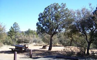
Walker Road
Lynx Campground
Overview
Lynx Campground is located in the Lynx Lake Recreation Area at 5,600 feet in elevation. Within 1/4 mile of the popular Lynx Lak...
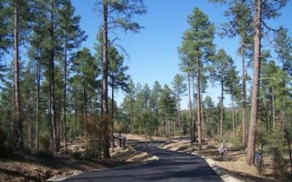
Prescott, Arizona
Eagle Ridge Group Campground
Overview
Eagle Ridge Group Campground sits within a tall ponderosa pine forest of Prescott National Forest. The site lies in the Bradshaw...
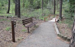
Prescott, Arizona
Groom Creek Schoolhouse
Overview
Built in 1902, this historic schoolhouse and adjacent picnic area in Arizona's Prescott National Forest may be reserved for day ...
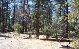
Prescott, Arizona
Groom Creek Horse Camp
Overview
Equestrian campers will find Groom Creek Horse Camp seven miles south of Prescott, Arizona at an elevation of 6,398 feet. The p...
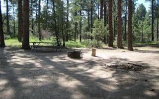
Prescott, Arizona
Upper Wolf Creek Group
Overview
Upper Wolf Creek Group Campground provides a quiet forest setting for groups of up to 100 people to camp and enjoy the outdoors....

Mayer, Arizona
Sycamore Cabin
Overview
Sycamore Cabin provides a unique recreation opportunity and lodging experience for visitors to Prescott National Forest. In 1938...


