Maricopa County, Arizona
Looking for the best running in Maricopa County? We've got you covered with the top trails, trips, hiking, backpacking, camping and more around Maricopa County. The detailed guides, photos, and reviews are all submitted by the Outbound community.
Top Running Spots in and near Maricopa County
-
Phoenix, Arizona
Ruth Hamilton Trail
3.32 mi / 981 ft gainRuth Hamilton Trail is an out-and-back trail where you may see beautiful wildflowers located near Phoenix, Arizona.Read more -
Scottsdale, Arizona
Hike Bell's Pass
7.3 mi / 1700 ft gainStarting at 1800 ft elevation, the trail begins at Gateway Loop. This part of the trail will start off pretty flat and be more crowded than Bell's Pass depending on the day and time you are hiking. If you enjoy running this would be the time to do it before you reach Bell's Pass and the incline i...Read more -
Phoenix, Arizona
Mojave Connector Trail #202
2.18 mi / 820 ft gainThe best starting point to access this hike is parking at the Mojave Picnic Area and heading up the Mojave Trail #200. At .4 miles, you will hit the junction and stating point for the Mojave Connector Trail. Head left at the saddle and begin a rapid ascent up switchbacks to a small flattened summ...Read more -
Phoenix, Arizona
Piestewa Peak Summit
4.42.25 mi / 1050 ft gainPiestewa Peak, formerly known as Squaw Peak and conveniently located in the heart of the Phoenix metropolitan area, is a relatively short hike that yields impressive views of the city and is a perfect spot to watch the sunset. Piestewa Peak is a popular spot for locals who do not want to drive or...Read more -
Phoenix, Arizona
Mojave Trail #200
4.51.88 mi / 430 ft gainThe entrance for the Piestewa Peak area is located at 2701 E. Squaw Peak Drive. The Mojave Picnic Area & Trailhead is the first parking area on the right. This is a very popular trail when the outside temps drop a bit so get there early for sunset hikes to ease parking. The trail begins on t...Read more -
Scottsdale, Arizona
Tom's Thumb
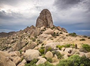
4.33.98 mi / 1236 ft gainThe infamous “thumb” can be seen from most places in the valley – a white burst of rock jutting skyward out of the desert ridgeline. The new Tom’s Thumb Trailhead in 2012 has nice restrooms and offers tons of information about the surrounding rock climbing areas, day hikes and desert knowledg...Read more -
Phoenix, Arizona
Shadow Mountain Loop
2.07 mi / 600 ft gainShadow Mountain Loop is a loop trail that takes you past scenic surroundings located near Phoenix, Arizona.Read more -
Phoenix, Arizona
North Mountain Trail
4.71.42 mi / 571 ft gainBeginning from the start of the trail on 7th Street, this short hike can be a good quick workout that offers great views of the greater Phoenix area. Be aware that this hike is a fairly steep climb 600 feet to the top. Once you reach the summit of North Mountain you'll find great views of the...Read more -
Phoenix, Arizona
Shaw Butte Trail
5.04.22 mi / 866 ft gainThe Shaw Butte Trail is a short loop hike that leads you to the top of Shaw Butte in the Phoenix Mountains Preserve. Beginning from the trailhead on Central Avenue, The first section of trail follows a steady uphill service road to the top. Near the top you'll find an array of towers and a good...Read more -
Scottsdale, Arizona
Upper Ranch and Brown's Ranch Road Trail
3.98 mi / 154 ft gainUpper Ranch and Brown's Ranch Road Trail is a loop trail where you may see wildflowers located near Scottsdale, Arizona.Read more -
Phoenix, Arizona
Apache Wash Loop Trail
5.79 mi / 541 ft gainThis hike begins at the Apache Wash Trailhead where you will find restrooms and a covered rest area. This loop is simple to follow and offers various shortcuts along with an access to an optional summit climb. The loop begins from the north-east end of the parking lot near the restrooms. Turn l...Read more -
Glendale, Arizona
Run at Thunderbird Park
5.02 mi / 475 ft gainThis is a great spot to go for a quick run or a short hike if you're in North Phoenix. Thunderbird park is easily accessible with free entry and a number of picnic areas.There are 3 main hills with a variety of trail options to hike up/around each. From the top you'll find a nice view of valley...Read more -
Cave Creek, Arizona
Hike the Go John Trail
5.05.6 mi / 804 ft gainAs you park at the trailhead, you have the option to take this trail in either direction. I recommend that you travel north, which will immediately provide 0.75 miles of elevation gain. You will then reach a pass with panoramic views of the Tonto National Forest. A bench in this area provides the...Read more -
Goodyear, Arizona
Hike Estrella Mountain's Baseline Trail
4.02.4 mi / 259 ft gainBaseline Trail is a 2.4 mile moderately trafficked loop trail. This trail features lovely wild flowers and is rated as intermediate. You can use this trail not just for hiking but you can also use the trail for running as well as mountain biking. On the trail you are allowed to bring your furry f...Read more

