Fredonia, Arizona
Looking for the best hiking in Fredonia? We've got you covered with the top trails, trips, hiking, backpacking, camping and more around Fredonia. The detailed guides, photos, and reviews are all submitted by the Outbound community.
Top Hiking Spots in and near Fredonia
-
Kanab, Utah
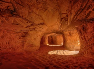
Sand Caves of Kanab
4.51.17 mi / 69 ft gainTo get to this cave, drive north of Kanab on Highway 89. Just after you pass Best Friends Animal Sanctuary, you will see these caves on the right. To hike to the caves, try accessing the trail from as far to the left as possible. The hike isn't strenuous or tricky in that case. The other thing t...Read more -
Kanab, Utah
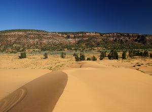
Nature Trail Loop
4.50.75 mi / 33 ft gainThis state park is not heavily visited and for a makes a great day trip from Zion National Park or Kanab, UT. Expect endless beautiful pink dunes and Utah's red rocks as your backdrop. Once you park, walk out onto the boardwalk and the short Nature Trail will head out just beyond the signs explai...Read more -
Orderville, Utah
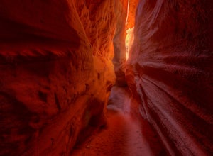
Kanab's Peek-a-Boo Canyon
4.87.71 mi / 587 ft gainThe trailhead is Red Canyon (aka Peek-a-boo) trailhead located just off of Highway 89 between Kanab and Mt. Carmel Junction. The GPX track shows the entirety of the trail, but if you have 4WD and a high-clearance vehicle, you're able to reach the closer parking area for a less than 1-mile roundtr...Read more -
Kanab, Utah
See Dinosaur Tracks at the Moccasin Mountain Dinosaur Tracksite
5.0The Moccasin Mountain Dinosaur Tracksite is one of the most diverse track sites in North America. The site contains hundreds of fossilized tracks from at least five different species of dinosaur. The tracks have been preserved since the early Jurassic period dating back to approximately 180 mil...Read more -
Orderville, Utah
Hike through the Red Caves (Sand Wash)
5.0They don't require any technical gear unless you would like to do two short rappels near the beginning of Lower Red Cave and one short rappel into the Upper Red Cave. We didn't take a rope and were fine although the canyons are usually filled with water and have some difficult obstacles to overco...Read more -
Orderville, Utah
Hike Red Hollow Slot Canyon
5.03.2 mi / 200 ft gainThe trailhead is about 18 miles from the eastern entrance of Zion National Park, located in the small town of Orderville. In Orderville, the streets aren't marked too well, so follow the road that goes past the cemetery and the school, 100 East. When the road Ts, turn left. The road ends in a san...Read more -
Hildale, Utah
Water Canyon Arch (Eye of the Heavens)
9.61 mi / 1936 ft gain…Who doesn’t enjoy a hike that gives you views as if you’re on top of the world! I know I do, and this hike to Water Canyon Arch (Eye of the Heavens Arch) will do just that!There’s two ways of getting to the arch, but the route I took was the squirrel creek trail, to the Canaan mountain trail. On...Read more -
Hurricane, Utah
Water Canyon Trail in the Canaan Mountain Wilderness
5.03.09 mi / 1302 ft gainWater Canyon is a narrow canyon on the southern side of Canaan Mountain in the Canaan Mountain Wilderness south of Zion. It makes for a great hike away from the crowds, though do not expect to have the trail to yourself as it is a great starting point for backpacking and canyoneering trips into t...Read more -
Marble Canyon, Utah
Hike the Buckskin Mountain Passage from Stateline Campground on the Arizona Trail
8 mi / 1400 ft gainDepending how you approach this 800 mile trail, I did the first 4 miles or last 4 miles as an out and back from Stateline Campground on the Utah/Arizona state line and the border of Vermilion Cliffs National Monument. This section of the trail does not pass through Vermilion Cliffs N.M. b...Read more -
Orderville, Utah
East Rim Trail, Zion NP
5.010.19 mi / 3000 ft gainThe East Rim Trail is approximately 10-miles (one-way) and can either be started from the Eastern Entrance of Zion National Park, or more commonly from the Hidden Canyon or Observation Point Trailheads. Many people start from within Zion Canyon and do the arduous Observation Point Trail, forgoing...Read more -
Kanab, Utah
Hike Buckskin Gulch, Vermillion Cliffs Wilderness
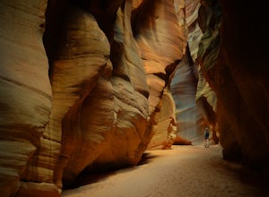
4.615 miBuckskin Gulch is a natural wonder. At 15 miles long it is the longest slot canyon in the world. It sometimes is as narrow as 2ft. Because of the nature of this canyon and Utah topography this canyon is subject to deadly flash flood if it rains anywhere along the headwaters. Be sure to check in w...Read more -
Kanab, Utah
The Wave via Coyote Buttes North
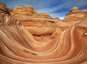
5.05.41 mi / 755 ft gainThe hike to the Wave is 2.5 miles (one-way). When you arrive, take in the sandstone showing incredible striations of red, orange, pink, yellow, and beige. Please note that this adventure is only accessible by obtaining a permit. Only 20 visitors are allowed access per day with 10 permits given on...Read more -
Kanab, Utah
Wire Pass Slot Canyon
4.63.75 mi / 325 ft gainWire Pass is a hike through a scenic slot canyon that is often overlooked due to its close proximity to the very famous Wave. Unlike the "Wave" a permit is not required to make the hike, only a day use fee at the trailhead. Be sure to check local weather for rainfall and please do not go on this ...Read more -
Springdale, Utah
Canyoneering Keyhole Canyon
4.0Keyhole Canyon is an experience for the adventurous, thrill seeking explorer. Hidden between the jagged mountains of Zion National Park, this canyon sits roadside, just two miles from the east entrance. Before we continue, please note that Canyoneering is a dangerous sport. This canyon is not for...Read more -
Springdale, Utah
Hike Many Pools
4.62 miTo get there, drive about .8 miles east of the smaller tunnel on the Zion-Mt. Carmel highway. There will be a place to pull out and park on a large turn. Continue walking down the road about 150 yards east and cross the street before the next turn. There is no marked trail, but there should be a ...Read more -
Hurricane, Utah
Canyon Overlook Trail
4.80.88 mi / 57 ft gainThe trailhead is located east out of the 1.1 mile long tunnel off highway 9. Parking is available immediately to the right after exiting the tunnel and the trail then begins with these charming steps, carved into sandstone, that climb above the Zion-Mt. Carmel Tunnel. The trail is broad and easy ...Read more

