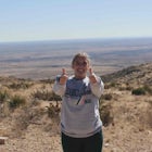
Rock Garden Trail
Canyon, Texas
Details
Distance
4.98 miles
Elevation Gain
600 ft
Route Type
Out-and-Back
Description
Added by Greg Christensen
Rock Garden Trail is Palo Duro's most difficult, and most scenic hike.
Of all the trails in Palo Duro Canyon, the Rock Garden is arguably the most challenging, the most strenuous, and – not coincidentally – rewards hikers with the best views of the canyon. It is a five-mile round-trip hike with a rigorous incline, and is the only trail in the park that takes hikers from the floor of the canyon to the rim, an elevation gain of over 600 feet in under 2.5 miles.
A relatively new addition to the park, the Rock Garden trail was officially established by the park service in 2012. While most of the park’s visitors flock to the iconic Lighthouse, the Rock Garden’s dramatic incline keeps the trail sparsely populated. But the vistas are worth the hour or two of exertion.
When Georgia O’Keeffe made her home in the Texas Panhandle, she hiked through and painted Palo Duro frequently. She described it as a “burning, seething cauldron, filled with dramatic light and color.” And the elevation hikers gain in the Rock Garden offers some of the canyon's best views.
The trailhead begins near the main road, with some roadside parking nearby. It is also a short walk from the Sunflower Day Use Area. The quarter of the trail rises and falls, oscillating between inclines and declines through the rockiest part of the eponymous trail. It is the remains of an ancient landslide that today feels like an alien landscape, unlike anything else in Palo Duro.
A little before the midway point, the trail intersects with the Upper Comanche Trail, a northwest-southeast trail which is well-marked to hikers, but does not appear on recent, park-issued maps of Palo Duro. Passing the Upper Comanche, the Rock Garden continues a steady incline through its first mile where it plateaus a bit through patches of sand sage, prickly pear cactus, and Rocky Mountain juniper, offering the first of several dramatic panoramas.
The last quarter of the trail veers back into a minor tributary canyon, obscuring some views as the trail becomes a myriad of switchbacks where the inclines are at their strictest. After a final push, the trail spills out onto the canyon rim, connecting with the Rylander Fortress Cliff Trail, which winds north and south along the lip of the canyon offering more vistas, variations on a theme.
As the second biggest canyon in America behind the Grand, Palo Duro is not as jaw-droppingly vast as its Arizona cousin. But it is breathtakingly beautiful. And the Rock Garden Trail is one of the best means for hikers to saturate their senses, and see Palo Duro as Georgia O'Keeffe did: as a "burning, seething cauldron, filled with dramatic light and color."
Download the Outbound mobile app
Find adventures and camping on the go, share photos, use GPX tracks, and download maps for offline use.
Get the appFeatures
Rock Garden Trail Reviews
This was a great hike, around 6 miles for me. I absolutely loved how nice the park was all together. Plan to go back next weekend. Tons of camping spots as well as horse back riding. Super immense variety of hikes of all different difficulties. This hike was my first solo hike, as well as the hardest hike I have done. The view definitely pays off though! Weather was great, a bit hot, but I prefer it that way! On the way back stopped at the trading post/restaurant. Food was pretty good after a long day and they offer pretty good priced camping gear as well. (Also is like a little souvenir shop to.) Overall 10/10!
5.0
Beautiful desert canyon hike, and the best (only?) reason to go to Amarillo!
4.0
A few weeks ago, a hiker was killed at Palo Duro Canyon on one of the spurs at the top of the canyon (Duck Pond). The Rock Garden hike connects to several spurs leading to rim views. A ledge on which the hiker was standing to take pictures, collasped and the hiker was killed. I hiked another spur (Tub Springs Draw) close to the Duck Pond Spur today and was astonished to see that no danger signs were in evidence. Parts of the ledge had cracks that appeared to be ready to separate. I would advise hikers to stay back at least 10- 12 feet from the edge. Looking across the canyon, one can see similiar ledges in which the upper rock ledge extends out beyond the underlying supporting soil. It is impossible to know this if you are standing on the ledge. It would appear fine on a first impression. Enjoy hiking the trail and the spurs; just be very cautious near any of the rims and stay back.
5.0
Leave No Trace
Always practice Leave No Trace ethics on your adventures and follow local regulations. Please explore responsibly!
Nearby
Hike Juniper Cliffside Trail And Juniper Riverside Trail Loop
Lighthouse in Palo Duro Canyon
Explore the Route 66 Historic District of Amarillo
Cadillac Ranch
Camping at Caprock Canyon State Park
Community
© 2024 The Outbound Collective - Terms of Use - Privacy Policy


