Rotoroa, New Zealand
Looking for the best backpacking in Rotoroa? We've got you covered with the top trails, trips, hiking, backpacking, camping and more around Rotoroa. The detailed guides, photos, and reviews are all submitted by the Outbound community.
Top Backpacking Spots in and near Rotoroa
-
Rotoroa, New Zealand
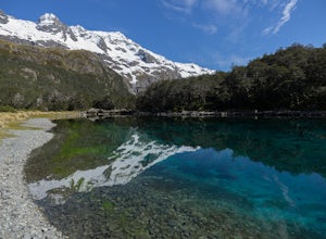
Backpack and Kayak to Blue Lake
5.031.1 mi / 1430.4 ft gainThis lake has the clearest visibility fresh water found anywhere in the world with visibility between the 70-80 meter range. And the Colours are beautiful! (We just ask that you do not swim in this lake or do your dish washing in it as it is a super fragile ecosystem, oh and the duck in the pictu...Read more -
Nelson Lakes National Park, New Zealand
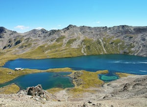
Backpack to Lake Angelus Alpine Hut
7.6 mi / 3987 ft gainFrom the Mt. Robert car park, take the Pinchgut Track up to the Bushline shelter (approx. 1 hr 30 mins). This beginning portion of the track is steep, with numerous switchbacks that will have you questioning whether you really need everything in your pack. The panoramic views of Lake Rotoiti are ...Read more -
Nelson Lakes National Park, New Zealand
Winter Overnight in Lake Angelus Hut
7.5 mi / 4000 ft gainThis is a popular and crowded route in summer months, but in winter you could have this 28 bunk hut with a stove all to yourself!Begin by climbing switchbacks to the summit of Mt Roberts and then following the crest of Robert Ridge. The route is exposed in a few places and an un-checked fall on s...Read more -
Saint Arnaud, New Zealand
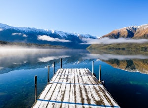
Hike the St Arnaud Track in Nelson Lakes NP
3.4 mi / 3668 ft gainPark in the Kerr Bay Car Park and take a moment to enjoy views from the iconic Kerr Bay Dock.The well signed track starts just to your left.The lower section of the walk crosses moraine terraces deposited by past glaciers while gaining very little elevation. The track cuts through a lovely beech ...Read more -
Tapawera, New Zealand
Backpack to Granity Pass Hut
10.4 mi / 4593 ft gainOnce in Tapawera, follow the signs indicating Kahurangi National Park by way of the Wangapeka Valley. The road winds, becomes gravel, and narrows before it dead-ends at Courthouse Flat where you'll find picnic tables and restrooms. Begin the trek by following either the ridge or the Blue Creek Tr...Read more -
Maruia, New Zealand
Hike the Lewis Pass Tops Route
5.6 mi / 2624.7 ft gainPark at the well marked Saint James Walkway Car Park. You will find the Lewis Pass Tops Trail Head across the street. The trail begins by climbing steeply through beech forest and then breaks through the tree line before arriving at the ridge crest. The maintained trail ends here but the route is...Read more -
Motueka Valley, New Zealand
Hike Mount Arthur and the Tablelands
4.8Mount Arthur and the Tablelands are a unique and beautiful portion of Kahurangi National Park. The area is remote, making it perfect for astrophotography.There are many hiking options and places to stay - consult the map at the Flora Car Park shelter for options. Here is a short circuit that can ...Read more

