Milford Sound, New Zealand
Looking for the best photography in Milford Sound? We've got you covered with the top trails, trips, hiking, backpacking, camping and more around Milford Sound. The detailed guides, photos, and reviews are all submitted by the Outbound community.
Top Photography Spots in and near Milford Sound
-
Milford Sound, New Zealand
Explore Milford Sound
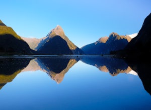
4.71.2 mi / 1 ft gainMilford Sound can be explored by land or sea. Short hiking trails departing from the main parking lot are numerous and well signed, walk along the Foreshore Trail or up into the hills for expansive views.Going on a cruise is an exciting way to get up close and personal with Milford's scenery and ...Read more -
Milford Sound, New Zealand
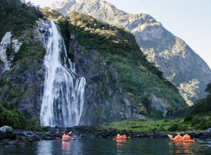
Kayak to Lady Bowen Falls in Milford Sound
4.0There are multiple options for getting to Milford Sound. If you have a car and can drive, then just take the Milford Sound Highway from Te Anau, and once you get to the end of the road and see all the big boats, just park your car and get ready for some fun in the water. If you don't have your ...Read more -
Milford Sound, New Zealand
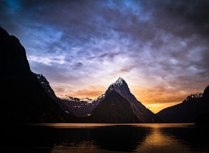
Overnight Cruise the Milford Sound
5.0If you are ever visiting New Zealand's south island, I cannot implore you more to consider doing the overnight cruise of the Milford Sound via Real Journeys. For roughly $300, you board, in Queenstown, a custom designed Real Journeys tour bus that has seats slightly angled towards the windows as ...Read more -
Fiordland National Park, New Zealand
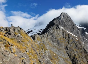
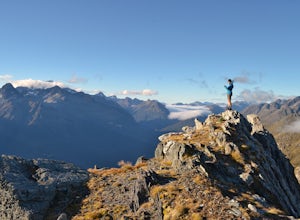
Climb to Homer Saddle, Fjordland NP
1.6 mi / 1574.8 ft gainThis route is not marked, riddled with loose rock, and requires climbing on narrow exposed ledges. There are often snow patches on the saddle and an unchecked fall will almost certainly result in a fatality. However, for experienced and well prepared parties this can be one of the most rewarding ...Read more -
Fiordland National Park, New Zealand
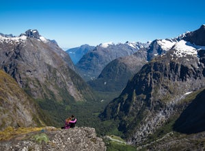
Hike to Gertrude Saddle
4.84.3 mi / 2624.7 ft gainThe trail begins at the signposted car park along Milford Road just before the Homer Tunnel, about 98km from Te Anau. Follow the marked track through the valley and left, steeply uphill. About halfway up you will cross the Gertrude Stream below a large, steep waterfall.Upon reaching Black Lake, c...Read more -
Mount Aspiring National Park, New Zealand
Valley of the Trolls
1.9 mi / 1312.3 ft gainThe Valley of The Trolls can be accessed from the head of Lake Harris, off the Routeburn track. The trail in the valley is a lot tougher going than the well maintained Routeburn track. The valley floor will quickly become a swampy bog after a rain. Getting to the trail is easily done about 300 ...Read more -
Fiordland National Park, New Zealand
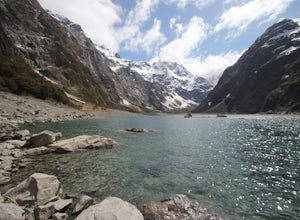
Hike to Lake Marian
4.53 mi / 1312.3 ft gainThe track starts soon after the turnoff onto Hollyford Rd off the Milford Highway. The track begins with a bridge crossing over a river and then soon reached Marian Falls. From the falls the trail climbs steeply through forest until the lake. The lake is a beautiful place to spend several hour...Read more -
Fiordland National Park, New Zealand
Camp at Cascade Creek
This campsite is just off the Milford Highway. There will be a sign for the Cascade Creek Campground exit. Follow the dirt road for several minutes before reaching the campground. You may find a spot immediately, but the campground is fairly large and can get busy, so drive until you find a spot ...Read more -
Kinloch, New Zealand
Backpack the Routeburn Track
5.012.5 miIf you're looking for the best the Routeburn Track has to offer but only have one night to spend - hike from the Glenorchy side Routeburn Shelter to Lake Mackenzie in 12.5 miles (approx. 3,500 feet of elevation gain) and stay at this stunning hut location before backtracking over Harris Saddle th...Read more -
Kinloch, New Zealand
Day Hike to Harris Saddle (Routeburn Track)
4.014.3 mi / 2460.6 ft gainThe Routeburn Track is world famous, and with good reason. But the because it is a through hike that requires multiple hut reservations and an expensive car-shuttle or two day bus ride to complete, many people feel overwhelmed or underprepared. This day hike options allows you a no-strings-attach...Read more -
Glenorchy, New Zealand
Backpack the Magical Earnslaw Burn
8.7 mi / 1968.5 ft gainOnce you identify the parking area (Right turn off Glenorchy Paradise Road just before crossing the Earnslaw Burn, park a the bend in the road.) Cross the boggy meadow in a NW direction until you see the orange trail markers on trees.The trail below bush line is long, very rugged and covered with...Read more -
Mount Earnslaw, New Zealand
Climb Mount Earnslaw, Mount Aspiring National Park
5.016.8 mi / 8000 ft gainStart at the Rees Valley Trailhead, approximately 30 minutes from Glenorchy. The trail begins as a dirt road that passes through grazing land and small tributary creeks that flow into the Rees. The first 4.4 miles (7 km) of the trail hugs the Rees River and stays in the grassy and often boggy riv...Read more -
Greenstone, New Zealand
Hike to Lake Rere
The track begins from the Greenstone carpark. After walking for around 5 minutes, you will chose which direction you would like to complete the loop. For our hike we chose to go left over the swing bridge that crosses the river. After crossing the river you continue through open farm paddocks....Read more -
Ben Lomond, New Zealand
Camp at Moke Lake
5.04.3 miThe drive to Moke Lake from Queenstown is only 14km but it takes about 30 minutes since you're on a dirt road for a good portion of it. You'll pass Lake Kirkpatrick and lots of sheep on your way to Moke Lake, but keep driving until you get to the campground that's on the southeast end of the lake...Read more -
Mount Aspiring, New Zealand
Hike to the Rob Roy Glacier
5.06.2 mi / 1625 ft gainFollow the Wanaka-Mount Aspiring Rd. west of Lake Wanaka. The pavement turns into a dirt road shortly after you drive around the lake. You will drive for about an hour, then park at Raspberry Flats in the Matukituki Valley. From the Raspberry Flats lot, the trailhead begins at the swing bridge ab...Read more -
Queenstown Lakes District, New Zealand
Ben Lomond Track via Old Skyline Road
5.025.99 mi / 3107 ft gainAdventuring up to Ben Lomond's summit is an out-and-back day hike with views that are arguably more rewarding than some of those you get on New Zealand's Great Walks. You can take the Skyline gondola part way up if you want to shorten the climb, but I usually start at the small signposted carpark...Read more

