Buffalo Point
Book this listing through our partner Recreation Gov
About Buffalo Point
Overview
Buffalo Point is a convenient, fun-filled destination for families and adventurists of all types. It's perched along the Buffalo National River, providing exciting river sports and hiking opportunities. In peak season, a restaurant is open at the facility, serving up meals for those who want a break from preparing them.Recreation
The wild river is a gathering place for a plethora of water activities. Many campers spend their days fishing, hiking, canoeing, or kayaking. Evenings are ideal for gathering next to the fire to revamp for another great day out on the river.Facilities
Buffalo Point offers campsites with water, electricity and a pay phone. It's the only area in the park with a restaurant, open daily from Memorial Day to Labor Day and on weekends only from mid-April to Memorial Day Weekend and Labor Day Weekend to mid-October.
Natural Features
The campground is set along Buffalo National River, one of the few free-flowing rivers remaining in the contiguous United States. The river runs 135 miles without dams and cuts through the Arkansas Ozarks and into the White River. The region is surrounded by droves of lush hardwood trees and grassy open meadows.Nearby Attractions
Two popular attractions within the Buffalo Point Area are the Indian Rockhouse Trail and the Rush Historic District. Rush was a zinc mining community until the zinc market collapsed and the settlement was deserted. Tours about the town's history are available. Buffalo Point is the former Buffalo River State Park developed in the 1930's as project of the Civilian Conservation Corps.Blanchard Springs Cavern, an extraordinary living cave, is a one-hour drive from Buffalo Point.
Buffalo Point Reviews
Top Spots in or near Yellville
Fly Fish the White River
Flippin, Arkansas
5.0
Spend a week or weekend trout fishing on the world famous White River, located in north central Arkansas.The White River is a tailwater of Bull Shoals Lake, and is known worldwide as the “Capital of Trout Fishing.” Its beautiful banks are lined with fishing resorts that offer cabins, boat rentals, and guide services. The river is stocked by local fish hatcheries that keep the river full of grea...
Hike to Punchbowl Falls
Witts Springs, Arkansas
3.2
4 mi
/ -600 ft gain
Go in the early Fall or late Spring! You start off on the Ozark Highland Trail. As you start walking along the trail you can see where people have slept the night before. Camping is acceptable out here, you do not have to pay, but the downside is that the closest town is about an hour away so if you have an emergency you are on your own.The trail has white strips on the trees so if you get off ...
Richland Creek Campground Trail
Witts Springs, Arkansas
5.0
3.53 mi
/ 292 ft gain
Richland Creek Campground Trail is an out-and-back trail that takes you by a waterfall located near Witts Springs, Arkansas.
Richland Falls and Twin Falls of Richland Creek
Witts Springs, Arkansas
4.0
4.8 mi
/ 472 ft gain
The hike to Richland Falls and Twin Falls of Richland creek begins at the Richland Creek Campground. From the entrance of the campground take the road to the right heading to the day use area. The trailhead is found at the end of the day use area.
The trail immediately begins with a crossing of Falling Water Creek. You’ll notice a sign for Richland Falls and Twin Falls just beyond the crossi...
Hike to Twin Falls in the Richland Creek Wilderness Area
Witts Springs, Arkansas
4.0
5 mi
/ 200 ft gain
This hike begins at Richland Creek Campground. There's a trace trail that begins from the lowest walk-in campsites and continues along Richland Creek as you head back towards the waterfall. Parking and trailhead coordinates are 35.79839, -92.95774.
It's not quite a bushwhack, but it's still a pretty tough hike. It's slippery when wet and slipper when dry. One slip on the steep canyon walls coul...
Camp at Richland Creek Campground
Witts Springs, Arkansas
5.0
This is one of my favorite places to camp in Arkansas. Once you get there you can hike to Twin Falls or Sandstone Castle, or explore the numerous cascades along Richland Creek. It's a relatively small campground with 11 campsites, but has a lot of places to hang hammocks and also offers a picnic area and bathrooms.Getting there: Take Hwy. 16 east from Pelsor (located on Hwy. 7 between Jasper an...
Camping and Lodging in Yellville
170 Ranger Road
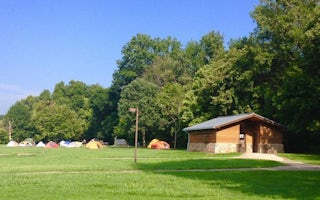
Tyler Bend Campground
Overview
Campers will delight in the picturesque river views at Tyler Bend. Located 11 miles northwest of Marshall, Arkansas, Tyler Bend ...
Lakeview, Arkansas
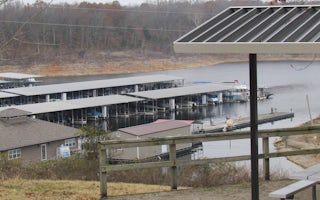
Lakeview Park
Overview
Lakeview Park Campground is located on Bull Shoals Lake. Set in the scenic Ozark Mountains of northern Arkansas and southern Mis...
Mountain Home, Arkansas
Henderson Park
Overview
Henderson Park is surrounded by the clear waters of Norfork Lake. Spectacular lake views and plenty of secluded coves for water...
Mountain Home, Arkansas
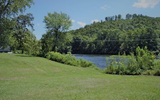
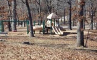
Dam Quarry
Overview
Dam Quarry Campground is an angler's paradise. Located in northern Arkansas, just downstream of the Norfork Dam, the campground ...
Mountain Home, Arkansas
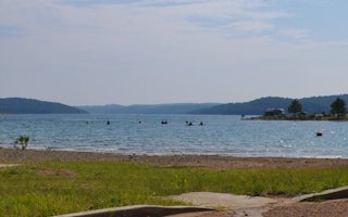
Cranfield Park
Overview
Cranfield Park is surrounded by the clear waters of Norfork Lake. It's the closest campground to the city of Mountain Home and o...
Mountain Home, Arkansas
Robinson Point
Overview
Robinson Point is one of the most popular parks in the central portion of Norfork Lake. The 102 campsites are sprawled across tw...
Unfortunately, we don't have up-to date pricing data for this listing, but you can check pricing through Recreation Gov.
Book NowAdd your business today to reach The Outbound's audience of adventurous travelers.
Community
© 2024 The Outbound Collective - Terms of Use - Privacy Policy


