Villnöß, Italy
Top Spots in and near Villnöß
-
Cortina d'Ampezzo, Italy
Hike to Lago Di Sorapis & Rifugio Vandelli In The Dolomites
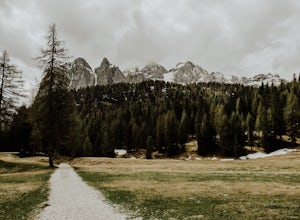
7.1 mi / 1148.3 ft gainThe hike to Lake Sorapis and Rifugio Vandelli is a nice day hike for all abilities of hiker. The trail starts from the roadside, on the road that leads from Cortina d'Ampezzo to Misurina. You'll see a gravel area at the side of the road where you can park - but get there early in the high season ...Read more -
Schwaz, Austria
Hike to Olpererhütte in the Austrian Alps
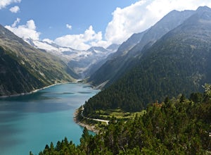
4.04 mi / 1969 ft gainAustria’s Zillertal Valley is a spectacular region of the Alps offering a plethora of hiking options. Locals as well as tourism hosts overwhelmingly recommended Olpererhütte! From Mayrhofen, a public transit bus delivers hikers directly to the trailhead. Mayrhofen is a great village to use as hom...Read more -
Misurina, Italy
Photograph Lago di Misurina
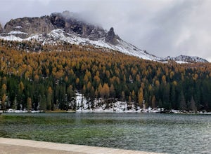
This beautiful lake and small town are tucked away in the Dolomite Mountains. It is the largest lake in Cadore, and also was the last outdoor location ever used for an Olympic speed skating event. There is ample parking alongside the lake along with a dock where you can set up your tripod. On a c...Read more -
Misurina, Italy
Photograph The Dolomites Near Misurina
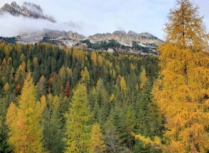
The Dolomites in this area are absolutely stunning, and you can pair these massive mountains well in pictures with small towns like Auronzo, Reane, and Misurina. It may be a bit cold, but going in October or later will allow you to see the mountains with some snow sprinkled among the peaks. If y...Read more -
Auronzo di Cadore, Italy
Hike to Rifugio Auronzo & The Three Peaks in the Dolomites
8.7 mi / 1935.7 ft gainYou start this easy hike from just before the toll road station on the road up from Misurina to Rifugio Auronzo. As you are looking towards the peaks and the trail starts on the right side of the road. The first part of the route takes you through some forest and across a couple of streams before...Read more -
Obernberg am Brenner, Austria
Hike to the Lichtersee Lake
8.6 mi / 2198.2 ft gainPark at the large car park (paid parking) for the main Obernberg lake, but instead of following the trail to the lake, take the road on the right towards Haus Waldbauer. At the end of the paved road, a gravel road bends off to the right. Follow this gravel road as it leads you uphill and back al...Read more -
Obernberg am Brenner, Austria
Climb Obernberg Tirol
Whilst Innsbruck is known for being a top destination for world-class sport climbing, many of the most popular areas can get very busy, especially in the summer months. This summer we discovered the small crag up at Obernberg and it quickly become one of our favourite places to climb. The crag is...Read more -
Auronzo di Cadore, Italy
Tre Cime Di Lavaredo Loop
5.06.27 mi / 1352 ft gainThe famous Italy Dolomites are littered with numerous great hikes to showcase them, however, this trail is the cream of the crop. It will not disappoint. You have the option of hiking up to Rifugio Auronzo from Misurina, which is detailed out here. The other option that makes it easier if you're ...Read more -
Gschnitz, Austria
Hike to the Lapones Alm
1.1 mi / 508.5 ft gainThe Laponesalm hike is an easy family-friendly hike in the stunning Gschnitz valley in Tirol, Austria. Park the car at the paid parking at the end of the valley, and follow the asphalt road which is signposted towards the Lapones Alm. After about 15-20 minutes of walking, you'll come to a bridg...Read more -
Gschnitz, Austria
Hike to the Italian Border
9.9 mi / 4327.4 ft gainThe Gschnitz valley is one of my favourite places to hike in Tirol. Not only does it have some absolutely stunning scenery, but I've never experienced crowded trails whenever I've been there. This hike is an extension of another hike I've shared on here, to the Tribulaunhütte. Whilst we did take ...Read more -
Gschnitz, Austria
Hike to the Tribulaunhütte in Gschnitztal
7.5 mi / 2575.5 ft gainThe Tribulaun Hütte mountain hut in the Gschnitztal is one of the easiest mountain huts to reach in the area. Leave your car (or take the Post Bus) to the end of the Gschnitztal valley. Just past the car park, the trail up to the Tribulaun hut begins. The trail starts as a wide gravel road that s...Read more -
36 Via Val Fiscalina, Italy
Ski Tour to the Sextener Stein in the Dolomites
8.7 mi / 3608.9 ft gainThe stunning tour in the Dolomites can be done in the winter as a ski/splitboard tour or as a snowshoe tour. It's also possible to hike the same route in the summer. The tour starts next to the Hotel Dolomitenhof, just across from the main parking area. Stating at 1450m, the first section of the...Read more -
Neustift im Stubaital, Austria
Stubai High Trail Section 4 - Hike from the Sulzenau Hut to the Dresdener Hut
2.5 mi / 1640.4 ft gainWe spent the night before this hike at the Sulzenau hut, and woke up early to watch the sunrise over the glacier, which I highly recommend. From the Sulzenau hut, follow the trail as it rises gradually up the valley floor towards the Sulzenau Ferner Glacier. On the route you'll follow a gushing s...Read more -
Neustift im Stubaital, Austria
Hike to the Suzlenau Hut in the Stubai Valley
9.3 mi / 2168.6 ft gainThe Sulzenau Hut is a popular destination for hikers in the Stubai Valley in Tirol. There are a few different routes to approach the hut, but for this adventure, we took the route that follows the WildWater Trail (WilderWasser Weg). We started this route from the Grawa Alm at the foot of the Graw...Read more -
Mutterbergalm, Austria
Hike to the Hildersheimer Hut on the Stubai Glacier
2.1 mi / 721.8 ft gainThis short hike is a great mini tour when you want to get up high without a whole lot of effort but enjoy some stunning glacier views. The hike to the Hildersheimer Hut is a high altitude tour on the Stubai glacier, that if done during the summer months from the top station of the Schaufeljochbah...Read more -
Neustift im Stubaital, Austria
Hike to the Mutterberger See Lake in Stubai
5.3 mi / 2624.7 ft gainThe hike starts from the bottom of the Gamsgarten cable car lift station at the Stubai Glacier, so it's best to park in the highest car park. (Most cars park at the lower Eisgrat cable car so the upper car park should be fairly quiet). If you're arriving by bus, this is the very last bus stop on ...Read more

