Selva dei Molini, Italy
Looking for the best hiking in Selva dei Molini? We've got you covered with the top trails, trips, hiking, backpacking, camping and more around Selva dei Molini. The detailed guides, photos, and reviews are all submitted by the Outbound community.
Top Hiking Spots in and near Selva dei Molini
-
Schwaz, Austria
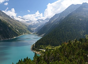
Hike to Olpererhütte in the Austrian Alps
4.04 mi / 1969 ft gainAustria’s Zillertal Valley is a spectacular region of the Alps offering a plethora of hiking options. Locals as well as tourism hosts overwhelmingly recommended Olpererhütte! From Mayrhofen, a public transit bus delivers hikers directly to the trailhead. Mayrhofen is a great village to use as hom...Read more -
Braies, Italy
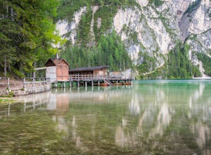
Explore Pragser Wildsee
4.02.2 mi / 400 ft gainPragser Wildsee, also known as Lago di Braies, lies in a mostly German-speaking area of northern Italy close to the border with Austria. This glacial blue lake is surrounded by towering mountains and thick evergreen forests, which can be experienced on the 2.2-mile loop trail or Alta Via 1 trail....Read more -
Braies, Italy
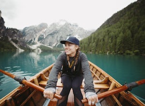
Hike and Canoe at Lago Di Braies
4.02.2 miStarting at the Hotel Lago Di Braies, you have the option to loop around the lake to hiker's left or right. To the left is the local dock, while to the right is a chapel and barn. Either way, you will end up where you started no longer than an hour and a half later. Once you are done with the loo...Read more -
Braies, Italy
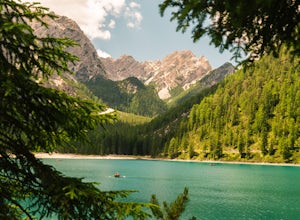
Hike around Lago Di Braies
5.02.2 mi / 80 ft gainOnly an hour and a half from Bolzano, or an hour from Cortina d'Ampezzo, (my home base while in the Dolomites), Lago Di Braies is a must do half day trip. This popular destination is known for it's beautiful blue water and towering surrounding peaks and it does not disappoint. Most only see the p...Read more -
Braies, Italy
Hike or Run the Alta Via 1 in the Dolomites
5.093.2 mi / 26250 ft gainThe Alta Via 1 is the definite trail through the Italian Dolomites, showcasing some of the most scenic terrain in all of the Alps. It begins at Lago di Braies and ends in the town Belluno, covering 150 kilometers and over 26,000' of elevation gain.Unlike backpacking or fastpacking in the United S...Read more -
Santa Cristina Valgardena, Italy
Hike from Col Raiser to Seceda in the Dolomites
Seceda is one of the most famous (and most photographed) spots in all of the Italian Dolomites. This summer I decided to finally visit it to see if it was really worth the hype, and to see if there was a way to escape the worst of the crowds.Most tourists visit Seceda from Ortisei, taking the cab...Read more -
Obernberg am Brenner, Austria
Hike to the Lichtersee Lake
8.6 mi / 2198.2 ft gainPark at the large car park (paid parking) for the main Obernberg lake, but instead of following the trail to the lake, take the road on the right towards Haus Waldbauer. At the end of the paved road, a gravel road bends off to the right. Follow this gravel road as it leads you uphill and back al...Read more -
Corvara in Badia, Italy
Climb The Brigata Tridentina Via Ferrata
2.5 mi / 2316.3 ft gainIf you want to add a via ferrata on to your itinerary for the Dolomites, then the Pisciadù Via Ferrata (also known as Brigata Tridentina Klettersteig) is one of the best. A Dolomites classic! This VF is easily accessible from the village of Colfosco, on the Passo Gardena mountain pass, with a sma...Read more -
Corvara in Badia, Italy
Hike from Rifugio Pisciadu to Rifugio Franz Kostner via Piz Boè
5.4 mi / 2099.7 ft gainIf you're planning a trip to the Dolomites, you simply must plan a hut-to-hut hike.Last year I did a number of multi-day hikes from hut to hut, and this one definitely has to be one of the most dramatic.I've already shared the first day of the adventure in this post, so today I'm going to share t...Read more -
Gschnitz, Austria
Hike to the Lapones Alm
1.1 mi / 508.5 ft gainThe Laponesalm hike is an easy family-friendly hike in the stunning Gschnitz valley in Tirol, Austria. Park the car at the paid parking at the end of the valley, and follow the asphalt road which is signposted towards the Lapones Alm. After about 15-20 minutes of walking, you'll come to a bridg...Read more -
Gschnitz, Austria
Hike to the Italian Border
9.9 mi / 4327.4 ft gainThe Gschnitz valley is one of my favourite places to hike in Tirol. Not only does it have some absolutely stunning scenery, but I've never experienced crowded trails whenever I've been there. This hike is an extension of another hike I've shared on here, to the Tribulaunhütte. Whilst we did take ...Read more -
Gschnitz, Austria
Hike to the Tribulaunhütte in Gschnitztal
7.5 mi / 2575.5 ft gainThe Tribulaun Hütte mountain hut in the Gschnitztal is one of the easiest mountain huts to reach in the area. Leave your car (or take the Post Bus) to the end of the Gschnitztal valley. Just past the car park, the trail up to the Tribulaun hut begins. The trail starts as a wide gravel road that s...Read more -
Cortina d'Ampezzo, Italy
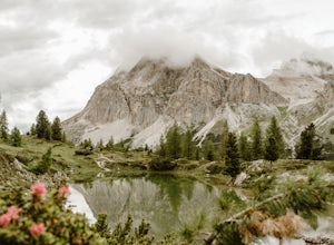
Hike to Lago Limides
1.6 mi / 426.5 ft gainLago Limides is a small alpine lake on the Falzarego Pass in the Italian Dolomites, not far from Cortina d'Ampezzo.For this hike, we parked at the Falzarego Lagazuoi cable car station, and followed the trail on the opposite side of the road. The trail is a narrow dirt trail, but it's easy to foll...Read more -
Oberkrimml, Austria
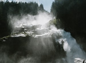
Hike to Krimml Waterfalls
2.6 mi / 1414 ft gainThe Krimml Waterfalls are situated in the Hohe Tauern National Park in the Salzburg region of Austria. At 380m high, they are the highest waterfalls not just of Austria, but in all of Europe. In the village of Krimml, near base of the waterfall you'll find a number of parking areas and the Wasser...Read more -
Auronzo di Cadore, Italy
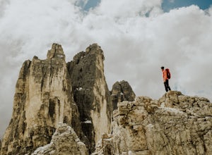
Hike to Rifugio Auronzo & The Three Peaks in the Dolomites
8.7 mi / 1935.7 ft gainYou start this easy hike from just before the toll road station on the road up from Misurina to Rifugio Auronzo. As you are looking towards the peaks and the trail starts on the right side of the road. The first part of the route takes you through some forest and across a couple of streams before...Read more -
Auronzo di Cadore, Italy
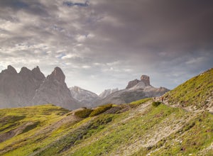
Tre Cime Di Lavaredo Loop
5.06.27 mi / 1352 ft gainThe famous Italy Dolomites are littered with numerous great hikes to showcase them, however, this trail is the cream of the crop. It will not disappoint. You have the option of hiking up to Rifugio Auronzo from Misurina, which is detailed out here. The other option that makes it easier if you're ...Read more

