
Palmer Trail (Section 16)
Manitou Springs, Colorado
Rated 5.0/5
based on 1 reviews
5.0/5
Details
Distance
5.51 miles
Elevation Gain
1352 ft
Route Type
Loop
Description
Added by Outbound
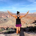
Palmer Trail (Section 16) is a loop trail where you may see beautiful wildflowers located near Colorado Springs, Colorado.
Download Outbound mobile app
Find adventures and camping on the go, share photos, use GPX tracks, and download maps for offline use.
Get the appFeatures
Mountain Biking
Running
Hiking
Dog Friendly
Forest
River
Scenic
Wildlife
Palmer Trail (Section 16) Reviews
Beautiful hike, nice and clear sand packed trail. Great city views
5.0
Leave No Trace
Always practice Leave No Trace ethics on your adventures and follow local regulations. Please explore responsibly!
Nearby

Hike Palmer Trail Loop at Section 16
The Section 16 trailhead can be found on lower Gold Camp Road. Almost immediately, the trail begins to rise in elevation. The grade is gentle at first but soon becomes a steep steady climb for about a mile and a half, until you reach the ridge.
Along the way, you will see many intersecting trails on the right that will lead you to Red Rock open space-- to stay on section 16, continue to stay t...

Mt. Cutler Trail
This is a quick hike to add to the list if you're making a trip to the Cheyenne Canon area. Parking is limited to about 15 cars and fills up fast so be sure to start early or the first part of your hike might start from a further parking or pull-off along the road.
This is the same parking lot and trailhead as Mt. Muscoco and is a great hike to pair together!

Mt. Muscoco Trail
The Basics: Mt. Muscoco (8020 ft.) is one of the easier summits in the Colorado Springs Front Range area, and you are quickly rewarded with 360 degree views after climbing 1.8 miles and 1,400 feet. The path is well-defined and maintained after it was reconstructed in 2015. Pack water and a light snack, bring the kids, and don't forget a camera for the top.
The Hike: The trail begins at the po...

Hike, Climb, or Bike Red Rock Open Space
Red Rock Canyon Open Space was made public in the early 00's after years of use as a quarry and landfill. Some of the stone quarried from the area have even been used in some of the downtown buildings.
Getting there is straightforward, heading West on 24 there is an obvious turn off left between 31st street and Manitou Springs. From the entrance of the park, you can turn right to a small parkin...

Seven Bridges Trail
Follow North Cheyenne Creek through the canyon as it forms several cascades along the way. Due to water levels, spring is an especially good time for this hike.
Most turn around just past the seventh bridge, where the trail starts to disappear.

Hike the Saint Mary's Falls Trail
This moderately difficult hike is a total of 6 miles, with a 1500' incline. You start from the parking lot off Gold Camp Road that intersects with High Drive, and start hiking up the part of Gold Camp Road that is closed off to vehicles. You will see a few trails stemming off from this main road, but continue along the dirt road to get to the falls. Once the trail turns from a road into a small...
Discover
Community
Mobile Apps

© 2026 The Outbound Collective - Terms of Use - Privacy Policy