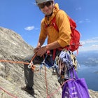
Mt. Muscoco Trail
Colorado Springs, Colorado
Details
Distance
3.66 miles
Elevation Gain
1453 ft
Route Type
Out-and-Back
Description
Added by Connor Bruson
This less-traveled summit in the foothills of Colorado Springs gives panoramic views of the city and Cheyenne Canyon in only ~3.5 miles.
The Basics: Mt. Muscoco (8020 ft.) is one of the easier summits in the Colorado Springs Front Range area, and you are quickly rewarded with 360 degree views after climbing 1.8 miles and 1,400 feet. The path is well-defined and maintained after it was reconstructed in 2015. Pack water and a light snack, bring the kids, and don't forget a camera for the top.
The Hike: The trail begins at the popular Mt. Cutler trailhead, on your left about halfway up Cheyenne Canyon. The hike shares the easy trail with the Mt. Cutler route to begin, and after about 0.5 miles at the saddle, the signed Mt. Muscoco trail cuts off to your right. The trail steepens from here until you get below the visible summit of Mt. Muscoco. Traverse right around to the back of the summit and then scramble to the top. The well-defined trail becomes rougher and more exposed once you begin traversing around the summit - use caution and be sure to stay on-route.
The Area: There are tons of other hikes and fun, free things to do in Cheyenne Canyon. Picnic areas dot the creek along the road from Starsmore Discovery Center all the way up to Helen Hunt Falls. Gold Camp Road parking lot at the top of the Canyon serves as a starting point for dozens more adventures. Seven Falls is a top paid visitor attraction.
Download the Outbound mobile app
Find adventures and camping on the go, share photos, use GPX tracks, and download maps for offline use.
Get the appFeatures
Mt. Muscoco Trail Reviews
Cool hike, but like others have said it is steep at the end and the trail can be hard to follow due to erosion. The view is a bit different from Cutler and adds a bit more of a challenge.
4.0
To say this is one of the easier hikes is misleading. This hike is difficult at the end (even the sign at the trail head say "intermediate to advanced") which is exactly what it is—intermediate at the beginning and requires advanced skill at the end as there is some scrambling involved to stay on trail. It is a great hike with very rewarding views once you summit. If you have trekking poles, bring them. With a few stops along the way it took me 3 hours to complete this hike up and back. Enjoy!
5.0
The trails snakes around the mountain giving a full 360 view on the hike up and the top gives a panoramic view of the surrounding area. Pike’s Peak is even visible from the summit
5.0
Well maintained trail the majority of the way up. A couple of different short splits that will take you to some boulder outcroppings. Amazing views all around at the peak.
5.0
Easily my favorite hike so far in the Springs! The map is a little off, maybe an older trail, however the trail can be followed pretty easily. Thanks to trail markers I only had to check the trail map a couple of times. Amazing views, great trail for dogs, not so much for kids.
5.0
This is an awesome hike. The trail is in great condition. Only thing I'd say as a parent of a 7, 4 and 1 year old is it's not a hike for the little ones. My 7 year old could do it but you'd have to carry the younger ones. There aren't many sections where you're not hiking at an incline which I love but the kiddos weren't to keen to it. Also, just a technicality, the topographical map is slightly wrong. When you take the right to go towards Mt. Muscoco the topo map is from an old trail that went up and over the ridge instead of what the trail does now, go left and around the ridge. Just an FYI. Great trail.
5.0
Leave No Trace
Always practice Leave No Trace ethics on your adventures and follow local regulations. Please explore responsibly!
Nearby
Mt. Cutler Trail
Helen Hunt Falls & Silver Cascades
Snowshoe to St. Mary's Falls
Hike the Saint Mary's Falls Trail
Hike the Seven Bridges Trail
Hike to St. Mary's Falls
Community
© 2024 The Outbound Collective - Terms of Use - Privacy Policy


