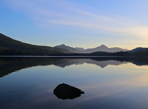
Camp at Nitinat Lake
Nitinat Lake is located about 70 km from Lake Cowichan on Vancouver Island. It's about a 2 h drive from Lake Cowichan with 1 h on logging roads. When you get close to Lake Cowichan, the highway splits into two possible routes, one on the south sid...
Hike Pulpit Rock and Flagpole, BC
3.5
1.9 mi
/ 1000 ft gain
This local trail starting from Johnstone Road is locally famous and really well maintained. Located off the other shore of Kootenay Lake, this hike reveals a beautiful view of the town of Nelson and the surrounding mountains.This trail is doable i...
Hike to Wilson Creek Falls
0.8 mi
/ 0 ft gain
The access to this spectacular waterfall is only a 11.5 km drive from Highway 6 in Rosebery. 10.5 km of the drive is easy on a well maintained road and the last 1 km is steep and rough. There you will reach the parking spot and see the trailhead.
Fishing at Lac Jovet in the French Alps
4.3 mi
/ 3215.2 ft gain
From Les Contamines-Montjoie drive towards Notre-Dame de la Gorge. Park there and continue in direction of the church. There you will have to cross the bridge and start the ascent of the old Roman Road and into the mountains towards the Refuge de ...
Exploring North Beach and Tow Hill
Starting from the town of Masset, there is only one gravel road to access to Tow Hill. This road is well maintained but I you don't have a car it's a pretty long walk. The beach start from the village of Masset but the hill is located more than 20...
Walking to the DC3 Plane Wreck
5 mi
The Sólheimasandur airplane wreckage is located on Iceland’s South coast between Skógafoss waterfall and the town of Vik. After driving past Skógafoss going East on Route 1, you will notice a spot to park on the side of the road. From there you wi...
Hike to Lone Cone
1.9 mi
This trail is located on Meares Island which is about a 10 minute boat ride from Tofino. You can kayak or boat over to the island (Tofino Water Taxi charges about $40 per person for the round-trip). When you reach the dock you travel for about 5 m...
Watch the World's Highest Tides at Burntcoat Head
0 mi
Drive to the small town of Noel and then turn right onto Burntcoat Road, the Park is 5 km on the right
Hike to the Canso Bomber Plane Wreck
1.9 mi
The trail to the Canso Plane Crash Site is located exactly 15 telephone poles south of the turnoff to Radar Hill. There is no parking allowed along the highway, so the closest parking is at the Radar Hill turnoff a few hundred meters from the high...
Hike to Lyle Lakes
1.9 mi
/ 2624.7 ft gain
From Kaslo, drive west on Highway 31 A for 23 km. Just before Retallack, you will find the Rossiter Creek FSR on your right. Follow the road and stay left at 1 km, travel 1.4 km more and take a second left. After 3.6 km take a left. Drive 1 km mor...
© 2021 The Outbound Collective - Terms of Use - Privacy Policy