Outbound Collective logo

The Best Hiking in Sault Ste Marie

Looking for the best hiking in Sault Ste Marie? We've got you covered with the top trails, trips, hiking, backpacking, camping and more around Sault Ste Marie. The detailed guides, photos, and reviews are all submitted by the Outbound community.

Top hiking spots in and near Sault Ste Marie

  • Brimley, Michigan

    Mission Hill

    3.31 mi / 358 ft gain
    Mission Hill is an out-and-back trail that takes you by a lake located near Brimley, Michigan.
    Read more
  • Cedarville, Michigan

    William C. Derby Jr. Nature Preserve Loop

    2.41 mi / 262 ft gain
    William C. Derby Jr. Nature Preserve Loop is a loop trail where you may see local wildlife located near Cedarville, Michigan.
    Read more
  • Paradise, Michigan

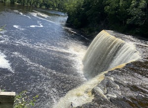
    Hike to Tahquamenon Falls

    5.0
    1 mi
    The waterfall is only a short stroll from the parking lot but is well worth the stop. It drops over 50ft and is 200ft wide. A stunning, powerful flow. The obvious 'Rootbeer' color comes from tannic acid produced by decaying hemlocks, cedars, and spruces along the river's banks. There are various ...
    Read more
  • Paradise, Michigan

    Clark Lake Loop

    5.07 mi / 344 ft gain
    Clark Lake Loop is a loop trail that takes you by a lake located near Newberry, Michigan.
    Read more
  • Paradise, Michigan

    Tahquamenon Falls -Upper Falls

    1.67 mi / 302 ft gain
    Tahquamenon Falls -Upper Falls is a loop trail that takes you by a waterfall located near Paradise, Michigan.
    Read more
  • Mackinac Island, Michigan

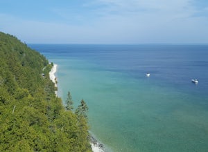
    Tranquil Bluff Trail on Mackinac Island

    5.0
    3.09 mi / 180 ft gain
    You will need to take a ferry to the island to access this hike, but the fare is cheap and is worth it for a day trip. This hike starts at the very popular (and thus usually crowded) Arch Rock and takes you halfway across the island to British Landing. Even with the initial crowds, you should be...
    Read more
  • Mackinac Island, Michigan

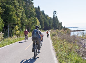
    Bike around Mackinac Island

    4.0
    8.05 mi / 115 ft gain
    Mackinac Island is accessible only by ferry, and there are no cars allowed on the island. While you can rent bikes over there, we opted to bring ours along on the Star Line ferry. Super easy and we had no problems! Lake Shore Boulevard, or State Highway M-185, wraps around the entire island and ...
    Read more
  • Mackinac Island, Michigan

    Arch Rock

    2.07 mi / 253 ft gain
    Arch Rock is an out-and-back trail that takes you through a nice forest located near Mackinac Island, Michigan.
    Read more
  • Mackinac Island, Michigan

    Mackinac Island Inner Loop

    7.7 mi / 745 ft gain
    Mackinac Island Inner Loop is a loop trail that takes you through a nice forest located near Mackinac Island, Michigan.
    Read more