Shawnigan Lake, British Columbia
Looking for the best hiking in Shawnigan Lake? We've got you covered with the top trails, trips, hiking, backpacking, camping and more around Shawnigan Lake. The detailed guides, photos, and reviews are all submitted by the Outbound community.
Top Hiking Spots in and near Shawnigan Lake
-
Port Angeles, Washington
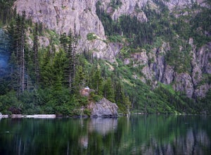
Backpack to Lake Angeles
5.07.12 mi / 2503 ft gainLake Angeles is, rightfully, a popular day hike and overnight backpacking option, as its one of the larger, more accessible lakes in Olympic National Park. It can be done either as a moderate day hike with a refreshing swim and picnic lunch or a relaxing overnight with gorgeous views and reliable...Read more -
Port Angeles, Washington
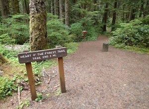
Hike the Heart O' the Forest Trail
5.04.52 mi / 840 ft gainThis hike is a short, 4.0 mile round trip, half-day or less hike, located just past the Hurricane Ridge entrance into Olympic National Park. Being relatively level and the trail head just off loop E of the Heart O' the Hills Campground, the Heart O' the Forest hike offers those looking for a tast...Read more -
Surrey, British Columbia
Walk the 1001 Steps Trail
2.00.3 miOne of Surrey's hidden gems, head down to this short trail down a set of stairs that will take you to an uninhabited beach.The zig zagged steps take you down to the Birlington Rail Lines and you can walk along a trail to an opening under the tracks. Head to the beach from here where you will like...Read more -
Blaine, Washington
Terrell Marsh Trail
3.00.63 mi / 82 ft gainTerrell Marsh Trail is a loop trail that takes you past scenic surroundings located near Blaine, Washington.Read more -
Port Angeles, Washington
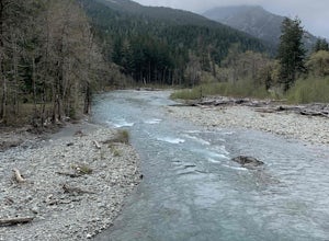
West Elwha River Trail
5.06.11 mi / 1198 ft gainWest Elwha River Trail is an out-and-back trail that takes you by a river located near Port Angeles, Washington.Read more -
Surrey, British Columbia
Hike the Elgin Heritage Park Nature Trail
4.02 miHead over to this magical little park by the water. The forested area between the 2 entrances to the park has many large trees often used by eagles and hawks to survey the surrounding area for prey. The habitat functions of the marsh significantly contribute to the ecological value of the lower N...Read more -
Port Angeles, Washington
Ancient Groves
5.00.49 mi / 105 ft gainGreat little hike to explore while in the Sol Duc area. I would strongly recommend doing this hike near sunset as the sun will stream through the trees and light everything up in a beautiful glow. The hike will take you to a cliff edge to walk along and get views of the Sol Duc river below. Ver...Read more -
Port Angeles, Washington
Klahhane Ridge (Switchback Route)
4.05 mi / 1700 ft gainHiking to Klahhane Ridge is a rewarding experience that provides you with sweeping views of the Olympic Mountains. Further access to overnight opportunities is possible if you venture beyond the summit trail. Here’s the scoop: Get an early start. There is a decent amount of parking available at ...Read more -
Port Angeles, Washington
Hurricane Hill
4.83.13 mi / 689 ft gainTo get to this hike you drive up to Hurricane Ridge in Olympic National Park. The drive up to Hurricane Ridge is on a winding road with amazing views of the mountains. Once you reach the visitors center at Hurricane Ridge you can fill up water bottles or use the restroom. The trailhead for Hurric...Read more -
Delta, British Columbia
Hiking through Burns Bog Delta Nature Reserve
1.9 miAs you begin your journey into Burns Bog Delta Nature Reserve from the parking lot and small trail coming off of Westview Drive, notice the gravel trail ahead of you and across the train tracks that will take you into the bog itself and take a left. After spending a few minutes on the straight tr...Read more -
Anacortes, Washington
Hike Sares Head
2.1 mi / 440 ft gainStarting at the parking area, there is a roughly 2 mile hike through the woods. Depending on which route you take, you will suddenly end up at one of many incredible view points looking West at the Olympic Mountains, open ocean, and the San Juan Islands. In some areas you will be about 150 feet a...Read more -
Port Angeles, Washington
Wolf Creek Trail
8.12 mi / 3970 ft gainTo tackle the Wolf Creek Trail, you start by winding up Whiskey Bend Road just outside of Port Angeles, falling the curves and hills of Elwha River. The peaks of the Olympic Mountains stand in the distance.Once you approach a clearing and small parking area, you grab the gear and hit the trail. T...Read more -
Port Angeles, Washington
Humes Ranch and Goblin Gates
6.4 mi / 994 ft gainThe Elwha River Trail cuts south into the heart of Olympic National Park along a densely forested valley, following the same route taken by some of the earliest explorers of the Olympic Peninsula at the end of the 19th century. Past Port Angeles, at a hard curve in US-101, take Olympic Hot Sprin...Read more -
Port Angeles, Washington
Klahhane Ridge Trail
13.2 mi / 4016 ft gainThe winding roads and drop-off cliffs provide an outstanding journey to the trailheads on a clear day. If you have to bear through the fog, your reward at the top is worth every second of what you missed. The first image above is your view from the Hurricane Ridge Visitor Center, so even if you a...Read more -
Anacortes, Washington
Pacific NW Trail in Deception Pass State Park
5.02.12 mi / 259 ft gainStarting from the Rosario Beach parking lot, the trail heads out past a large recreation area for families and into a wooded area leading up to Rosario Head. At this point in the trail there are beaches on either side that provide a great opportunity to explore some tidal pools. If you choose to...Read more -
Anacortes, Washington
Hike to the Summit of Mt. Erie
4.05 mi / 900 ft gainTo start this hike, jump on trail 215 for a short distance of about a 1/4 mile. From here, continue until you cross trail 320 and head left onto it. Stay on 320 until you come across trail 230.Take 230 uphill (resembles an old fire road) toward the ravine just above a creek. From here, head onto ...Read more

