Powell River, British Columbia
Top Spots in and near Powell River
-
Errington, British Columbia
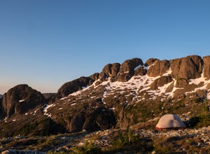
Mt. Arrowmsith's claim to fame is the tallest mountain on "southern" Vancouver Island. Standing at 1,819 m (6,000 ft), it barely squeezes into the top 50 of the Island, as it stands no chance against the peaks of Strathcona, which you can see gazing north from the summit!The advantage of Arrowsmi...
Read more
-
Errington, British Columbia
This is an easy 3 km or so hike that you can meander along and enjoy the lush greenery and the two waterfalls. The lower waterfalls is best viewed in the spring or winter. When summer comes the river gets lower and in turn that waterfall gets hard to see. Although, when the water levels are low y...
Read more
-
Errington, British Columbia
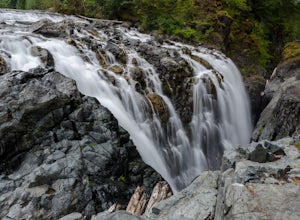
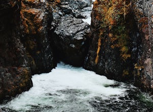
Situated amid a quiet forest of both old and new growth Douglas firs, cedar, hemlock, and maple, the Englishman River Falls consist of two waterfalls which cascade into a deep canyon beneath a secluded bridge. Perfect for intermediate hikers, day-trippers, photographers and curious tourists, this...
Read more
-
Sechelt, British Columbia
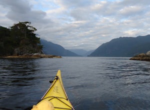
Set off from Sechelt, a small seaside community on the Sunshine Coast - about two hours from Vancouver which is accessed by ferry or float plane.As soon as you start paddling from the harbour in Sechelt, the calm waters are so clear that starfish and other marine life are easily visible beneath t...
Read more
-
Errington, British Columbia
Mount Arrowsmith resides in the heart of Vancouver Island between Nanaimo and Tofino within the Alberni Valley region. At the height of 1817m this peak boasts being the tallest point on the southern half of the island. With it's easy access it is surely the most visited and summited mountain on t...
Read more
-
Heriot Bay, British Columbia
Sayward Lakes Canoe Route
This is an easy canoe route through a series of lakes west of Campbell River on Vancouver Island BC. It is ideal for beginner or intermediate level trippers, providing a good multi-day trip through a mix of remote lakes and lakes with serviced campsites. The trip feature...
Read more
-
Nanoose Bay, British Columbia
This trail isn't much to look at but it's all about the destination here as you will stumble upon scenic waterfalls nestled in the quiet Nanoose Bay area.
Turn off the highway next onto Sea Blush Drive next to the Arlington Pub in Nanoose BC. Take your first right onto Sundew Place. Start your wa...
Read more
-
Comox-Strathcona D, British Columbia
Though the Meadows can be reached by an alternate (very long) route not requiring a boat, the standard access is had by crossing Buttle Lake from the Augerpoint Day Area parking lot on the Buttle Lake Parkway (turn south towards the Westmin mine at the Buttle Lake bridge, just before the provinci...
Read more
-
Alberni-Clayoquot F, British Columbia
I have lived on Vancouver Island my entire life yet I had never heard about this world class trail until last summer. A 24km point to point coastal trail that travels the length of the Alberni Inlet from the coast right to the town? Through paradise meadows, along sun drenched bluffs, past water...
Read more
-
Comox-Strathcona D, British Columbia
The drive to Lupin Falls from Courtenay BC is approximately 1.5 hours. Along the way you will drive past beautiful lakes, forests and mountains. Once at the parking/day use area the trailhead for Lupin Falls is on the opposite side of the road. Everything is very well marked and signed. The walk ...
Read more
-
Comox-Strathcona D, British Columbia
With a name like Flower Ridge, who wouldn't want to add this hike to their bucket list?The Flower Ridge trailhead is located approximately 26kms down the Buttle Lake Parkway, towards Westmin Mine, in Strathcona Provincial Park. A classic Island alpine approach, you will be more than warmed up af...
Read more
-
Comox-Strathcona D, British Columbia
These beautiful falls are just a short and easy 500 metre stroll from the parking lot, making this one of the more family-friendly hikes in the area. Located at the end of the trail are the 75 metre cascading falls and spectacular views of Buttle Lake.Located approximately 1 1/2 hours north of th...
Read more

