Manning Park, British Columbia
Looking for the best photography in Manning Park? We've got you covered with the top trails, trips, hiking, backpacking, camping and more around Manning Park. The detailed guides, photos, and reviews are all submitted by the Outbound community.
Top Photography Spots in and near Manning Park
-
Skagit County, Washington
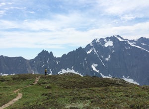
Sahale Arm via Cascade Pass
4.312.34 mi / 5230 ft gainTo get to this hike, go to Marblemount, WA. Then, drive ~23 miles east on Cascade River Road until the end, the Cascade Pass Trailhead. Even before you hit the trail, you'll get an amazing view of Johannesburg Mountain. Once you're ready to get going, the initial 3.7 miles of this hike to Cascad...Read more -
Skagit County, Washington
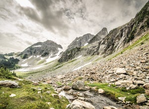
Pelton Basin Camp
8.82 mi / 2543 ft gainStarting at 3,640 feet elevation, the Cascade Pass Trailhead begins adjacent to the Johannesburg Camp and proceeds east along a relentless series of switchbacks. Though the trail is consumed by a thick Washington evergreen forest, the switchbacks frequently open to sweeping vistas of the far-reac...Read more -
Deming, Washington
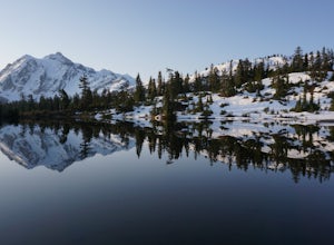
Catch a Sunrise at Picture Lake
4.7Set your eyes on one of the most photographic mountain landscapes in North America. You can drive up early for the sunrise, but really any time of day will be a treat.In the spring, make sure to come when the lake isn't frozen over so you can get the full reflection of Mt. Shuksan on the water. T...Read more -
Marblemount, Washington
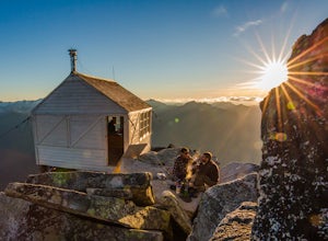
Hidden Lake Lookout
4.97.39 mi / 3415 ft gainBe careful when heading up this 4.5 mile trail since there can be snow coverage into the summer. When you start the trail, you'll get a little tree coverage as you start climbing up. Unfortunately, the shade starts to dissipate after about a mile, where you'll cross over Sibley Creek and enter th...Read more -
Deming, Washington
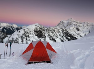
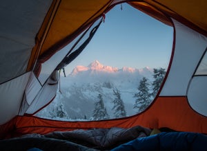
Winter Backpack to Artist Point
4 mi / 1000 ft gainYou do need a Northwest Forest Pass to park in the lot overnight. You can buy a day use E-pass online here (pick Mount Baker-Snoqualmie National Forest from the drop down menu) and print it out and it's ready to use. Or you can buy the annual pass here.The adventure to Artist Point begins in the ...Read more -
Deming, Washington
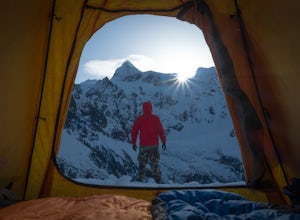
Winter Backpack in the Mt. Baker Backcountry
6 mi / 1500 ft gainArrive at the upper ski resort parking lot (approx. 4300 feet elev.) and snowshoe, skin, or split board up. Make your way toward Artist Point and eventually Huntoon Point, gaining approximately 1500 feet of elevation over approximately 3 miles (one way). Past Huntoon Point, there are several grea...Read more -
Deming, Washington
Winter Backpack to Lake Anne Ridge
14 mi / 2000 ft gainArrive at the upper ski resort parking lot (approx. 4300 feet elev.) and snowshoe, skin, or split board up. Make your way toward Artist Point and halt at Austin Pass, gaining approximately 1200 feet of elevation over approximately 2 miles (one way). From Austin Pass, turn left (south) to take the...Read more -
Deming, Washington
Chain Lakes Loop
4.08.35 mi / 2005 ft gainDriving Directions: Travel east on Mt. Baker Highway 542 to the road's end and the Mount Baker Ski area. Follow the signs to the upper parking lot and the Bagley Lakes/Chain Lakes trailhead. The trail can also be accessed from Austin Pass and Artist Point. Trail: From the Bagley Lakes trail...Read more -
Marblemount, Washington
Lookout Mountain Trail
5.09.06 mi / 4610 ft gainBeginning about 7 miles down the Cascade River Road from Marblemount, the Lookout Mountain Lookout trailhead is on the north side of the road with parking for about 4-5 cars. With about 4500' elevation gain in 4.7 miles, this hike is definitely a thigh burner. The trail begins with a steep climb...Read more -
Marblemount, Washington
Hike to Monogram Lake
9.8 mi / 4500 ft gainOn a drizzly day, we set out to patrol Monogram Lake. Sore legs and thousands of feet later, we had the pristine lake all to ourselves with gorgeous fall weather and peek-a-boo views of the North Cascades.From Highway 20 in Marblemount, take Cascade River Road for 7 miles and look for a small par...Read more -
Deming, Washington
Hike the Bagley Lakes Trail
4.52 mi / 150 ft gainSet within the Mount Baker hiking wonderland, the Bagley Lakes trail is an easy, family-friendly hike with alpine lakes, copious amounts of wildflowers, and striking views of Table Mountain. Compared to the notoriety of many of the other hikes within the area, this is a hidden gem. There are actu...Read more -
Deming, Washington
Hike the Fire and Ice Trail
0.5 mi / 100 ft gainSet within the Mount Baker hiking wonderland, the Fire & Ice Trail may be the easiest and most family friendly hike set within the park. About ½ mile beyond the Heather Meadows Ski Area and about a mile before Artists Point, you’ll encounter the sign for the Austin Pass Picnic Area. It’s a ra...Read more -
Deming, Washington
Climb Mt. Shuksan via The Fisher Chimneys
Out of all of the ruggedly beautiful, non-volcanic mountains in the Pacific Northwest, Mt. Shuksan is the center piece. Rising to a height of 9,131 feet, Mt. Shuksan is one of the most photographed mountains in the world with its jagged ridges, hanging glaciers, steep rocky faces and ease of acce...Read more -
Deming, Washington
Hiking the Kulshan Ridge
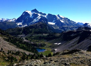
This hike starts out at Artist Point, where already you can see jaw-dropping scenery of Mt. Shuksan, Baker, Coleman, and many other peaks of the North Cascades. No matter what time of year you visit, you are bound to get unbelievable views and photos.Artist Point is the furthest destination along...Read more -
Deming, Washington
Hike to Table Mountain via Artist Point
5.03 mi / 560 ft gainThe hike takes off from the Artist Point parking lot at an elevation of 5,220 feett.The trail slowly meanders up for a while until reaching the final steep switchbacks where you'll have a sheer cliff to your side—don't let it distract you, and keep focused on the trail in front of you!Once you've...Read more -
Deming, Washington
Hike Ptarmigan Ridge in the North Cascades
5.09 mi / 1350 ft gainDirections are from Bellingham. Drive Sr 542(Mt Baker Highway) approximately 60 miles to the parking area at Artist Point, elev. 5140 ft. Try to park towards the southwest corner of the lot as this is where our trail begins. Toilets are available.The trail starts from the southwest corner of t...Read more

