East Kootenay E, British Columbia
Looking for the best photography in East Kootenay E? We've got you covered with the top trails, trips, hiking, backpacking, camping and more around East Kootenay E. The detailed guides, photos, and reviews are all submitted by the Outbound community.
Top Photography Spots in and near East Kootenay E
-
Kananaskis, Alberta
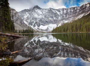
Rawson Lake
4.55 miGetting There From Highway 1, Take Highway 40 South to Kananaskis Lakes Trail, and turn left at Upper Kananaskis Lakes Drive. The Trail The trail to Rawson Lake starts at the end of the "Day Use Area" at Upper Kananaskis Lake. The lake gently laps the shoreline to the right and moss carpets the...Read more -
Kananaskis, Alberta
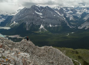
Hike Mount Indefatigable
4.5If you choose to do this hike, you'll find yourself at Kananaskis Lakes, one of my favourite spots in K-Country! Park your car at the Interlakes parking lot, have that one last bathroom break, and make your way north to get to the trailhead. The trailhead is impossible to miss as it's blocked off...Read more -
Turner Valley, Alberta
Mist Mountain Scramble
4.5This is a pretty big objective, but doesn't feature any technical climbing, so anyone who keeps a clear head and can put one foot in front of the other can do it.Mist Mountain is located in Highwood Pass - whose highway is only open between June and December, so scheduling Mist Mountain as a big ...Read more -
Kananaskis, Alberta
Hike to Little Arethusa
2.8 mi / 2034.1 ft gainUnfortunately, pictures of larches in autumn never actually do them justice. It's worth it to go out and experience them for yourself. This hike is pretty scenic for the short distance it is, but my favourite part is that you get to be up close and personal with the larches as the forest is bathe...Read more -
Kananaskis, Alberta
Hike Pocaterra Ridge
4.09 mi / 650 ft gainDuring the fall I find the biggest treat is the changing of the larch trees and the beautiful contrast they provide against the landscape with their intense golden yellow colors. One of the best places to experience this is Pocaterra Ridge, located in the Highwood Pass of the Kananaskis region in...Read more -
Kananaskis, Alberta
Explore the Pocaterra Cirque
Start at the Pocaterra/Highwood pass parking lot. The pond is about 1.5km directly west from the parking lot, but the trail head is not always obvious, especially if there is snow. Keep an eye out for the flagging tape that marks the trail. Consider bringing snowshoes in November.This makes for ...Read more -
Kananaskis, Alberta
Scramble Mount Rae
4.0Mount Rae has given me the slip a couple times before, so I opted to take it on solo in the hopes of getting a successful attempt in. Damn, this is a good one.Park at the Highwood Pass parking lot, and start off on the Ptarmigan Cirque Trail. Forested until you get to the cirque, check beforehand...Read more -
Fernie, British Columbia
Hike the Mountain Lakes Trail (Heiko's Trail)
5.014.9 mi / 6889.8 ft gainFinished in 2003 by Fernie legend Heiko Socher, Mountain Lakes Trail (aka Heiko’s Trail) is about as good as it gets. This hike is not for the inexperienced hiker. You are way out in the backcountry with little to no other human contact. This is grizzly bear and cougar country so make sure to bri...Read more -
Longview, Alberta
Carnarvon Lake Trail
12.9 mi / 2221 ft gainI first heard about Carnarvon Lake (mistakenly called Carnivore Lake) in 2015 at my sister's wedding in Rhode Island - which is actually the last place I figured I'd get a recommendation. I spent a good amount of time trying to find any mention of Carnivore Lake on the internet, and asked anyone ...Read more -
Kananaskis, Alberta
Snowshoe up Gypsum Ridge
3.7 mi / 1378 ft gainIf you have a topographic map of Kananaskis Lakes, the trailhead is just to the east of Blackshale Creek. If you don't have a topographic map of the area, the Google Maps pin on this adventure will help you get there --- you'll see a pretty large opening on the south side of the road. Luckily, th...Read more -
Kananaskis, Alberta
Snowshoe the Kent Ridge North Outlier
3.7 mi / 2395 ft gainAttempt this in a winter with some great snowfall and you might be able to get some great shots of the beautiful cornices that form on the ridge.The trailhead is at the north end of the Sawmill Parking lot right by the outhouses. It heads past a metal gate to a maze of old logging roads. The prop...Read more -
Kananaskis, Alberta
Exploring Burstall Pass
5.0Head to the northwest corner of the parking lot to find the trail. For the first 5.5 km the trail is quite easy, with only modest elevation increase. At 5.5 km you will arrive at what is known as the gravel flats. Depending on the time of year the gravel flats can be either quite dry or a wide, s...Read more -
Kananaskis, Alberta
Hiking Burstall Pass
5.09.3 mi / 1542 ft gainThe trail begins along the berm beside Mud Lake. After a rather uninspiring 3 km (you can mountain bike this part) the trail narrows and enters trees where tangled roots twist across the path and you breathe in the smells of damp earth and moss.Ten minutes later the trail spits you across a spl...Read more -
Kananaskis, Alberta
Backpack the Fortress Cirque
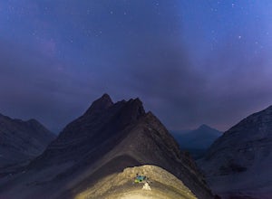
5.012.19 mi / 3507 ft gainNo better way to watch the stars with friends than huddled up in your sleeping bag on top of a 3000m summit. This describes the bivy at The Fortress. Starting at the Chester Lake Trailhead, take the unmarked trail on the right side of the parking lot. These winter cross-country ski trails take y...Read more -
Kananaskis, Alberta
Hike from Headwall Lakes to Chester Lake
5.010.6 mi / 2650.9 ft gainThe hike starts at the Chester Lake trailhead along the Smith Dorian road in Kananaskis. The first few kilometers follow the old logging roads, now used as cross country skiing trails. Find the beginning of the trail at the upper right end of the parking lot, and continue to follow parallel to t...Read more -
Kananaskis, Alberta
Scramble the Fortress
Have you ever done a hike where you just don't want the day to end? Scramble the Fortress and you'll know the feeling. The thing that drew me to the Fortress was its summit elevation of 3000 masl, as well as its blocky, fortress-like profile when viewed from the north. It's so much more than that...Read more

