East Kootenay E, British Columbia
Looking for the best hiking in East Kootenay E? We've got you covered with the top trails, trips, hiking, backpacking, camping and more around East Kootenay E. The detailed guides, photos, and reviews are all submitted by the Outbound community.
Top Hiking Spots in and near East Kootenay E
-
Longview, Alberta
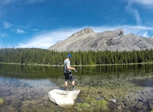
Backpack to Pickle Jar Lakes
4.05 mi / 1328.7 ft gainPark in the Lantern Creek Recreation Area across the street from the trailhead. Highway #40 is closed at the Upper Lakes and Highwood House Junction from Dec 1st to June 14th for wildlife preservation, so you will have to plan your trip here accordingly. Once you cross the street you will see the...Read more -
Longview, Alberta
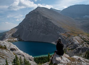
Carnarvon Lake Trail
12.9 mi / 2221 ft gainI first heard about Carnarvon Lake (mistakenly called Carnivore Lake) in 2015 at my sister's wedding in Rhode Island - which is actually the last place I figured I'd get a recommendation. I spent a good amount of time trying to find any mention of Carnivore Lake on the internet, and asked anyone ...Read more -
Kananaskis, Alberta
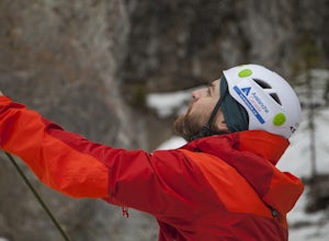
Ice Climb at King Creek
4.0Follow the defined path trailing roughly along the creek bed, a 20 minute hike from the car park. King Creek lies at the bottom of a gorge with steep rock walls on either side and a cascade of fat ice being forced out of the rocks. It's a gorgeous spot, showcasing the true beauty of Kananaskis.It...Read more -
Kananaskis, Alberta
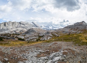
Exploring Burstall Pass
5.0Head to the northwest corner of the parking lot to find the trail. For the first 5.5 km the trail is quite easy, with only modest elevation increase. At 5.5 km you will arrive at what is known as the gravel flats. Depending on the time of year the gravel flats can be either quite dry or a wide, s...Read more -
Kananaskis, Alberta
Hiking Burstall Pass
5.09.3 mi / 1542 ft gainThe trail begins along the berm beside Mud Lake. After a rather uninspiring 3 km (you can mountain bike this part) the trail narrows and enters trees where tangled roots twist across the path and you breathe in the smells of damp earth and moss.Ten minutes later the trail spits you across a spl...Read more -
Kananaskis, Alberta
Backpack the Fortress Cirque
5.012.19 mi / 3507 ft gainNo better way to watch the stars with friends than huddled up in your sleeping bag on top of a 3000m summit. This describes the bivy at The Fortress. Starting at the Chester Lake Trailhead, take the unmarked trail on the right side of the parking lot. These winter cross-country ski trails take y...Read more -
Kananaskis, Alberta
Hike from Headwall Lakes to Chester Lake
5.010.6 mi / 2650.9 ft gainThe hike starts at the Chester Lake trailhead along the Smith Dorian road in Kananaskis. The first few kilometers follow the old logging roads, now used as cross country skiing trails. Find the beginning of the trail at the upper right end of the parking lot, and continue to follow parallel to t...Read more -
Kananaskis, Alberta
Hike to Chester Lake
5.06.2 mi / 984.3 ft gainChester Lake was officially one of my favorite hikes of 2016. It's a short & sweet 5 km's to the lake, with outstanding views in every direction. Fall colors were just starting to peak through and the sky looked amazing. From what I understand, this is one of the more popular hikes in the are...Read more -
Kananaskis, Alberta
Scramble the Fortress
Have you ever done a hike where you just don't want the day to end? Scramble the Fortress and you'll know the feeling. The thing that drew me to the Fortress was its summit elevation of 3000 masl, as well as its blocky, fortress-like profile when viewed from the north. It's so much more than that...Read more -
Kananaskis, Alberta
Hike Alberta's Grizzly Peak
4.0The trailhead is located on the north side of Ripple Creek, the first creek you come across after passing the Grizzly Creek turnoff. There is an easy pull-off on the east side of the highway. You should be able to see the trailhead from the road, which follows the southern slope of the mountain f...Read more -
East Kootenay F, British Columbia
Hike to Jumbo Pass
6 mi / 2200 ft gainFrom Invermere, British Columbia, head West towards Panorama Ski Area on Toby Creek Forest Service Road. At the turnoff for the bridge that heads towards Panorama, set your trip odometer to 0. At a fork in the road at about 12 miles, stay right on Jumbo Creek Road. In another mile, stay left. At ...Read more -
Kananaskis, Alberta
Hike Opal Ridge's South Summit
5.0Opal Ridge is located on the East side of highway 40 in Kananaskis.The trailhead starts at Fortress Gas Station. Park at the North end of the parking lot. The trailhead is easy to spot from here. Follow the creek a couple hundred meters till you reach an open area with power lines. Turn left. Con...Read more -
Turner Valley, Alberta
Hike Junction Creek to Junction Falls
4.09.2 miJunction creek is a tributary that flows into the larger Sheep River near Eden, Alberta with many cool and uncrowded waterfalls. Once you start at the trailhead there is a river crossing of the Sheep River. This can deter a lot of people as the water can be fast and quite cold. When we went it w...Read more -
Fernie, British Columbia
Hike through Mount Fernie Provincial Park
4.02.5 mi / 65.6 ft gainFernie is a well-known destination for outdoor rec activities, from resort skiing to backcountry touring to hiking and mountain biking. Going for a short winter hike might seem like the least exciting thing you could do, but as a break from the regular nine-to-five, it provides a perfect reconnec...Read more -
Kananaskis, Alberta
Scramble Smutwood Peak
5.011.8 mi / 2772.3 ft gainThe trailhead is is located at the first left after the bridge past Engandine Lodge in Kananaskis. The trail forks after a while and you need to take a right which takes you into Smuts Pass. This trail is actually really cool and fun to walk - undulating, narrow, rooted, and right along the edge ...Read more -
Kananaskis, Alberta
Hike Along Tent Ridge
4.5Starting off just past the Mt Engadine Lodge there is a make shift parking lot on your right hand side (usually filled with 10 or so cars depending when you go) This trail is a loop so there are two trail heads. The first is easily seen about 500m up the road on your left and the second was about...Read more

