Comox, British Columbia
Top Spots in and near Comox
-
Comox-Strathcona D, British Columbia
Summit The Golden Hinde
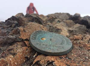
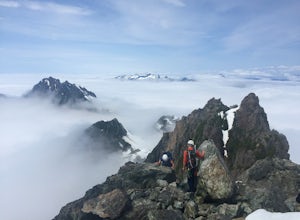
5.040.4 mi / 5987.5 ft gainAs Vancouver Island's highest peak, the Golden Hinde is an obvious draw for coastal climbers. Its gravitational pull, however, requires a commitment, given this crown jewel of the Island Alpine is also one of its most remote, and gains more elevation than from Base Camp to Everest's summit.Winter...Read more -
Refuge Cove, British Columbia
Kayak Camping in Desolation Sound Marine Park
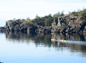
5.0Leave from Okeover Arm just north of Powell River to get into the passage to the park. If you are coming from Vancouver, expect a 6 hour drive with multiple ferry rides.The paddle to the campground is fairly easy for an intermediate kayaker. Distances are about 10km from one camp to the next. Onl...Read more -
Comox-Strathcona D, British Columbia
Hike to Cream Lake, BC
12.4 mi / 1312.3 ft gainThe hike to Cream Lake starts at the trailhead for the Bedwell Lake trail, which you can find directions to here.From Bedwell Lake the trail to Cream Lake heads Eastward from the campground (past the outhouse), and begins climbing steadily. Shortly you will reach a waterfall with the trail climb...Read more -
Comox-Strathcona D, British Columbia
Hike to Baby Bedwell & Bedwell Lake
5.07.5 mi / 2132.5 ft gainDriving: From Campbell River, take Highway 28 West to the bridge over Upper Campbell Lake/Buttle Lake. Do not cross the bridge, but take the road down the East side of Buttle Lake. Follow Buttle Lake road south to Jim Mitchell Lake road which is on the left just after the Thelwood Creek Bridge. ...Read more -
Comox-Strathcona D, British Columbia
Mt. Myra via Tennent Lake Trail
9.33 mi / 4810 ft gainVery few people know about this hidden gem which makes it less crowded and all the more special. The views and serenity that this place possess are what will really draw you in. The hike starts at the Westmin Mine parking lot, located 2 hours north of Courtenay. To find the start of the trailhea...Read more -
Alberni-Clayoquot F, British Columbia
Run the Alberni Inlet Trail
14.9 mi / 3937 ft gainI have lived on Vancouver Island my entire life yet I had never heard about this world class trail until last summer. A 24km point to point coastal trail that travels the length of the Alberni Inlet from the coast right to the town? Through paradise meadows, along sun drenched bluffs, past water...Read more -
Errington, British Columbia
Summit Mount Cokely
3.5The starting point depends a lot on the time of year and snow level. On a bad snow year you can get all the way to the old ski area base. Depending on the road conditions, however, be prepared to snowshoe/skin in anywhere from an extra 3 to 5 km (2-3 mi). The Rousseau Chute route is an alternativ...Read more -
Errington, British Columbia
Hike and Camp at Mt. Arrowsmith
5.0Mt. Arrowmsith's claim to fame is the tallest mountain on "southern" Vancouver Island. Standing at 1,819 m (6,000 ft), it barely squeezes into the top 50 of the Island, as it stands no chance against the peaks of Strathcona, which you can see gazing north from the summit!The advantage of Arrowsmi...Read more -
Errington, British Columbia
Winter Climbing Mount Arrowsmith
Mount Arrowsmith resides in the heart of Vancouver Island between Nanaimo and Tofino within the Alberni Valley region. At the height of 1817m this peak boasts being the tallest point on the southern half of the island. With it's easy access it is surely the most visited and summited mountain on t...Read more -
Parksville, British Columbia
Explore Lasqueti Island
15.5 mi / 754.6 ft gainLasqueti Island is a beautiful island that covers about 75 square kilometres. It is one of the drier islands in the strait, and has some of the warmest waters too. The shores are dotted with arbutus trees, and feral sheep run wild through the woods. The lack of car ferry and direct utilities kee...Read more -
Alberni-Clayoquot D, British Columbia
Climb Triple Peak
4.05.6 mi / 3149.6 ft gainAccess to Triple Peak mountain is found via the Marion Creek Main logging road approximately 48km west of Port Alberni on your left hand side along highway #4 headed towards Tofino. The road can present seasonal challenges and is rough so best to have a high clearance and 4x4 capable vehicle if p...Read more -
Parksville, British Columbia
Catch a Sunset from Little Mountain Lookout
3.51 mi / 0 ft gainAmazing lookout just outside of Parksville, British Columbia. From Parksville, drive towards Coombs and turn left off of Bellevue Rd. Then take the left onto Little Mountain Road and drive to the top parking lot. You can park at the bottom of the hill and run up the steep incline in case your car...Read more -
Errington, British Columbia
Hike through Englishman River Falls Provincial Park
4.31.9 miThis is an easy 3 km or so hike that you can meander along and enjoy the lush greenery and the two waterfalls. The lower waterfalls is best viewed in the spring or winter. When summer comes the river gets lower and in turn that waterfall gets hard to see. Although, when the water levels are low y...Read more -
Errington, British Columbia
Hike to BC's Englishman River Falls
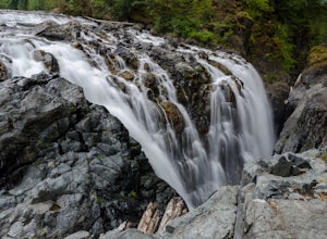
1.9 miSituated amid a quiet forest of both old and new growth Douglas firs, cedar, hemlock, and maple, the Englishman River Falls consist of two waterfalls which cascade into a deep canyon beneath a secluded bridge. Perfect for intermediate hikers, day-trippers, photographers and curious tourists, this...Read more -
Heriot Bay, British Columbia
Canoe the Sayward Lakes Loop
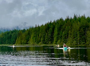
Sayward Lakes Canoe Route This is an easy canoe route through a series of lakes west of Campbell River on Vancouver Island BC. It is ideal for beginner or intermediate level trippers, providing a good multi-day trip through a mix of remote lakes and lakes with serviced campsites. The trip feature...Read more -
Comox-Strathcona D, British Columbia
Hike to Lady Falls
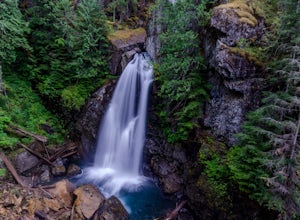
5.01.2 mi / 131.2 ft gainThis waterfall is a pretty stellar sight. Located in one part of Strathcona Provincial Park, it plunges about 90 feet from a small slot canyon into a wide deep canyon. From the view point you can feel the mist from the waterfall on your face. For a different perspective, there is a small trail ju...Read more

