Alberni-Clayoquot D, British Columbia
Top Spots in and near Alberni-Clayoquot D
-
Errington, British Columbia
The starting point depends a lot on the time of year and snow level. On a bad snow year you can get all the way to the old ski area base. Depending on the road conditions, however, be prepared to snowshoe/skin in anywhere from an extra 3 to 5 km (2-3 mi). The Rousseau Chute route is an alternativ...
Read more
-
Comox-Strathcona C, British Columbia
Trail access begins at the end of Forbidden Plateau Road, at the site of the old abandoned ski lodge. It is an ugly place to begin a hike to such a beautiful summit, but do not let that deter you. Past the trash of forest parties, around the remnants of the old ski lodge and over the washed out r...
Read more
-
Hornby Island, British Columbia
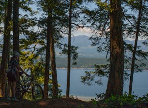
Hornby Island riding is almost too good to be true. The island itself is charming and laid-back – for its beaches and warm water swimming, it has been described as the Hawaii of the North.Furthermore, the centrally located Mt. Geoffrey is jam-packed with extremely fast, smooth, well graded trails...
Read more
-
Nanaimo F, British Columbia
Little Qualicum Falls Provincial Park is just off the #4 highway on your way out to Port Alberni. Simply look for the signs indicating Little Qualicum Falls Provincial Park, and you will turn into the park before Cameron Lake.Easily accessible by everyone, this park can get busy in the summer mon...
Read more
-
Comox-Strathcona D, British Columbia
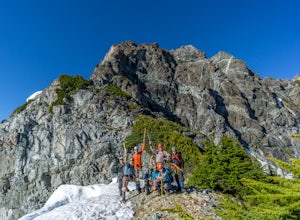
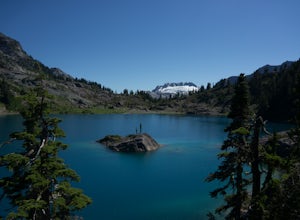
Mt Septimus lies deep within the beautiful and untouched Strathcona Park on Vancouver Island. The route takes you high into the alpine where you will cross glacial fed lakes amongst large peaks and thick forest. To climb Mt Septimus the route you will be taking is the X-Gully route, a steep snow ...
Read more
-
Comox-Strathcona D, British Columbia
The hike to Cream Lake starts at the trailhead for the Bedwell Lake trail, which you can find directions to here.From Bedwell Lake the trail to Cream Lake heads Eastward from the campground (past the outhouse), and begins climbing steadily. Shortly you will reach a waterfall with the trail climb...
Read more
-
Comox-Strathcona D, British Columbia
5.0
7.5 mi
/ 2132.5 ft gain
Driving: From Campbell River, take Highway 28 West to the bridge over Upper Campbell Lake/Buttle Lake. Do not cross the bridge, but take the road down the East side of Buttle Lake. Follow Buttle Lake road south to Jim Mitchell Lake road which is on the left just after the Thelwood Creek Bridge. ...
Read more
-
Courtenay, British Columbia
Mixing of sea and river waters at the Courtenay River Estuary means its an abundant place for wildlife. Coupled with incredible views of the Comox Glacier to the west, it's no wonder this is a popular spot to paddle in the small island town of Courtenay.
Head over to Comox Valley Kayaks and Cano...
Read more
-
Comox, British Columbia
For a mid week adventure that is closer to home, nothing beats a climb up the stairs at Goose Spit Regional Park. The Goose Spit stairs are a fantastic addition to the Comox Valley's urban playgrounds, beaches, trails and green spaces. There are 165 steps to the main lookout, with an additional 2...
Read more
-
Comox-Strathcona D, British Columbia
These beautiful falls are just a short and easy 500 metre stroll from the parking lot, making this one of the more family-friendly hikes in the area. Located at the end of the trail are the 75 metre cascading falls and spectacular views of Buttle Lake.Located approximately 1 1/2 hours north of th...
Read more
-
Comox-Strathcona D, British Columbia
With a name like Flower Ridge, who wouldn't want to add this hike to their bucket list?The Flower Ridge trailhead is located approximately 26kms down the Buttle Lake Parkway, towards Westmin Mine, in Strathcona Provincial Park. A classic Island alpine approach, you will be more than warmed up af...
Read more
-
Comox-Strathcona D, British Columbia
The hike starts at the Westmin mine parking lot, located 2 hours north of Courtenay. To find the start of the trail you need to walk 50 metres down a dirt road from the parking area. You will see a sign for Phillips ridge, which marks the start of your journey.The trail starts in a relatively fl...
Read more
-
Comox-Strathcona D, British Columbia
5.0
40.4 mi
/ 5987.5 ft gain
As Vancouver Island's highest peak, the Golden Hinde is an obvious draw for coastal climbers. Its gravitational pull, however, requires a commitment, given this crown jewel of the Island Alpine is also one of its most remote, and gains more elevation than from Base Camp to Everest's summit.Winter...
Read more
-
Comox-Strathcona D, British Columbia
Very few people know about this hidden gem which makes it less crowded and all the more special. The views and serenity that this place possess are what will really draw you in.
The hike starts at the Westmin Mine parking lot, located 2 hours north of Courtenay. To find the start of the trailhea...
Read more
-
Ucluelet, British Columbia
The Willowbrae trailhead is not marked along the Tofino Ucluelet highway and the turnoff is easy to miss. Driving from Tofino look for Willowbrae Road on the right hand side, 2 kilometers past the Port Alberni junction. From Ucluelet this road is on the left, 5 kilometers from town. Drive up...
Read more
-
Ucluelet, British Columbia
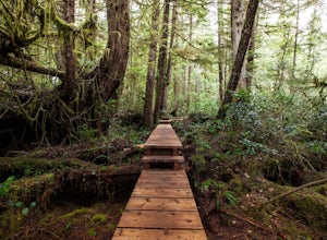
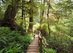
For an amazing jungle experience in Clayoquot Sound, the fantastic Rainforest Trails is the place to go. Located in the Pacific Rim National Park, the forest is deep, wet and massive. The wonderful aroma of nature fills your lungs as an incredibly elaborate boardwalk leads you along massive nurs...
Read more

