Alberni-Clayoquot A, British Columbia
Looking for the best hiking in Alberni-Clayoquot A? We've got you covered with the top trails, trips, hiking, backpacking, camping and more around Alberni-Clayoquot A. The detailed guides, photos, and reviews are all submitted by the Outbound community.
Top Hiking Spots in and near Alberni-Clayoquot A
-
Tofino, British Columbia
Hike to Tonquin Beach
5.00.25 miPark at the trailhead, and follow the wooded trail for a short ways. You'll wind through the temperate rainforest, and across wooden walkways before reaching the beach itself. Scramble around on the rocks, or just chill out on the sand and enjoy!Read more -
Tofino, British Columbia
Hike Lone Cone
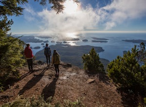
4.1 mi / 2400 ft gainThe trailhead for Lone Cone is located on Meares Island, accessible by water taxi ($40 return). Some choose to rent kayaks and paddle to the trailhead. The dock for the water taxi is located at the end of Main St.49°09’12.8”N 125°54’40.5”WThe water taxi is roughly 15 minutes and travels across th...Read more -
Neah Bay, Washington
Hike to Shi Shi Beach - Point of the Arches
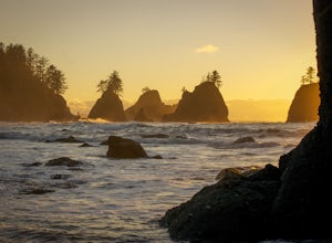
5.08 mi / 200 ft gainShi Shi offers an incredible reward for those who feel like venturing out a bit further and reaching a less accessible beach on the Olympic Coast, just be sure to time your hike with the low tide! The trail starts off near the fish hatchery on the Makah Indian Reservation. To get there from Port ...Read more -
Neah Bay, Washington
Backpack and Camp at Shi Shi Beach
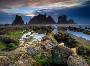
5.04 mi / 200 ft gainIntroduction:My friends and I decided to head out to the Pacific Northwest (PNW) from Philadelphia to do some backpacking and beach camping. We choose Shi Shi Beach for it's terrific beach camping and extraordinary photography potential. Here is a rundown of the out and back, 2-night backpackin...Read more -
Nanaimo F, British Columbia
Hike Little Qualicum River and Falls
4.30.6 miLittle Qualicum Falls Provincial Park is just off the #4 highway on your way out to Port Alberni. Simply look for the signs indicating Little Qualicum Falls Provincial Park, and you will turn into the park before Cameron Lake.Easily accessible by everyone, this park can get busy in the summer mon...Read more -
Port Renfrew, British Columbia
Camp and Surf at Sombrio Beach
5.01 miHeading west from Victoria, take the TransCanada Highway to Hwy 14. Continue past Sooke towards Port Renfrew. Look for the sign that reads Sombrio Beach Trailhead (approximately 45 minutes past Sooke) and take the left. Note that this dirt road can be incredibly rugged (aka full of potholes) and ...Read more -
Port Renfrew, British Columbia
Hike to the Red Creek Fir
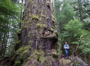
I’m blessed with a husband who is crazy enough to agree to my endless adventures! When I suggested we go find the tallest Douglas Fir Tree in the world, and we happened to be in the area, my husband again said, “why not!”For anyone who just has to see it for themselves, here’s some directions:Fo...Read more -
Errington, British Columbia
Hike through Englishman River Falls Provincial Park
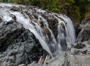
4.31.9 miThis is an easy 3 km or so hike that you can meander along and enjoy the lush greenery and the two waterfalls. The lower waterfalls is best viewed in the spring or winter. When summer comes the river gets lower and in turn that waterfall gets hard to see. Although, when the water levels are low y...Read more -
Errington, British Columbia
Hike to BC's Englishman River Falls
1.9 miSituated amid a quiet forest of both old and new growth Douglas firs, cedar, hemlock, and maple, the Englishman River Falls consist of two waterfalls which cascade into a deep canyon beneath a secluded bridge. Perfect for intermediate hikers, day-trippers, photographers and curious tourists, this...Read more -
Fanny Bay, British Columbia
Rosewall Creek Falls
4.33.84 mi / 515 ft gainStarting at the Rosewall Creek Provincial Park parking lot you take the trail upstream of the creek passing under the inland island highway bridge. This trail eventually leads out of the provincial park boundary, but don't worry you haven't gone too far. It is about a 7 km roundtrip hike and the...Read more

