Longview, Alberta
Top Spots in and near Longview
-
Kananaskis, Alberta
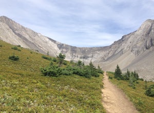
Hike Ptarmigan Cirque
4.03.1 mi / 754.6 ft gainPtarmigan Cirque is a great beginner hike in Highwood Pass. Take Hwy. 40 approximately 50 km's from Hwy. 1. You will find the trail head at the Highwood Pass Day Use Area. This interpretive trail heads north along the road for about 100 meters and then crosses the highway. The trail is easy to na...Read more -
Bragg Creek, Alberta
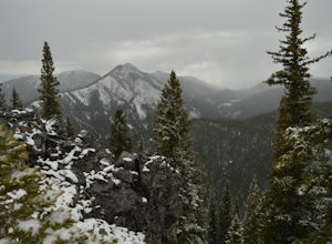
Winter Hike Up Vent's Ridge
Whether it was the unseasonably warm weather; the forested, uneven, foot-wide, root-covered trail; limestone cliffs towering above me; the view of Myosotis Peak from the ridge; or exploring along Powderface Creek on the descent, this trail was an absolute blast.If you do this hike in February lik...Read more -
Bragg Creek, Alberta
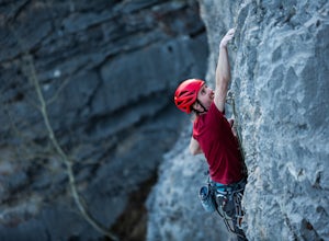
Rock Climb at White Buddha
4.01.9 mi / 492.1 ft gainTo reach White Buddha, park at the Powerface Creek parking lot. Between December and May, Route 66 is closed at Elbow Falls, so you may need to park at the gate and walk in, about 0.3 miles (500 m). The trailhead is well marked from the parking lot.The first section of the trail is mellow, though...Read more -
Bragg Creek, Alberta
Hike White Buddha via Powderface Trail
3.02.5 mi / 1148.3 ft gainFollow Hwy. 66 until you come upon the Powderface Staging Area. This is the trailhead. If you are coming between December & May, park at the Elbow Falls Day use area and walk along the road approximately 100 meters. This trail is easy to find and is quite wide. Follow the Powderface Creek Tra...Read more -
Kananaskis, Alberta
Backpack the Northover Ridge Loop
5.025 mi / 4000 ft gainWhile most people opt to hike this route as a 2 or 3 day trip, camping at Aster and Three Isle Lakes, this description is for a 1 day loop. This is NOT an easy hike to do in 1 day, however, and the ridge is no pushover for any length trip. Exercise caution and don't be afraid to backtrack if weat...Read more -
Kananaskis, Alberta
Rawson Lake & Sarrail Ridge
4.06.8 mi / 2427.8 ft gainTake Hwy. 40 to Kananaskis Lakes Trail. Continue on this road until you reach a turn off for Upper Kananaskis Lake Day Use Area. This is your trail head. Follow the trail along west side of the lake. After about 1 km you will reach Sarrail Falls. Shortly after crossing the bridge, take the trail ...Read more -
Kananaskis, Alberta
Hike the Aster Lake Trail in Kananaskis Provincial Park
7.5 mi / 1969 ft gainA long day hike or perfect backpack trip, this alpine lake surrounded by high peaks, starts out relatively easy from the upper Kananaskis Lake parking lot, at the far end of the south side of the lake, with a short tour around the east side of Hidden Lake, you start, what at some points will seem...Read more -
Kananaskis, Alberta
Rawson Lake
4.55 miGetting There From Highway 1, Take Highway 40 South to Kananaskis Lakes Trail, and turn left at Upper Kananaskis Lakes Drive. The Trail The trail to Rawson Lake starts at the end of the "Day Use Area" at Upper Kananaskis Lake. The lake gently laps the shoreline to the right and moss carpets the...Read more -
Kananaskis, Alberta
Hike Mount Indefatigable
4.5If you choose to do this hike, you'll find yourself at Kananaskis Lakes, one of my favourite spots in K-Country! Park your car at the Interlakes parking lot, have that one last bathroom break, and make your way north to get to the trailhead. The trailhead is impossible to miss as it's blocked off...Read more -
Kananaskis, Alberta
Ice Climb at King Creek
4.0Follow the defined path trailing roughly along the creek bed, a 20 minute hike from the car park. King Creek lies at the bottom of a gorge with steep rock walls on either side and a cascade of fat ice being forced out of the rocks. It's a gorgeous spot, showcasing the true beauty of Kananaskis.It...Read more -
Bragg Creek, Alberta
Hike Jumpingpound Summit
3.03.1 mi / 1148.3 ft gainThis is a great short hike that will only take about ½ day. Take Hwy. 1 west and take the exit for the Sibbald Creek Trail. Follow this road until you hit the Powderface Trail. (NOTE: this road is closed from December 1 – May 14 annually). Follow this road for approximately 15km’s. Take note tha...Read more -
Kananaskis, Alberta
Hike Alberta's Grizzly Peak
4.0The trailhead is located on the north side of Ripple Creek, the first creek you come across after passing the Grizzly Creek turnoff. There is an easy pull-off on the east side of the highway. You should be able to see the trailhead from the road, which follows the southern slope of the mountain f...Read more -
Kananaskis, Alberta
Snowshoe up Gypsum Ridge
3.7 mi / 1378 ft gainIf you have a topographic map of Kananaskis Lakes, the trailhead is just to the east of Blackshale Creek. If you don't have a topographic map of the area, the Google Maps pin on this adventure will help you get there --- you'll see a pretty large opening on the south side of the road. Luckily, th...Read more -
Kananaskis, Alberta
Hike Opal Ridge's South Summit
5.0Opal Ridge is located on the East side of highway 40 in Kananaskis.The trailhead starts at Fortress Gas Station. Park at the North end of the parking lot. The trailhead is easy to spot from here. Follow the creek a couple hundred meters till you reach an open area with power lines. Turn left. Con...Read more -
Kananaskis, Alberta
Scramble the Wedge
5 mi / 3444.9 ft gainDrive south on Highway 40 and your adventure begins at Wedge Pond. Parking in the parking lot is easy enough if you're there early enough in the day (before 10:00). The trail up the Wedge starts near the bathrooms, and heads south - not southwest towards the pond. After only a few minutes of walk...Read more -
Turner Valley, Alberta
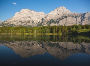
Photograph Wedge Pond
3.00.25 mi / 10 ft gainJust off Highway 1 in Kananaskis Country is a beautiful pond that makes for a wonderful spot to enjoy the first light on the Canadian Rockies. Bring warm clothes as this place can be especially cold. Don't forget a camera and a blanket. I recommend going for sunrise as this is when the lighting i...Read more

