Victoria
Top Spots in and near Victoria
-
Iguana Creek, Victoria
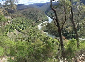
Backpack Mitchell River
5.023.6 mi / 4986.9 ft gainThe thing I loved the most about this hike is how isolated it was. It may have been the time of year, but in the spring I saw no one else on the trail for two days, though I did see snakes, monitors, kangaroos, wallabies, wombats, and many birds. Given it was springtime, the forest was full of wi...Read more -
Zumsteins, Victoria
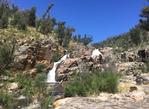
Hike to Fish Falls, Grampians NP
5.02.9 mi / 150 ft gainStart at the Zumsteins Picnic Area Car Park, and follow the signs and track to Fish Falls to the right. You'll follow along the river for about 2.5km before coming up onto Fish Falls. The path is very easy to follow, and has some areas of gradual ascent/descent along the walk. Along the way you'l...Read more -
Mount Buffalo, Victoria
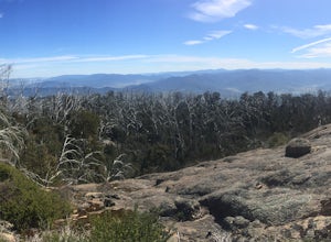
Hike Mount Buffalo
14 mi / 3937 ft gainI love this walk. It ticks all the boxes of the perfect day walk for me. A fantastic variety of vegetation and terrain. A superb ascent (and descent) with an impressive 1200m gained over 11km! The views are simply spectacular and there's a real sense of community among walkers, trail runners and ...Read more -
Hamilton, Victoria
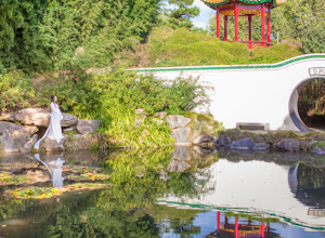
Explore the Hamilton Botanical Gardens
5.0The Hamilton Gardens is a massive property right along the Waikato River which runs through the city. The focus of the gardens is to replicate the historical gardens of specific civilizations around the world.Parking is very easy as there is a massive lawn in front of the entrance and there is no...Read more -
Woolamai, Victoria
Bike the Bass Coast Rail Trail
5.028.6 mi / 820.2 ft gainMany people complete the trail by beginning and ending in Wonthaggi. We decided to do the opposite and start in Woolamai, just a 90 minutes drive from Melbourne.Park the car on the side of Woolamai Road, unload the bikes and jump straight on the trail heading south-east. You'll begin by passing d...Read more -
Staughton Vale, Victoria
Hike the Ted Errey Nature Circuit
7.5 miThe hike is quite well marked, identified by blue markers, but as this park has several trails that cross paths, make sure to bring your map. It is twelve kms and there are some hills, but it is overall a relatively easy hike. There is lots of wildlife in the park, so look out for lots of beautif...Read more -
Baw Baw Village, Victoria
Backpack from Mt Baw Baw to Mushroom Rocks
18.6 mi / 3933.7 ft gainPlease note that the weather on this walk can change drastically, so be prepared for anything! The first day on our walk was +15 and sunny and we woke up to a blanket of snow and had to walk back in freezing temperatures. Please note that, depending on the year, you may need to buy a permit to dr...Read more -
Rye, Victoria
Photograph Lizard Head Point at Sunrise
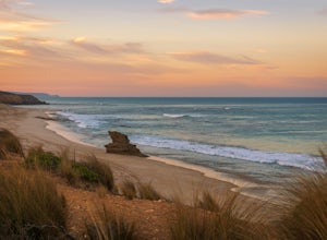
0.3 mi / 820.2 ft gainVictoria's Mornington Peninsula is a stunning example of one of Australia's many rugged coastlines, dotted with rock formations, pristine sand beaches & epic waves. Lizard Head Rock is a unique formation rising out of the ocean which is especially beautiful at sunrise. The "hike" is really j...Read more -
Devils River, Victoria
Hike Blowhard Circuit
13 mi / 1738.8 ft gainStarting off at the carpark, walk back the way you came about 500m until you reach Merlo's Lookout. Here, you can take in some great views of the lake before you start the summit.From the lookout, there is a trail that leads uphill directly behind you. The trail is well marked and ascends quickly...Read more -
Wilsons Promontory, Victoria
Backpack Wilson's Promontory's Northern Circuit
37.3 miMost of the northern section of Wilson's Promontory is designated as a wilderness zone and as such there are vast sections of the park that have only sparse markers to guide the way. There are sections as well where you may need to cross creeks that are as high as 1.5m. Since this is a difficult ...Read more -
Bellfield, Victoria
Hike to Mount Rosea
10.6 mi / 2395 ft gainThere are several different ways you can get to Mount Rosea, parking on either side of the Grampians Peaks Trail. As well, you can camp on either side (or create a longer backpacking circuit from Hall's Gap), staying at either Borough Huts or Bugiga Hikers Camp. Starting from Borough Huts, you c...Read more -
Glenisla, Victoria
Backpack to The Fortress and Mt Thackeray
4.017.4 mi / 3937 ft gainIn the summer, this hike can be extremely dry, so make sure to bring lots of water. There are some creeks that offer water, but they can be mere trickles at certain times of year (as we found out!). The first day of the hike is 6km. To start, head to the south section of the car park and follow t...Read more -
Arapiles, Victoria
Rock Climb Mount Arapiles
5.0The nearest regional centre to the Arapiles, is Horsham. Head west from there on the Wimmera Highway until you get to the small township of Natimuk. There’s a really good general store there for some basic last minute supplies. From there, you can’t miss the mountain range. It’s dramatic, stunnin...Read more -
Wilsons Promontory, Victoria
Hiking to the top of Mt Oberon
2.2 mi / 1300 ft gainMount Oberon is located in Wilsons Promontory National Park in Victoria, Australia. In my opinion it's a must hike when visiting the area. Considering Australia is rather flat, climbing to the top of this mountain is highly rewarding, with one of the best views in Victoria. I recommend doing this...Read more

