
Backpack to The Fortress and Mt Thackeray
Glenisla, Victoria
Details
Distance
17.4 miles
Elevation Gain
3937 ft
Route Type
Loop
Description
Added by Katie Kessel
See the Western section of the Grampians where you can admire the Manja Cave Shelter rock art, camp in the Western Cave, and take in the views at the top of Mt Thackeray.
In the summer, this hike can be extremely dry, so make sure to bring lots of water. There are some creeks that offer water, but they can be mere trickles at certain times of year (as we found out!).
The first day of the hike is 6km. To start, head to the south section of the car park and follow the signs to the Manja shelter. The shelter has fascinating aboriginal hand paintings, the most prominent being hand stencils.
From the shelter, there is a slightly overgrown track heading south west, meeting back up with Harrop Track. This section makes its way through a few clearings. One you get to the road, follow it to the left until you see the walking track start again to your left. The track follows a management road parallel to Deep Creek for around 600m , then winds up through brush and bluffs, slowly turning into forest. You will start to be able to see fantastic views of the Fortress as you climb.
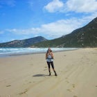
There are two places you are able to camp, depending on availability. At 6km in, you will make your way into the Western Cave, identified initially by a large cave you can fit your tent in (pictured above).
If you have additional time or there is no room, you can continue past the Fortress to the Eastern Cave at 8km (an additional 2km of hiking, though it is all uphill).
There is water available here near the top of the campsite.
On the second day (8.5 km), continue along the trail on the other end of the campsite, through the rocks and uphill. When you reach the top, just under 1km from the Western Cave, you will be on top of the Fortress (875m). There are some amazing views of the valley from the top here.
Continue along the path until you reach the Eastern Cave on the other side of the Fortress. Here is where you can also camp.
From the Eastern Cave, it can be somewhat tricky to find the trail, as it is not well marked. The track makes it way down from the range here, heading down the hill. Look for some trail markers in the trees here, knowing that the trail becomes more obvious as you near the bottom. At the bottom, follow the trail until you meet with a 4WD track.
Follow the track here until you reach Mt Thackeray Campsite. The track slowly but steadily goes uphill. Just before the last hill before the camp, there is a small creek that runs under the road. When we went through it was no more than a trickle, so it had to be well-treated, but it was water! Look out for an extremely sharp upward bend in the trail heading 90 degrees to the right. The creek is at the bottom, a pipe built under the road.
Once you get to the camp, you have the option of a 3km return to Mt Thackeray. The hike is a scrambler with fantastic views at the top of the valley, ascending 110m. To get to the trail, head to the far end of the campsite, following the road, and look for an unmarked walking track that breaks through the trees. Follow the track over the rocky terrain, following a rock wall. Around 1km in, head into a side gully, then head up the track to the summit of Mt Thackerlay (962m). Making your way up the rocks, it slowly turns into a scrambler that opens up to the flat summit, where you can admire the view before you head back.
On the third day (13.5km), follow the 4WD track. Around 2km into the walk, you will meet a creek that is fairly dependable and can fill up your water. Follow the track for a total of 7.5kms until you reach the Hut Creek Track. This section of the trail is fairly easy and wide, but can be somewhat steep as it descends quickly. Look out on the right for little breaks in the rock where you can admire the views.
Turn left on the Hut Creek Track, following it until you reach Harrop Track. This track is beautiful, winding with the creek through grasslands and forests. Keep a lookout for all kinds of wildlife here. Towards the beginning, please note that you will need to wade across the creek, which is fairly easy to get across.
Once you make it to Harrop Track, you are around 500m north of the carpark. When you meet the track, head left and follow the road until you reach your car.
Download Outbound mobile app
Find adventures and camping on the go, share photos, use GPX tracks, and download maps for offline use.
Get the appFeatures
Backpack to The Fortress and Mt Thackeray Reviews
Great views of the Grampians at several different sections of the trail as well as a great opportunity to scramble.
4.0
Leave No Trace
Always practice Leave No Trace ethics on your adventures and follow local regulations. Please explore responsibly!
Nearby

Hike to Fish Falls, Grampians NP

Hike to Mount Rosea

Backpack to Bugiga Hikers Camp

Explore the Hamilton Botanical Gardens

Rock Climb Mount Arapiles
Discover
Community
Mobile Apps

© 2026 The Outbound Collective - Terms of Use - Privacy Policy