Bondurant, Wyoming
Looking for the best fishing in Bondurant? We've got you covered with the top trails, trips, hiking, backpacking, camping and more around Bondurant. The detailed guides, photos, and reviews are all submitted by the Outbound community.
Top Fishing Spots in and near Bondurant
-
Jackson, Wyoming
Whitewater Raft the Grand Canyon of the Snake River
5.0If you have never been whitewater rafting, you should definitely go for the first time to the Grand Canyon of the Snake River. It's an amazing experience, and you can float the river in about two hours depending on the water levels. Afterwards, you can spend the rest of the day at nearby Jackson ...Read more -
Cora, Wyoming
Backpack Square Top Mountain
15 mi / 2400 ft gainYou have two options when starting from Green River Lakes Campground, located 52 miles north of Pinedale, WY, (21 of these miles are on a washboard dirt road). The first option is to start backpacking from the campground and follow the trail that runs alongside the first lake, up the river and pa...Read more -
Cora, Wyoming
Hike to Shirley Lake
5.013 mi / 2000 ft gainShirley lake is a beautiful and not heavily traveled area in the Winds. To get there, you start at the Green River Lakes trailhead (8,000 ft) and head out on the Western shore of the lower lake. You can shave off three miles by canoeing to the end of the lake, if you like. But I prefer the hike. ...Read more -
Cora, Wyoming
Hike to Slide Lake
12 mi / 1600 ft gainThe Winds in Wyoming are incredibly beautiful and offer some of the most challenging, but rewarding hikes. And the popular northern trailhead, Green River Lakes, is one of the most spectacular entry points. GETTING THERE: There are only two ways to get to the Green River Lakes trailhead. and one ...Read more -
Pinedale, Wyoming
Backpack to Green River Lakes, Wind River Range
27 mi / 2100 ft gainDAY 1 - SPRING CREEK TH TO TRAPPER LAKEShuttle cars to park one vehicle at the Green River Lakes Trailhead (about 40 minutes outside of Pinedale, Wyoming) and return back to Pinedale to begin at the Spring Creek Trailhead. Begin hiking making your way to Trapper Lakes. There are several wonderful...Read more -
Pinedale, Wyoming
Hike to the Crow’s Nest in the Wind River Range
12 mi / 500 ft gainThe Crow’s Nest sits just above Glimpse Lake in the Winds. It is best accessed from the most infrequently used trailhead in the range. To access the remote trailhead from Pinedale, take Jackson Street north toward Soda Lake Wildlife Management Area. It becomes an improved dirt road about a mile i...Read more -
Jackson, Wyoming
Camp in the Gros Ventre Wilderness
4.8Take highway 89 out of Jackson, headed north, and turn on to Gros Ventre Rd. This will take you right past the campground, wild rivers, and ample hiking. Keep driving for about 20 miles as views of the Tetons appear behind you, and ample backcountry camping options become available.Read more -
Jackson, Wyoming
Hike along the Gros Ventre River
4.4The Gros Ventre (pronounced gro-vant) lies on the southern boundary of Grand Teton National Park, and is home to a great deal of wildlife. As the seasons change, so do the wildlife that frequent this area, but no matter what time of year you hike along the river, you're bound to see something spe...Read more -
Pinedale, Wyoming
Backpack and Fly Fish the Wind River Range
5.0Day 1: Hit the Elkhart trailhead. Get set up at Hobbs lake, do a little fishing, eat and turn in for the night.Day 2: Head out for Island Lake to set a base camp for the next few days. Keep an eye out for mountain storms and if you do catch as short one, be sure to take in the view. It's amazing!...Read more -
Pinedale, Wyoming
Backpack the Pole Creek Trail, Wind River Range
5.018 mi / 2687 ft gainBackpacking in the Wind River Range Requires a permit, so make sure you go through the process of getting that before you set out on this adventure. https://www.fs.usda.gov/detail... Getting to the trailhead from the town of Pinedale, WY, you drive to the east side of town and turn left onto Frem...Read more -
Pinedale, Wyoming
Seneca Lake Trail
5.018.4 mi / 2280 ft gainThe Wind River Range is one of the best backpacking + climbing wildernesses in the lower 48. Seneca Lake is right at the beginning of some of the most spectacular high alpine climbing and backpacking routes. From the Elkhart trailhead parking lot, take the Pole Creek Trail directly adjacent to ...Read more -
Pinedale, Wyoming
Backpack to Titcomb Basin and Summit Gannett Peak
5.050 mi / 4000 ft gainIf you are looking for a challenging hike in one of the most remote areas of the rocky mountains then this is the expedition for you. Starting near Pinedale, Wyoming in Elkhart Park you begin a 50 mile round trip that can include a summit of Gannett Peak. Starting elevation of the hike is near 8...Read more -
Pinedale, Wyoming
Elbow Lake in the Wind River Range
2.035.66 mi / 4357 ft gainElkhart Park Trailhead; Wind River Range, WY. Pole Creek Trail->Seneca Lake Trail->Highline Trail->Elbow Lake This is an advanced 4 day out and back trip departing from the Elkhart Park Trailhead with two days of travel to Elbow Lake. As one of the most remote ranges in the country, th...Read more -
Moose, Wyoming
Explore the 4 Lazy F Ranch
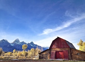
4.5This ranch is not very well known at all, even by those who have lived in the area for years, but it's definitely worth the visit. It's giant red barn against the backdrop of the Tetons, which is any photographer's dream and trumps the more famous Mormon Row with its beauty.To get there, park at ...Read more -
Alta, Wyoming
Huckleberry Point via Death Canyon Trailhead
5.06.45 mi / 1401 ft gainGetting There: Coming from Jackson Hole, enter Grand Teton National Park and turn left onto Moose-Wilson Road. Continue southwest until you come to Death Canyon trailhead on your right. There is a large parking lot beside the trailhead, as well as bathrooms and picnic areas. The Trail: The ...Read more -
Alta, Wyoming
Backpack to Alaska Basin via Death Canyon
28.2 mi / 7500 ft gainDeath Canyon Trailhead is easily accessed by heading south on Moose-Wilson Rd. from Grand Teton National Park Headquarters for 3 miles. Once at the junction turn right onto an uneven dirt road and go north 0.7 miles to the parking area.Day 1: (8.3 miles) From Death Canyon Trailhead hike west for ...Read more
Top Activities
Let Adventure be your Destination in Wyoming
Wyoming’s wide-open spaces make it easy to get off the grid and on a trail, through a park, into a forest, up a mountain or down a river. During your journey through Wyoming’s Black to Yellow Region, discover geologic marvels, dense evergreen forests and sprawling prairielands.
Learn More

