Alta, Wyoming
Looking for the best hiking in Alta? We've got you covered with the top trails, trips, hiking, backpacking, camping and more around Alta. The detailed guides, photos, and reviews are all submitted by the Outbound community.
Top Hiking Spots in and near Alta
-
Moose, Wyoming
Hike to Bradley Lake
5.58 mi / 7022 ft gainSo the hike starts out at Taggart Lake Trailhead ( 6625') and the highest point on the trail is (7022'). Follow this trail all the way along the stream to your left. You will go through a pretty dense forest for a bit, this area can get wet and muddy depending on the season so equip yourself acco...Read more -
Moose, Wyoming
Snowshoe to Taggart Lake
3.04 mi / 460 ft gainPark at the nicely kept Taggart Lake trailhead parking lot and grab your snowshoes for an exciting 2 mile trail hike to the gorgeous frozen Taggart Lake. The lake is situated right in the middle of a view of the Mount Wister, South Teton, and Middle Teton peaks. The trails are all well kept and p...Read more -
Moose, Wyoming
Teton Park Road
15.73 mi / 646 ft gainTeton Park Road Trail is a point-to-point trail where you may see beautiful wildflowers located near Moose, Wyoming.Read more -
Teton Village, Wyoming
Teton Crest Trail
5.025.35 mi / 9681 ft gainThe Teton Crest Trail has several variations that allow the hiker to enter and exit through different canyons. The classic trail begins at the Phillips Pass Trailhead and comes to a close at Paintbrush Divide. Many hikers choose to take the Teton Village Tram up to Marion Lake and join up with th...Read more -
Jackson, Wyoming
Hike the Rockefeller Preserve Loop
4.33 miThe Rockefeller Preserve loop starts from a gravel trail that begins in the parking lot. The gravel pathway leads to a meadow and then goes right up to the visitor center. From the visitor center the trail continues to a thick forest that parallels the scenic Lake Creek. The trail leads around th...Read more -
Teton Village, Wyoming
Hike the Granite Canyon Trail
3.013.14 mi / 1703 ft gainThe Granite Canyon Trail is located near Teton Village, Wyoming and is best for experienced hikers. The trail is typically trafficked from March until August. This hike can be shortened by taking the tram in Teton Village to the top of Rendezvous Mountain, and then hiking down to Marion Lake and ...Read more -
Jackson, Wyoming
Backpack to Marion Lake
4.013.73 mi / 3409 ft gainMarion Lake is one of Grand Teton National Park’s many spectacular high altitude lakes. The lake sits above Granite Canyon, and next to sweeping meadows that are loaded with colorful wildflowers during July and August. Campsites at the lake may be available by obtaining a backcountry permit from ...Read more -
Jackson, Wyoming
Granite Canyon to Death Canyon Loop
4.525 mi / 4000 ft gainThis fairly easy 2-night backpacking trip in the Tetons can be started around noon, allowing you to finish around noon, 2 days later. From the visitor center, obtain a permit for 2 nights. Ask for a first night at Marion Lake (the Granite Canyon campsites are not my favorites), and for a second ...Read more -
Moose, Wyoming
Explore the 4 Lazy F Ranch
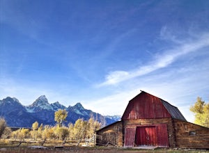
4.5This ranch is not very well known at all, even by those who have lived in the area for years, but it's definitely worth the visit. It's giant red barn against the backdrop of the Tetons, which is any photographer's dream and trumps the more famous Mormon Row with its beauty.To get there, park at ...Read more -
Alta, Wyoming
Bird Watch Along Moose Willson Road
Moose Wilson Road provides a diversity of bird watching opportunities for everyone from novices to experts. The road heads out of Moose, Wyoming, then runs through the park for about an 8 mile stretch. There are many pull-offs along the way, where you can start looking for birds, as well as a num...Read more -
Moran, Wyoming
Signal Mountain
5.07.72 mi / 1158 ft gainThis gorgeous hike to Signal Mountain begins from the Signal Mountain Lodge parking area. The trailhead is located on the opposite side of the entrance road from the lodge. To reach the trailhead from the parking area you can either walk westbound along the road, passing the general store, showe...Read more -
Moran, Wyoming
Colter Bay Lakeshore Trail
4.02.55 mi / 148 ft gainWithin the first 100 feet on the trail, you are greeted with the stunning view of the peaks of Grand Teton reflecting off of Jackson Lake. Here you can enjoy lunch or a small snack at one of the picnic tables before or after the short hike. Continue following the Colter Bay Lakeshore Trail along...Read more -
Jackson, Wyoming
Camp in the Gros Ventre Wilderness
4.8Take highway 89 out of Jackson, headed north, and turn on to Gros Ventre Rd. This will take you right past the campground, wild rivers, and ample hiking. Keep driving for about 20 miles as views of the Tetons appear behind you, and ample backcountry camping options become available.Read more -
Jackson, Wyoming
Hike along the Gros Ventre River
4.4The Gros Ventre (pronounced gro-vant) lies on the southern boundary of Grand Teton National Park, and is home to a great deal of wildlife. As the seasons change, so do the wildlife that frequent this area, but no matter what time of year you hike along the river, you're bound to see something spe...Read more -
Alta, Wyoming
Hike Coal Creek Trail
Imagine hiking through the expansive valleys of wildflowers and evergreen forests with grand views of the Tetons. That is exactly what this trail provides. The coal creek trail is an access trail to many other great trails throughout the Bridger-Teton National Forest. This gives the adventurer th...Read more -
Alta, Wyoming
Taylor Mountain via Cole Creek
8.76 mi / 3261 ft gainThe Coal Creek Trailhead is at 7,250 feet. Follow the trail as it goes up Coal Canyon and through Coal Creek Meadows. Taylor mountain is the peak on the left side of the canyon as you climb. When you come to a fork at 2.5 miles (just after the meadow), take the left fork (toward the west) to begi...Read more
Top Activities
Let Adventure be your Destination in Wyoming
Wyoming’s wide-open spaces make it easy to get off the grid and on a trail, through a park, into a forest, up a mountain or down a river. During your journey through Wyoming’s Black to Yellow Region, discover geologic marvels, dense evergreen forests and sprawling prairielands.
Learn More

