Waukesha, Wisconsin
Looking for the best hiking in Waukesha? We've got you covered with the top trails, trips, hiking, backpacking, camping and more around Waukesha. The detailed guides, photos, and reviews are all submitted by the Outbound community.
Top Hiking Spots in and near Waukesha
-
Shorewood, Wisconsin
Explore Atwater Park
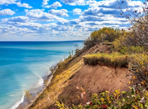
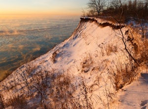
0.5 mi / 200 ft gainOne of Milwaukee's truly hidden gems, this beach is right off of Capitol Drive and approximately 50 stairs down from the bluffs to the shoreline! You can park anywhere on the road (Lake Drive) and be a short walk to the main overlook. This beach has many jetties that go out into the water which ...Read more -
South Milwaukee, Wisconsin
Hike the Seven Bridges Trail in Grant Park
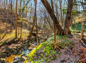
5.00.98 mi / 72 ft gainPlaced along the Lake Michigan lakeshore in Grant Park about 10 minutes south of Downtown Milwaukee, Seven Bridges Trail offers beautiful scenery that seems like something out of a fairy tail. The trail begins at the the Covered Bridge Entrance which you can access by entering off of Grant Park D...Read more -
Fox Point, Wisconsin
Hike the shore of Lake Michigan at Doctor's Park
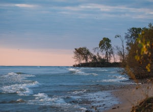
2 mi / 100 ft gainThis park has it all. There is ample parking, full bathrooms, and picnic areas. The trail starts right at the parking lot and there are two different paths you can take: 1.) Follow the paved path down toward the lake on the north side of the parking lot 2.) Walk straight from the parking lot acro...Read more -
Hartford, Wisconsin
Catch A Sunset from Powder Hill
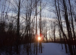
5.02.2 mi / 1350 ft gainAt 1350 feet, Powder Hill is the second highest point in southeastern Wisconsin. You can start the hike to Powder Hill from the Nature Trail parking lot (0.5 miles) or from the beach/picnic area parking lot (1.1 miles). There is an observation tower near the top of the peak that provides a pano...Read more -
Palmyra, Wisconsin
Hike the Bald Bluff Trail
3.2 mi / 475 ft gainParking There is a small parking lot off of County Rd H. The trailhead is marked at the back of the lot. Please be advised that there are no facilities here. Trail Description The Bald Bluff Trail starts at the trailhead marked behind the parking lot. From there, the trail traverses 0.5 miles up ...Read more -
Grafton, Wisconsin
Hike the Lion's Den Gorge Loop
4.71.8 miLion's Den Gorge is a gorgeous nature preserve featuring a variety of unique nature scenes. The park includes massive bluffs, sand dunes, forests, creeks and bridges, hiking trails and stunning vistas of the Lake Michigan shoreline. The preserve is 72 acres and is located in the town of Grafton, ...Read more -
Grafton, Wisconsin
Hike the Bluff Trail to the stairs at Lion's Den Gorge
4.01.7 mi / 100 ft gainThis is a longer hike than just simply appreciating the lake from the top. Follow the signs along the Gorge loop toward the "Stairs". This entire loop will take you approximately 1 hour from the parking lot to the lake roundtrip. There are multiple routes to the bottom. For those that want a st...Read more -
Kewaskum, Wisconsin
Backpack the Milwaukee River and Butler Lake Segments of the Ice Age Trail
16.8 miThe Milwaukee River Trailhead for the Ice Age Trail (IAT) is located on WI-28, east of the Kettle Moraine Scenic Drive. Before the hike, make sure to pack water, or hike off-trail to the New Fane trailhead (1.1 mile round trip, we got caught doing this) for an early water source on the trail. The...Read more -
Horicon, Wisconsin
Hike through the Wetlands of the Horicon Marsh
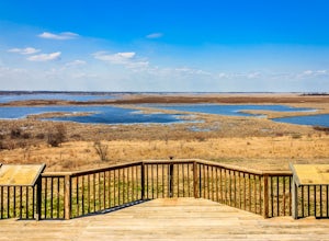
4.55.25 miHoricon Marsh is located about an hour north of Milwaukee. The wildlife refuge features several trails ranging from a quarter mile up to nearly 3 miles long. Terrain can vary slightly, but most of the land, especially around the wetlands, is flat. The marsh features an abundance of wildlife. Hund...Read more -
Belgium, Wisconsin
Hike the North and South Beach Trail at Harrington Beach State Park
2 mi / 10 ft gainThis state park is about a 30 minute drive north from Milwaukee on I-43. It has beach access along it's entire length, multiple hiking trails, and a great quarry lake that can be used for fishing, hiking, or general exploring. From the parking lot, you can go and hike one two areas (of course the...Read more -
Belgium, Wisconsin
Hike the Quarry Lake Trail at Harrington Beach State Park
1 mi / 15 ft gainThis state park is about a 30 minute drive north from Milwaukee on I-43. It has beach access along it's entire length, multiple hiking trails, and a great quarry lake that can be used for fishing, hiking, or general exploring. From the parking lot, go south toward the signs for Quarry lake. There...Read more -
Ringwood, Illinois
Hike the Glacial Park Loop Trail
2.3 mi / 216 ft gainGlacial Park is located in McHenry County Conservation District, near Richmond, Illinois. The park features prairies, a flowing river, and over 40 endangered plant and animal species. The park is open for hikers, horseback riders, fishers, and those wishing to canoe. Glacial Park is part of the H...Read more -
Lake Villa, Illinois
Hike Hastings Lake LCFP
5.02.37 mi / 88 ft gainPark in the lot off of Butler Lane (see map) to access the trail. This trail is open year round, is dog-friendly, and offers a variety of activities. In the winter, bring your snow gear!Read more -
Janesville, Wisconsin
Hike The Devil's Staircase (segment of the Ice Age Trail)
1 miThis segment of the Ice Age Trail features stairs, river views, pretty rocks, a nice park, and a golf course. We started at the north end (not the park end) and enjoyed it. If you have kids, I would recommend starting at the park end. It is an out-and-back type hike. From the south end of the...Read more -
Adell, Wisconsin
Visit the Parnell Observation Tower
4.00.5 mi / 200 ft gainLocated southwest of Plymouth, WI, the Parnell Observation Tower is located just west of the intersection of Cty Road A and Cty Road U. At the trail-head, the parking lot has a restroom facility, drinking water, and a picnic area.The start of the trail has well established wooden steps along the ...Read more

