McFarland, Wisconsin
Looking for the best photography in McFarland? We've got you covered with the top trails, trips, hiking, backpacking, camping and more around McFarland. The detailed guides, photos, and reviews are all submitted by the Outbound community.
Top Photography Spots in and near McFarland
-
Baraboo, Wisconsin
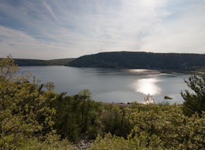
Camp at Devils Lake State Park
3.0Devil's Lake State Park has 29 miles of trail that vary in difficulty. The most popular trails are the East and West Bluff trails that circle Devil's Lake and offer some of the best views in the park. If you want a more relaxing day, head to the beach! It's a family-friendly spot that is the perf...Read more -
Baraboo, Wisconsin
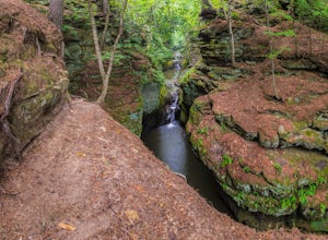
Explore Pewit's Nest State Natural Area
3.81 mi / 30 ft gainPlease note this warning from the park's website: Climbing on rock walls, cliff jumping or entering the closed area for any reason is prohibited, and violators will be subject to a $175 citation. Visitors are also prohibited from bringing in food or beverage or being on the property between 8 p.m...Read more -
North Freedom, Wisconsin
Hike the Natural Bridge State Park Loop
3.5 mi / 566 ft gainLocated in Wisconsin’s Driftless Region, Natural Bridge State Park includes 530-acres of oak and hardwood trees, small prairie remnants with grasses and cacti, ferns, and the rare goldenrod and purple cliffbrake. Wildlife in the park includes turkey vultures, pileated woodpeckers, and bald eagles...Read more -
Dodgeville, Wisconsin
Camp at Governor Dodge State Park
4.7You can make campground reservations ahead of time or drive into the park to talk to a ranger, and reserve a hike-in campsite for the a night.Once you're all set up, you can hike to the beach of Cox Hollow Lake to hang out, go for a swim, or snap a few sunset photos.There are beaches on both Cox...Read more -
Delafield, Wisconsin
Hike the Kettle View Trail at Lapham Peak
5.05.8 miHead 30 minutes west from Milwaukee along I-94 and you'll find yourself in the quaint town of Delafield, WI. Head south down Genesee St. for a half mile and you'll see the entrance to Lapham Peak, part of the Kettle Moraine State Forest. Once there, you can head up the winding road to the parking...Read more -
Nashotah, Wisconsin
Hike the Grass and Forest Lake Loop at Nashotah Park
3 mi / 200 ft gainPark Hours: 6AM to 10PM Official Nashotah Park Website Excerpt from the website: Nashotah Park is a 444-acre park nestled among rolling hills, woodlands, wetlands, and grasslands that offer habitat for deer, waterfowl and a variety of songbirds. Nature trails lead through easily identifiable lan...Read more -
Hartland, Wisconsin
Walk along the boardwalk at Nagawaukee Park
1 mi / 20 ft gainA great park that you can park nearby the lake (down by the boat launch), or park in the designated parking lot and take the boardwalk down to the lake, you can't go wrong with these views. There is a looped trail that goes from the boat launch, along the lake all the way to the beach. This a gre...Read more -
Reedsburg, Wisconsin
Hike the Echo Rock Trail
2 mi / 60 ft gainPark near the boat launch parking lot and follow signs for the "Echo Rock" trail. This trail will take you roughly 45 minutes round trip to complete from the parking lot. Well worth your time if you are already in the park as it is one of the best scenic areas and topographical landmarks that the...Read more -
Horicon, Wisconsin
Hike through the Wetlands of the Horicon Marsh
4.55.25 miHoricon Marsh is located about an hour north of Milwaukee. The wildlife refuge features several trails ranging from a quarter mile up to nearly 3 miles long. Terrain can vary slightly, but most of the land, especially around the wetlands, is flat. The marsh features an abundance of wildlife. Hund...Read more

