Renick, West Virginia
Looking for the best hiking in Renick? We've got you covered with the top trails, trips, hiking, backpacking, camping and more around Renick. The detailed guides, photos, and reviews are all submitted by the Outbound community.
Top Hiking Spots in and near Renick
-
Salem, Virginia
McAfee Knob
4.77.79 mi / 1296 ft gainIntro McAfee Knob is one of the most photographed and picturesque locations along the Appalachian Trail. Once you reach McAfee Knob, you'll have almost 270 degree views of the the Roanoke Valley to the East, Catawba Valley and North Mountain to the West, and Tinker Cliffs to the North. Due to t...Read more -
Ripplemead, Virginia
Hike Barney's Wall
4.68.4 mi / 1600 ft gainThis hike begins in the parking lot for Cascade Falls. Keep left at the first and second intersections to stay on the Upper Trail. At the third intersection, stay straight (don't turn right) to stay on the Conservancy Trail.Follow the Conservancy Trail for 0.4 miles, and continue on it when it br...Read more -
Pembroke, Virginia
Bald Knob Trail
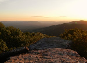
4.80.93 mi / 387 ft gainUnobstructed views with little hiking effort make Bald Knob one of the best locations to see the sunset in southwestern Virginia. Easy to access from US-460 in Giles County, take Mountain Lake Road (VA-700) for 7 miles and park in the gravel lot on the left by the intersection of VA-613 and Moun...Read more -
Ripplemead, Virginia
Cascade Falls
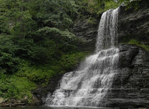
4.93.81 mi / 732 ft gainThe 66' Cascade Falls located in Giles Count is arguably one of the most beautiful waterfalls in Virginia. This classic hike is 4.0 miles and gains 800' in elevation. Located in Pembroke, Virginia, access the trail head by taking Cascade Drive (VA-623) off of US-460 and drive 3.3 miles to the p...Read more -
Lexington, Virginia
House Mountain Trail
4.08.93 mi / 2733 ft gainHouse Mountain provides two amazing views via two out-and-back hikes, for a combined hike of 8.75 miles. If you’re short on energy and/or time, the 6 miles round trip to Big House Mountain is (in my opinion) the better of the two overlooks. Either way, keep in mind that this hike covers a great...Read more -
Daleville, Virginia
Hay Rock
4.67.48 mi / 1276 ft gainIf you're looking for a hike in the Roanoke area without the crowds that McAfee Knob draws, but still want a challenging hike with great views, try hiking to Hay Rock. This 7.5 mile round trip hike begins at the Park and Ride just off I-81 at the US-220 Troutville/Fincastle exit (150B). The gra...Read more -
Narrows, Virginia
Rice Fields via Appalachian Trail
5.05.24 mi / 1302 ft gainThis hike begins on the Appalachian Trail just north of Pearisburg, Virginia. To get to the trail head, take Route 460 and turn on to Clendennin Road(Route 641). Take Clendennin road 1.5 miles and then turn left on to Pocahontas road. In about 300ft you will pass a cattle grate and an old barbed ...Read more -
Goshen, Virginia
Hike Goshen Pass
4.35.6 mi / 1200 ft gainThe parking for the trailhead is down an unmarked gravel/dirt road about 1.5 miles upriver from the Virginia Wayside rest area on Route 39 West. You'll see the swing bridge out across the river and the road will be immediately after this on your right. The road goes back about 200 yards to the pa...Read more -
Rockbridge Baths, Virginia
Fly Fish Goshen Pass
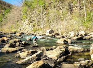
5.0The fly fishing on the Maury River is one of a kind through the Goshen Pass. The Pass is littered with huge boulders, which actually makes it possible to fish without waders, although it's much easier and more enjoyable with waders.From Lexington, VA, take Route 39 towards Goshen for approximatel...Read more

