Mathias, West Virginia
Looking for the best photography in Mathias? We've got you covered with the top trails, trips, hiking, backpacking, camping and more around Mathias. The detailed guides, photos, and reviews are all submitted by the Outbound community.
Top Photography Spots in and near Mathias
-
Bentonville, Virginia
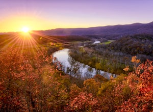
Hike the Shenandoah River State Park Loop
5.08 mi / 650 ft gainShenandoah River State Park is located in the heart of the Shenandoah Valley. The park is full of well-maintained trails great for hiking and mountain biking. The trails both parallel the banks of the river as it snakes through the Shenandoah Valley and through the rolling hills, which provides...Read more -
Davis, West Virginia
Dolly Sods Wilderness North Loop via Rocky Ridge Trail
5.012.78 mi / 1378 ft gainThe hike begins at the "Dolly Sods Trailhead Parking" location easily found on Google Maps. The lot is big enough for about 6-8 vehicles. Begin walking at the end of the gravel parking lot/road for about 0.5 miles until you enter the Dolly Sods Wilderness Area in a small grassy field where sever...Read more -
Luray, Virginia
Hike Around Lake Arrowhead Recreation Park
5.01 mi / 10 ft gainA few miles east of the town of Luray and just a couple miles outside of the Thorton Gap entrance to Shenandoah National Park sits Lake Arrowhead Recreation Park. This small lake and park features fishing, swimming, picnic areas, and other recreational park type of activities. Use of the faciliti...Read more -
Rileyville, Virginia
Backpack Jeremy's Run Trail, Shenandoah NP
3.310 miThis hike is best done as a two-day, one-night backpacking trip, however it can be done as a day hike if you don't wish to backpack.Jeremy’s Run is a beautifully forested 10 mile roundtrip hike with numerous stream-crossing. The trailhead starts at the Elkwallow Picnic area, at about mile 24 of S...Read more -
Davis, West Virginia
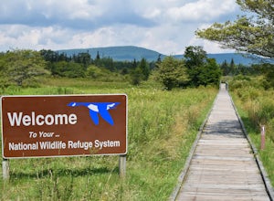
Freeland Boardwalk Trail
4.00.56 mi / 43 ft gainA free entrance and parking area for about a half dozen cars off Freeland Road features this quick adventure for all ages. The Canaan Valley National Wildlife Refuge and Freeland Boardwalk offers a variety of wildlife and environments like Ponds, Wetlands, Forests, and a natural limestone spring....Read more -
Rileyville, Virginia
Hike to Overall Run Falls
5.06.1 mi / 1700 ft gainStart at the Hogback parking lot at MP 21.1 on the Skyline Drive. Take the Appalachian Trail south for 0.8 miles, and turn right onto the Tuscarora-Overall Run Trail. After 0.5 miles you will come to another intersection-keep right to stay on the Tuscarora-Overall Run Trail. A final intersection...Read more -
Luray, Virginia
Little Stony Man, Shenandoah National Park
4.71.23 mi / 433 ft gainThe parking lot for the trail is right before mile 40 on Skyline drive in Shenandoah National Park. The entire out and back is only .9 miles, so it's the perfect hike to take in a sunset after a long day, take a break from driving, or just pick a hike that is family and dog friendly as Stoney Ma...Read more -
Luray, Virginia
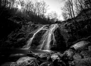
White Oak Canyon to Upper Falls
4.84.28 mi / 866 ft gainBetween mile 42 and 43 of Skyline Drive in Shenandoah National Park is the trailhead for WhiteOak Canyon. Begin at the trailhead from the parking lot and cross the Limberlost Trail in .3 miles. Continue on and you will cross your first footbridge shortly. After another mile you will cross the s...Read more -
Luray, Virginia
White Oak Trail to Lower Falls
5.06.68 mi / 1982 ft gainThe round trip is a total of 6.7 miles (10.8 km) from the Skyline Drive parking lot to the Whiteoak Canyon Trailhead parking lot (mile 42.6) to the final waterfall of the lower three. The elevation is moderate with a 900-foot drop to the upper falls, but an additional 1,100 feet to the lower fall...Read more -
Luray, Virginia
Mary's Rock via Appalachian Trail
3.36 mi / 1214 ft gainIf you're driving south on Skyline Drive, park in the lot on the right side of Skyline Drive immediately after you cross Route 211/Thornton Gap entrance. If you're driving north on Skyline Drive, the lot will be on the left side immediately before the Thornton Gap entrance. The trailhead is at t...Read more -
Stanley, Virginia
Three Falls Hike
8.3 mi / 2200 ft gainThe Three Falls Hike in Shenandoah National Park will take you past three beautiful waterfalls all found within the central district of the park: Lewis Spring Falls, Dark Hollow Falls, and Rose River Falls. You are able to start the loop from any of the waterfalls’ trailheads, but I prefer to sta...Read more -
Luray, Virginia
Hike Limberlost Trail in Shenandoah National Park
5.01.3 mi / 114 ft gainThe Limberlost Trail is a loop trail within Shenandoah National Park. It is classified as 'accessible' as the trail is flat and has features that would help those in a wheelchair or with other needs access the trail (boardwalk, bridge, benches). There is little-to-no elevation change and the pat...Read more -
Luray, Virginia
Hike Robertson Mountain in Shenandoah NP
6 mi / 1200 ft gainRobertson Mountain is often overshadowed by the nearby Old Rag Mountain, but standing 5 feet taller than Old Rag, this hike offers seclusion and gorgeous views to the south. Starting from the Limberlost Trailhead parking lot at MP 43 on the Skyline Drive, take the chained off Old Rag Fire Road. ...Read more -
Luray, Virginia
Photograph Jewell Hollow Overlook
One of Shenandoah National Park’s 72 overlooks, Jewell Hollow is a great place for people to stop while they are traveling through the park along Skyline Drive. Skyline Drive is the road that winds through the heart of Shenandoah National Park, starting at Front Royal in the north and ending at ...Read more -
Stanley, Virginia
Camp at Big Meadows, Shenandoah National Park
4.4Visiting Shenandoah National Park for the first time can be quite overwhelming. The 109 mile long Skyline Drive, combined with over 500 miles of hiking trails, makes camping is a necessity if you truly want to experience Shenandoah.From the Appalachian thru-hiker to the RV'er, Big Meadows is perf...Read more -
Stanley, Virginia
Photograph Spilter Knoll Overlook
5.0The Spitler Knoll is one of 72 overlooks for people to enjoy as they travel through Shenandoah National Park along Skyline Drive. Skyline Drive is the road that winds through the heart of Shenandoah National Park, starting at Front Royal in the north and ending at Rockfish Gap in the south. This...Read more

