Woodinville, Washington
Top Spots in and near Woodinville
-
North Bend, Washington
Melakwa Lakes via Denny Creek Trail
4.68.84 mi / 2615 ft gainThis hike has it all: old-growth forests, rivers, waterfalls, alpine lakes, views, peaks, and so on. The hike starts from near Denny Creek Campground in between the separate I-90 viaducts. Almost immediately, you will cross over a walk bridge over Denny Creek's waterfalls, and then eventually und...Read more -
North Bend, Washington
Kaleetan Peak
9 mi / 2200 ft gainInitial note: because this is an alpine scramble, do your research before tackling this adventure, including learning the correct route and the current conditions (such as any early- or late-season snow). From the Denny Creek Trailhead, take the Denny Creek trail just over 4 miles to Melakwa Lak...Read more -
North Bend, Washington
Kaleetan Lake via Denny Creek Trail
If you want to visit multiple lakes, get a view of or tackle a peak at Kaleetan, Chair, and Bryant, campgrounds for overnight or weekend adventures, fish in the lakes, explore off the trail and natural waterslides and picnic area waterfalls, this is for you. Denny Creek Trail offers it all! Afte...Read more -
Quilcene, Washington
Marmot Pass via Big Quilcene Trail
5.010.5 mi / 3481 ft gainThis trail has a nice, steady climb that's perfect for beginner or intermediate backpackers. The first 2.5 miles follow a forest trail along the Big Quilcene River. For the next 3 miles, the trail flows in and out of shaded trees, over a small talus field, and through a meadow before the final ac...Read more -
Quilcene, Washington
Buckhorn Mountain
12.26 mi / 4429 ft gainThe climb to Buckhorn Mountain above Marmot Pass is a must see for every PNW adventurer with the endurance to tackle nearly 14 miles and 4,400 feet of gain. Listen to the rushing waters of the Big Quilcene River as the trail gently traverses up 5.5 miles to Marmot Pass. Be sure to filter water ...Read more -
Quilcene, Washington
Backpack to Marmot and Constance Passes
24 mi / 5200 ft gainThe secret to this trip: Marmot Pass and Boulder Shelter, where you can camp on National Forest Service land. Multiple excellent, large backpacking sites sit just on the edge of the National Park, giving you great access to Mt. Constance and Mt. Deception, two of the tallest peaks in the Olympics...Read more -
National Forest Development Road 2530, Washington
Hike to Murhut Falls
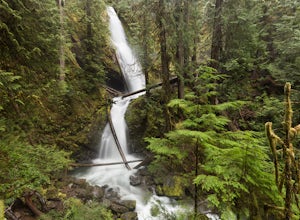
1.37 mi / 371 ft gainThe trailhead to Murhut Falls is located about 7.5 miles off US-101 S but the last couple of miles are on NF-2530 which can be potholed and rutted. I made it up the road in my 2WD sedan but it took quite some time to dodge all of the potholes. This hike is nice and quick! It starts with a small ...Read more -
Gold Bar, Washington
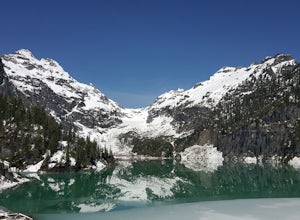
Blanca Lake
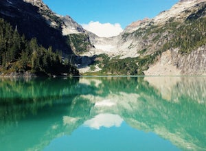
5.07.42 mi / 3540 ft gainAlthough the drive to the trailhead is mostly over gravel roads, Blanca Lake is a very popular hike. The drive is better for cars with clearance and AWD capabilities. The trail gets right down to it gaining almost 3,000 feet in the first 3 miles. But don't worry, the hard work is well worth the...Read more -
Gold Bar, Washington
Winter Backpack to Blanca Lake
7.5 mi / 3300 ft gainSince Blanca Lake is a very popular place for folks to explore and with the nice and sunny weekend. I drove out Friday night and slept in my Jeep. Got up at 7:30am when folks first started arriving to the trail head.A couple of things to keep in mind before you start this hike. The 7.5 miles ro...Read more -
North Bend, Washington
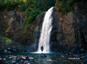
Franklin Falls via Wagon Road Trail
4.42.07 mi / 331 ft gainThis is an easy 2 mile roundtrip hike that leads to beautiful Franklin Falls. The trail is very well maintained and is easy for even young hikers to travel. The trail goes through the forest and along a gorge as you gain 400 feet in elevation to the falls. There are a few places you can scramble...Read more -
North Bend, Washington
Snowshoe to Franklin Falls
5.06 mi / 400 ft gainDepending on the road conditions and where you parked, the hike will be somewhere between 5-6 miles roundtrip. I always advise checking the weather and Washington Trail Association trip reports for the latest information. If conditions are ideal, grab your snowshoes and head to the mountains! Yo...Read more -
Quilcene, Washington
Mount Townsend
8.59 mi / 2949 ft gainThere are four trailheads that guide you to the top of Mount Townsend, but the most popular choice is to begin at the Upper Trailhead Trail #839 (snow permitting). The trail gradually climbs while traversing through forested area. While walking through the fir and hemlock trees, you pass three ...Read more -
Brinnon, Washington
Camp at the Dose Forks
15 mi / 1200 ft gainThe Dose Forks Campground is an overlooked campsite deep within the Olympic National Park, making it a perfect weekend camping destination. A mild, 7.5 mile (one-way) trail delivers you to this enchanting area and is a must for those who love photographing forests. There are no reservation requir...Read more -
Skykomish, Washington
Jade Lake via the Necklace Valley Trail
15.26 mi / 3323 ft gainThis hike is definitely one of our all-time favorites. The first time we did it was in August 2015 and due to the exceptionally mild winter that year, fall was already beginning to show its colors. We wanted to see it again in the springtime when everything was in bloom, so we decided to go again...Read more -
Skykomish, Washington
Tank Lakes via Necklace Valley
18.94 mi / 4721 ft gainTucked high in the heart of the Alpine Lakes Wilderness, Tank Lakes has everything you could ask for out of a Washington hike. You start low at the Necklace Valley trailhead just south of Skykomish along Highway 2 and meander five miles to a giant log crossing of the East Fork Foss River. From h...Read more -
North Bend, Washington
Lodge Lake via PCT
3.53.79 mi / 932 ft gainAs you begin your hike up to Lodge Lake you will pass through a small forest. After about .5 miles you will come out into the open. Simply follow the path under the chairlifts as you cut across the mountain. In the summer when there is no snow on the ground you can see lots of wildflowers. If you...Read more

