Woodinville, Washington
Top Spots in and near Woodinville
-
Darrington, Washington
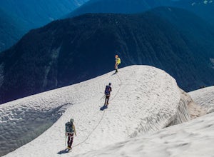
Climb Sloan Peak via the Corkscrew Route
5.014 mi / 6035 ft gainYou'll start the approach to this climb at the Sloan Peak trailhead at 1800ft elevation. Moving south along the trail, you'll begin with a traverse through some marshlands and several water crossings along the Sauk River and its tributaries for the first mile and before gaining any elevation. It ...Read more -
Skykomish, Washington
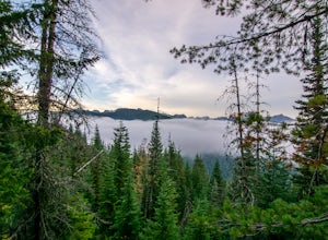
Hike Mount Sawyer
8 mi / 1200 ft gainThis trail starts off going through the forest of fir and hemlock for the first mile. Once you reach the top of the first hill, you will get a glimpse of all the views you will have the opportunity to enjoy later on. As you descend, the trees will start to thin out. The trail follows the ridge l...Read more -
Sequim, Washington
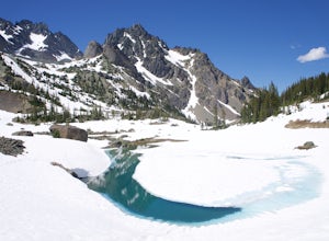
Hike to Royal Basin
4.715.76 mi / 3409 ft gainIf you're looking for a long day hike or multi-night backpacking trip in the Olympics, add Royal Lake and Royal Basin to your adventure list! The first mile of trail along the Dungeness River gains a gentle 300 feet. When you reach the bridge, do not cross it (the trail across the bridge goes...Read more -
Snoqualmie Pass, Washington
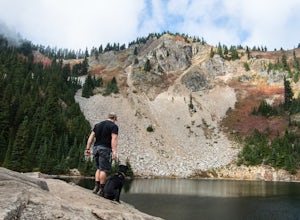
Hike to Margaret Lake
6 mi / 1800 ft gainStarting at an elevation of 3,300 feet, begin the hike on a steep gravel road for 1/4 of a mile. Take a left onto a dirt road that will lead to an area of clear cuts and windy switchbacks.As daunting as this may seem, don't be discouraged. On a clear day, the surrounding peaks of Snoqualmie Pass ...Read more -
Snoqualmie Pass, Washington
Lillian Lake
5.08.36 mi / 2969 ft gainWe backpacked our way to Lillian Lake and set up camp. There is a trail that lead around the lake and a trail that leads up to Rampart Lakes and Rachael Lake as well. We found a few more camps spots on Lillian Lake, then we noticed that only ONE other camp spot was being used. If you want peace ...Read more -
Mason County, Washington
Climb the Brothers (South Climb)
4.517 mi / 6062 ft gainThe Brothers is a notable peak on the border of Olympic National Park. The dual summits are a distinguishing feature of the Olympic Range, viewed from Seattle. This is a challenging route, testing a climber's route finding skills, physical fitness, and mental fortitude. From the parking lot, you ...Read more -
Mason County, Washington
Lena Lake
4.56.24 mi / 1644 ft gainThe trail climbs gently up and is accessible almost every season, weather permitting. Snowshoes may be needed December-February, so make sure and check with the Hoodsport Ranger Station. Just 45 minutes north of Hoodsport (a darling small town on the shores of Puget Sound), this trailhead has sp...Read more -
Mason County, Washington
Upper Lena Lake
5.012.61 mi / 4239 ft gainThe hike to Upper Lena Lake is a beautiful one. It first takes you past Lena Lake, which is a very popular weekend destination for families. Luckily you're pushing on to Upper Lena Lake that sits in a peaceful alpine meadow with Mt. Lena and Mt. Bretherton towering above. The first part of the t...Read more -
Leavenworth, Washington
Scenic Hot Springs
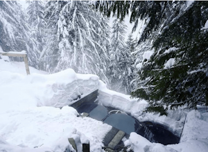
3.21 mi / 1135 ft gainScenic Hot Springs is a privately owned hot spring located near Stevens Pass outside of Leavenworth, Washington. To access the three steaming pools, please visit ScenicHotSprings.com to make a reservation. Reservations are required. The three tubs have varying temperatures and only 10 people ar...Read more -
Snoqualmie Pass, Washington
Hike to Rachel Lake
4.88 mi / 1600 ft gainThis hike is 8 miles roundtrip, with 1600 feet of elevation gain. Once you're on the trail, it starts heading uphill to help get your heart rate up on the hike. As you enter the Alpine Lakes Wilderness, the trail starts to level out. You'll cross a few streams and hike through a fair amount of ve...Read more -
Snoqualmie Pass, Washington
Day Hike to Lila Lakes and Alta Pass
4.312 mi / 3000 ft gainGetting There From Seattle, drive Interstate 90 to Exit 62, Signed Kachess Lake/Stampede Pass. Turn left and head north over the interstate; you'll reach Kachess Lake Campground in five miles. Turn left where the pavements ends and drive four miles on Box Canyon Road (FS Road #4930) to the Rachel...Read more -
Snoqualmie Pass, Washington
Take a Hike Up To Rampart Lakes
5.011 mi / 2200 ft gainGetting There: From I-90 East, take exit 62. Take a left, heading over the highway. After 5.2 miles, the road veers left, passing Lake Kachess Campground. Go another 0.3 miles on the gravel road and take a right at a sign for Rachel Lake/Trail 1313. At this point, the road gets a little rough, bu...Read more -
Snoqualmie Pass, Washington
Hike Alta Mountain
4.012 mi / 3300 ft gainStart off at Trail #1313 to Rachel Lake. The first 2.5 miles is a flat, slow uphill hike till you get to a river crossing. From there, the next 1.3 miles will be a 1,000 foot elevation gain to Rachel Lake. Once you arrive, this is a good spot to rest, eat some snacks, and replenish your water sup...Read more -
Snoqualmie Pass, Washington
Snowshoe to Rachel Lake
8 mi / 2100 ft gainBegin at the Rachel Lake Trailhead and fill out the registry with your individual/group information.As you start the hike heading Northwest towards the lake itself, the trail begins to steadily climb from its initial elevation of 2500 feet. Once you cross the Alpine Lake Wilderness sign, the path...Read more -
Mount Vernon, Washington
Explore the Flower Fields of Skagit Valley
4.3Skagit Valley is an important agricultural region of Washington State, but the prettiest time of year to attend is during the spring when flower season takes hold. Daffodils first, then tulips, and then irises bloom and cover fields as far as the eye can see. The Skagit Tulip Festival is held eve...Read more -
Snoqualmie Pass, Washington
Chikamin Peak via Mineral Creek Trailhead
15.34 mi / 5771 ft gainThis is a S5 T4 scramble that involves some routefinding past the alpine lakes. We did this as a day trip and we were out and back in about 12 hours. There are multiple routes to get to Chikamin, one from the PCT, which is 24 miles RT and the other is from the Mineral Creek Trailhead (47.4176, -...Read more

