Snoqualmie Pass, Washington
Looking for the best photography in Snoqualmie Pass? We've got you covered with the top trails, trips, hiking, backpacking, camping and more around Snoqualmie Pass. The detailed guides, photos, and reviews are all submitted by the Outbound community.
Top Photography Spots in and near Snoqualmie Pass
-
Ashford, Washington
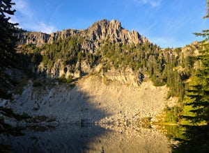
Hike to Eunice Lake in Mt. Rainier NP
6.5 miStarting out from the beautiful Mowich Lake (4,929 ft), this hike takes you through some of Mt. Rainier Nation Park's best scenery. Thanks to the 13 miles of dirt roads it takes to even get to the trailhead, this hike is also rarely crowded. At 6.5 miles roundtrip to Eunice Lake, this is a grea...Read more -
Ashford, Washington
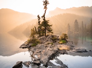
Mowich Lake
5.01.56 mi / 92 ft gainNo need to for an entire day hike to enjoy wonderful reflections, crystal clear water, and beautiful scenery a few hundred feet from the parking lot! Park at the Mowich Lake Campground parking lot and follow signs for the Wonderland trail. You will begin your hike on the south side of the lake ...Read more -
Carbonado, Washington
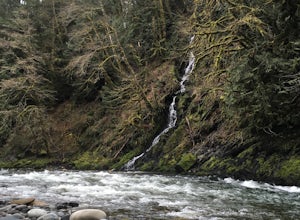
Hike the Upper Foothills Trail along the Carbon River
10 mi / 30 ft gainThe upper Foothills Trail from the Fairfax Bridge to Manley Moore can be hiked starting from either end as an "out and back" hike or a "point to point" by shuttling with two vehicles. Starting from the upper end of the trail you begin by walking under the Kolisch Rd. Bridge, which has the Manley...Read more -
Peshastin, Washington
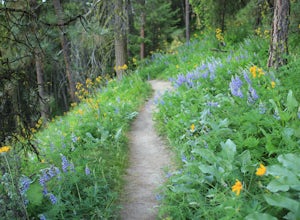
Hike Sauer’s Mountain
4.06 mi / 2000 ft gainSauer’s Mountain is one of those well defined, moderate, and rewarding hikes that give you just the right amount of views for the effort, but the real treat is catching the wildflower bloom in mid-May. The trailhead is located on private property. Start by parking along the private drive and walk...Read more -
Bellevue, Washington
Bellevue Botanical Garden
The park is open dawn to dusk. The botanical garden is free to visit and offers excellent photography opportunities. Additional InfoCopper Kettle Coffee Bar is available at the garden: Weekdays: 10am – 3pm; Saturday & Sunday: 10am – 5pmGarden Map with different attractions featuredBotanica...Read more -
Snohomish County, Washington
Hike to Glacier Basin
13 mi / 2600 ft gainStart off by traveling down the Mountain Loop Highway, arriving at the Barlow Pass Trailhead. You will walk about 200ft to reach an old gated road. This road will lead you towards Monte Cristo. About 1.5 miles down the road, the road will start to turn into a trail that runs along the river. You ...Read more -
Leavenworth, Washington
Kayaking Lake Wenatchee
3.0Glacier-fed Lake Wenatchee is only 2 hours east of Seattle, nestled in the Okanogan- Wenatchee National Forest. The park is fully equipped with all the amenities you'd expect - camping spots, a sand/rock beach, picnic tables, bathrooms and a boat launch.Pack up your boats at the south campground,...Read more -
Granite Falls, Washington
Gothic Basin
4.48.74 mi / 2785 ft gainLooking for a hike that will make you feel like you're in a foreign landscape, but don't have to deal with that far of a drive? Then consider hiking Gothic Basin. This hike is located only 30 miles down the Mountain Loop Highway, which is nearly a hour shorter for people that live in the greater ...Read more -
Granite Falls, Washington
Foggy Lake via Gothic Basin
4.59.78 mi / 3179 ft gainDrive the Mountain Loop Highway to Barlow Pass and park at the pass using your Northwest Forest Pass. (In early or late season, be aware of snow conditions at the pass and, more importantly, along the trail up to Gothic Basin.) From Barlow Pass, start hiking south past the trail gate and in the ...Read more -
Granite Falls, Washington
Climb Del Campo Peak, WA
5.0Begin by parking at Barlow Pass and following the Gothic Basin Trail to Foggy Lake. Most of the trip's mileage is consumed by just getting to Foggy Lake, from here, the summit sits about 3/4 of a mile distant and over a thousand above you.Face the mountain and identify the obvious leftward trendi...Read more -
Packwood, Washington
Hike the Grove of the Patriarchs
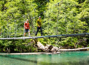
3.01.5 miThis trail is an easy trail to hike to the end and back. With very little to no elevation gain, some comfy shoes is all you need. There is a great opportunity near the start of the trail to walk down onto the beach and get right next to the river. Shortly after that there is a suspension bridge t...Read more -
Packwood, Washington
Canyoneering Olallie Creek, Mt. Rainier
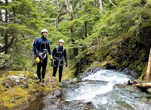
2.5 mi / 700 ft gainDisclaimer: Canyoneering is a dangerous and technical activity. Don’t enter any canyon without the skills to match it, or the knowledge to navigate it. Be sure to check the flow of Olallie creek to ensure that it's safe. In an area where canyoneering isn’t hugely popular, here lies a canyon that ...Read more -
Lewis County, Washington
Hike Indian Bar - Cowlitz Divide via Box Canyon
14.64 mi / 4235 ft gainThere are multiple ways to access Indian Bar. This one starts at Box Canyon. From the parking area at Box Canyon walk across the road and follow the signs for Wonderland Trail. Head up the Wonderland trail through the trees to the split with the Cowlitz trail. Continue on the Wonderland Trail...Read more -
Ashford, Washington
Backpack the Wonderland Trail
4.890 mi / 22000 ft gainPossibly one of the greatest loop hikes in the Lower 48, this trail sees a lot of use. You won't be alone out there, but opportunities for solitude are abundant with a little effort. The crowds show up for good reason - it's incredibly beautiful, relatively wild, and about as close to feeling l...Read more -
Ashford, Washington
Snowshoe or Ski to Mazama Ridge
5.06 mi / 900 ft gainThis scenic destination begins at the Paradise parking lot. Head north from the parking area towards Myrtle falls. Make sure to stay left of the Paradise in and cross Edith creek over a footbridge near Myrtle falls. From here, head east towards Mazama ridge by crossing through upper Paradise Vall...Read more -
Ashford, Washington
Snowshoe to Panorama Point Mount Rainier National Park
5.03.2 mi / 1700 ft gainArrive at Longmire in Mount Rainier National park about 9a.m. They open the gate during the late season at this time so you will want to get ahead of the crowd, especially if it is a beautiful day! This time of year it is required to carry chains, so don't forget those. Arrive at Paradise parking...Read more

