Skagit County, Washington
Looking for the best hiking in Skagit County? We've got you covered with the top trails, trips, hiking, backpacking, camping and more around Skagit County. The detailed guides, photos, and reviews are all submitted by the Outbound community.
Top Hiking Spots in and near Skagit County
-
Deming, Washington
Hike the Fire and Ice Trail
0.5 mi / 100 ft gainSet within the Mount Baker hiking wonderland, the Fire & Ice Trail may be the easiest and most family friendly hike set within the park. About ½ mile beyond the Heather Meadows Ski Area and about a mile before Artists Point, you’ll encounter the sign for the Austin Pass Picnic Area. It’s a ra...Read more -
Deming, Washington
Hike the Bagley Lakes Trail
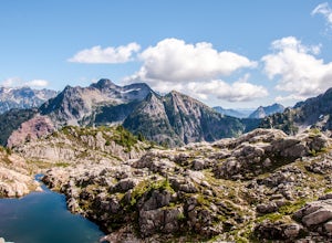
4.52 mi / 150 ft gainSet within the Mount Baker hiking wonderland, the Bagley Lakes trail is an easy, family-friendly hike with alpine lakes, copious amounts of wildflowers, and striking views of Table Mountain. Compared to the notoriety of many of the other hikes within the area, this is a hidden gem. There are actu...Read more -
Darrington, Washington
Climb Sloan Peak via the Corkscrew Route
5.014 mi / 6035 ft gainYou'll start the approach to this climb at the Sloan Peak trailhead at 1800ft elevation. Moving south along the trail, you'll begin with a traverse through some marshlands and several water crossings along the Sauk River and its tributaries for the first mile and before gaining any elevation. It ...Read more -
Granite Falls, Washington
Climb Del Campo Peak, WA
5.0Begin by parking at Barlow Pass and following the Gothic Basin Trail to Foggy Lake. Most of the trip's mileage is consumed by just getting to Foggy Lake, from here, the summit sits about 3/4 of a mile distant and over a thousand above you.Face the mountain and identify the obvious leftward trendi...Read more -
Deming, Washington
Hike to Sholes Creek Falls
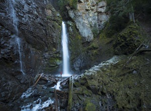
5.0Sholes Creek Falls is not easy to reach, but it is entirely worth the journey. The creek plunges over a two-tiered drop in stages of 62 and 103 feet into a massive amphitheater, which flows into Bar Creek. The waterfall is framed by massive columns of volcanic rock that dwarf the falls, in compar...Read more -
Granite Falls, Washington
Gothic Basin
4.48.74 mi / 2785 ft gainLooking for a hike that will make you feel like you're in a foreign landscape, but don't have to deal with that far of a drive? Then consider hiking Gothic Basin. This hike is located only 30 miles down the Mountain Loop Highway, which is nearly a hour shorter for people that live in the greater ...Read more -
Granite Falls, Washington
Foggy Lake via Gothic Basin
4.59.78 mi / 3179 ft gainDrive the Mountain Loop Highway to Barlow Pass and park at the pass using your Northwest Forest Pass. (In early or late season, be aware of snow conditions at the pass and, more importantly, along the trail up to Gothic Basin.) From Barlow Pass, start hiking south past the trail gate and in the ...Read more -
Deming, Washington
Chain Lakes Loop
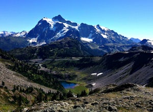
4.08.35 mi / 2005 ft gainDriving Directions: Travel east on Mt. Baker Highway 542 to the road's end and the Mount Baker Ski area. Follow the signs to the upper parking lot and the Bagley Lakes/Chain Lakes trailhead. The trail can also be accessed from Austin Pass and Artist Point. Trail: From the Bagley Lakes trail...Read more -
Deming, Washington
Winter Backpack to Lake Anne Ridge
14 mi / 2000 ft gainArrive at the upper ski resort parking lot (approx. 4300 feet elev.) and snowshoe, skin, or split board up. Make your way toward Artist Point and halt at Austin Pass, gaining approximately 1200 feet of elevation over approximately 2 miles (one way). From Austin Pass, turn left (south) to take the...Read more -
Rockport, Washington
Photograph Ketchum Falls
0.2 mi / 1388 ft gain...After spending my 3 days exploring and capturing the partial lunar eclipse at North Cascades National Park in Washington, I was eager to find another adventure that I haven't done yet or others didn't know much about. As I was driving East leaving Gorge Creek Falls, .9 miles on my left I spott...Read more -
Deming, Washington
Bike to Wells Creek Falls
Wells Creek Falls is an incredible waterfall nestled in a tight canyon below Mt. Baker. The falls plunges 93-ft. over a volcanic cliff face and envelops the small amphitheater below in a cloud of mist. From there, Wells Creeks snakes through the canyon and enters Bar Creek on the opposite side of...Read more -
Gold Bar, Washington
Greider Lakes Trail
8.5 mi / 2054 ft gainGreider Lakes Trail is an approximately 8+ mile hike out-and-back from the trailhead, which is labeled after a long drive up a gravel road. First 2 miles are flat, next 3 are switchbacks up. Once you reach the first larger lake, keep going! The second one is also gorgeous. This is a beautiful hik...Read more -
Darrington, Washington
Backpack to Glacier Peak Meadows and White Chuck Glacier
34 mi / 9000 ft gainStarting at the North Fork Sauk Trailhead (NFD 49) off the Mountain Loop Highway, you will travel 5.3 miles and gain a leisurely 1,100 feet of elevation until you reach Mackinaw Shelter. This is where the real work begins. The trail gains a calf-burning 3,000 feet in the next 2.9 miles until you ...Read more -
Snohomish County, Washington
Hike to Glacier Basin
13 mi / 2600 ft gainStart off by traveling down the Mountain Loop Highway, arriving at the Barlow Pass Trailhead. You will walk about 200ft to reach an old gated road. This road will lead you towards Monte Cristo. About 1.5 miles down the road, the road will start to turn into a trail that runs along the river. You ...Read more -
Deming, Washington
Hike Skyline Divide
5.09 mi / 2500 ft gainIf driving 13 miles on a forest road, and hiking miles of switchbacks doesn't bother you, your in for one of the most exquisite views that you can get from hiking in Washington state.Just a mile outside of the town of Glacier, turn onto Forest Road 37 and follow it up switchbacks for the majority...Read more -
Rockport, Washington
Hike to Pyramid Lake
2.1 mi / 1500 ft gainDay hike with moderate elevation gain, 2.1 miles one way. You will be going up, up, up until you get to the top where you will find the lake. Take your time going up - take breaks and stop to check out the forest around you. There were a few times where we found it difficult to follow the trail (...Read more

