Seattle, Washington
Looking for the best backpacking in Seattle? We've got you covered with the top trails, trips, hiking, backpacking, camping and more around Seattle. The detailed guides, photos, and reviews are all submitted by the Outbound community.
Top Backpacking Spots in and near Seattle
-
Granite Falls, Washington
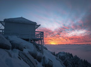
Mount Pilchuck Lookout
4.85.22 mi / 2113 ft gainHike the well-maintained Mount Pilchuck Lookout trail through a variety of terrain: old-growth forest and granite boulder fields. At the top, you'll reach a lookout tower perched on Mount Pilchuck. Pilchuck sits on the western edge of the Cascades, which offers up amazing panoramic views once you...Read more -
North Bend, Washington
Kaleetan Lake via Denny Creek Trail
If you want to visit multiple lakes, get a view of or tackle a peak at Kaleetan, Chair, and Bryant, campgrounds for overnight or weekend adventures, fish in the lakes, explore off the trail and natural waterslides and picnic area waterfalls, this is for you. Denny Creek Trail offers it all! Afte...Read more -
North Bend, Washington
Gem Lake, WA
4.710.4 mi / 2923 ft gainThis hike shares the trailhead for Snow lake at the Alpental Ski area in Snoqualmie Pass. You'll start out with a great warm up, walking through dense green underbrush and a brief wooded area. Before too long the trail increases in inclination slightly and begins to offer up some small rocky sect...Read more -
North Bend, Washington
Gem Lake and Wright Mountain
4.710.62 mi / 3107 ft gainThe trail to Gem Lake lies along the same trail that passes by the incredibly popular Snow Lake. While the masses typically stop the first place they can along the shores of Snow Lake, fewer make the short trek from there up to Gem Lake. Park at the giant lots at the end of the road to Alpental (...Read more -
North Bend, Washington
Winter Camping at Snow Lake
7.2 mi / 1800 ft gainStarting at the Snow Lake Trail Head you climb up the boot pack or ski track of those before you (hopefully) from ~3120 ft. to ~4400 ft. at the ridge line where Snow Lake becomes visible. If there are no tracks, follow the South Fork Snoqualmie River NE and aim just east of the lowest point of t...Read more -
North Bend, Washington
Snow Lake
4.06.24 mi / 1699 ft gainThis hike gets crowded fairly quickly so get there early. The parking lot is very large so parking is not really a problem. There are bathrooms at the very beginning of the trail so I highly suggest using them. However at the top there is also a designated restroom area. Starting at 2600 ft, thi...Read more -
North Bend, Washington
Winter Backpack Below Chair Peak
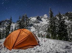
6 mi / 1500 ft gainHike or snowshoe to the ridge below Chair Peak and above Snow Lake and camp among numerous Snoqualmie Pass peaks.Drive to Snoqualmie Pass WA via I-90 and park at the Alpental parking lot (exit 52). Take the Snow Lake trail, which initially climbs 200 feet with wooden steps and eventually evens ou...Read more -
North Bend, Washington
Upper Wildcat Lake
1.014.43 mi / 4370 ft gainAlthough this hike is possible if you’re looking for an all-day training hike, it’s much more enjoyable if it’s an overnight backpacking trip. Head up the trail past Snow Lake toward Gem Lake. En route to Snow Lake will be a little crowded, but should lighten significantly as you continue hiking...Read more -
Gold Bar, Washington
Barclay Lake
4.44.4 mi / 607 ft gainWith less than 500 feet of total elevation and 4.4 miles of round trip hiking, the Barclay Lake trail is a perfect hike for beginners, families, or those looking for a quick morning or afternoon jaunt. Yet dont let the simplicity of the hike fool you. The end result of the hike is nothing short o...Read more -
Gold Bar, Washington
Greider Lakes Trail
8.5 mi / 2054 ft gainGreider Lakes Trail is an approximately 8+ mile hike out-and-back from the trailhead, which is labeled after a long drive up a gravel road. First 2 miles are flat, next 3 are switchbacks up. Once you reach the first larger lake, keep going! The second one is also gorgeous. This is a beautiful hik...Read more -
Carbonado, Washington
Summit Lake
4.56.13 mi / 1499 ft gainSummit Lake, nestled in a small basin just north of Mt. Rainier National Park in the Clearwater Wilderness, has everything a hiker could want in a day-hike or easy overnight backpack. The views, the well-maintained trail, and a perfect distance make this hike a must-do for anybody in the Pacific ...Read more -
Carbonado, Washington
Hike Bearhead Mountain
5.06 mi / 1800 ft gainFormerly the site of an old fire lookout, Bearhead Mountain located in the Clearwater Wilderness, provides great unobstructed views of the north side of Mount Rainier, Little Tahoma, and many other surrounding Cascade mountain peaks. In the summer months you are likely to encounter great wildflow...Read more -
Skykomish, Washington
Backpack from Dorothy Lake Trailhead to Snoqualmie Lake
18 mi / 1900 ft gainThe trail was not crowded although when we got to Snoqualmie Lake there were only a couple camping spots left. The trail up from Dorothy is not too hard at all. The weather was perfect. After passing Dorothy you have to ford a creek where the bridge has been washed out. We went through it on foot...Read more -
Skykomish, Washington
Hike to Lake Deer via Lake Dorothy Trailhead
12.6 mi / 1600 ft gainStart off by traveling along Highway 2 and turning towards the Money Creek Campground. Turn off onto Forest Road 6410 and follow that to the Lake Dorothy Trailhead (about 9 miles).This first section of the hike can be pretty crowded on a nice summer day as the trail is very family friendly and it...Read more -
Granite Falls, Washington
Cutthroat Lakes via Walt Bailey Trail
4.06.21 mi / 1978 ft gainAlong the Mountain Loop Highway, past the crowds crawling over Mt. Pilchuck, lies the muddy, unkempt Walt Bailey Trail into a verdant subalpine basin speckled with tiny tarns. The Cutthroat Lakes are a delightful location to spend the night with optional day hikes up to exposed ridgelines and cra...Read more -
Snoqualmie Pass, Washington
Hike-In and Camp at Alaska Lake
Driving Directions: From Seattle drive east on I-90 to exit 54 (signed "Hyak"). Turn left (north) under the freeway and right on the frontage road marked "Gold Creek." After about 0.5 mile turn left (north) on Gold Creek Road (Forest Road 4832), and in another 0.5 mile reach a junction. To the le...Read more

