Ronald, Washington
Looking for the best hiking in Ronald? We've got you covered with the top trails, trips, hiking, backpacking, camping and more around Ronald. The detailed guides, photos, and reviews are all submitted by the Outbound community.
Top Hiking Spots in and near Ronald
-
Leavenworth, Washington
Hike to the Summit of Rock Mountain, WA
5.011 mi / 4175 ft gainThe trail starts out poorly, following a jeep road under high-tension wires. Shortly, though, the trail begins to switchback up the south face of Rock Mountain and the views, as well as the wildflowers, are remarkable.After switchbacking up the mountain, follow a ridge-line towards the upper basi...Read more -
Leavenworth, Washington
Hike to the Summit of Mt. McCausland
8 mi / 1800 ft gainBegin by driving a fairly smooth Forest Road 6700 for 2.5 miles to the Smith Brook Trailhead and park in the space on the left. Much of the signage has been taken down along the trail, so it may be helpful to bring some written directions with you. The hike begins by keeping close to the road, me...Read more -
North Bend, Washington
Little Si
3.64.01 mi / 1250 ft gainLittle Si, neighbor to the bigger Mount Si is a decent hike for beginners and families with younger children. It is 4.7 miles round trip (including Boulder Garden Loop - 1.5 miles) gaining 1300ft in elevation - Discover Pass required. This trail is very popular, so if you want seclusion avoid thi...Read more -
Leavenworth, Washington
Day Hike to Lake Valhalla
4.57 mi / 1500 ft gainThe Smith Brook trail starts off with several switchbacks, then continues up to Union Gap where it meets the Pacific Crest Trail. Turn south (left) at Union Gap and continue hiking until you reach the gap between Mount Lichtenberg and McCausland, where you get a first glimpse of Lake Valhalla.Jus...Read more -
Carbonado, Washington
Summit Lake
4.56.13 mi / 1499 ft gainSummit Lake, nestled in a small basin just north of Mt. Rainier National Park in the Clearwater Wilderness, has everything a hiker could want in a day-hike or easy overnight backpack. The views, the well-maintained trail, and a perfect distance make this hike a must-do for anybody in the Pacific ...Read more -
Carbonado, Washington
Hike Bearhead Mountain
5.06 mi / 1800 ft gainFormerly the site of an old fire lookout, Bearhead Mountain located in the Clearwater Wilderness, provides great unobstructed views of the north side of Mount Rainier, Little Tahoma, and many other surrounding Cascade mountain peaks. In the summer months you are likely to encounter great wildflow...Read more -
Snohomish County, Washington
Hike Johnson Ridge to Scorpion Mountain
9 mi / 2650 ft gainFrom Skykomish, WA drive east on SR 2 roughly 1 mile and turn left on the Beckler River Road, FS RD 65. Drive north on this road approximately 7 miles taking a sharp right at the pavement's end just before crossing the Rapid River. You are now on FS RD 6520. Continue on this road bearing left a...Read more -
Leavenworth, Washington
Hike to Minotaur Lake
5.0This short, steep hike offers rewarding views that is well worth the vertical challenge. Round trip this hike is only 3.5 miles but you will gain 1400 feet elevation in the first mile.The trail starts off with switchbacks that head straight up the hill then about 200 feet from the wilderness boun...Read more -
Packwood, Washington
Hike the Grove of the Patriarchs
3.01.5 miThis trail is an easy trail to hike to the end and back. With very little to no elevation gain, some comfy shoes is all you need. There is a great opportunity near the start of the trail to walk down onto the beach and get right next to the river. Shortly after that there is a suspension bridge t...Read more -
Packwood, Washington
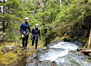
Canyoneering Olallie Creek, Mt. Rainier
2.5 mi / 700 ft gainDisclaimer: Canyoneering is a dangerous and technical activity. Don’t enter any canyon without the skills to match it, or the knowledge to navigate it. Be sure to check the flow of Olallie creek to ensure that it's safe. In an area where canyoneering isn’t hugely popular, here lies a canyon that ...Read more -
Ashford, Washington
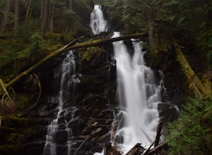
Hike to Rainier NP's Ranger Falls
4.57 miWhen heading to the adventure, stopped at the ranger station in Carbon to get your day pass ($5.00) and then continue on to the trailhead. Park on the road next to the Carbon river around. Start the hike down an old paved road that eventually leads through some trails and then to a gravel road. T...Read more -
Leavenworth, Washington
Evergreen Mountain Lookout
4.52.88 mi / 1522 ft gainThis is a relatively short hike, at only 2.6 miles round trip, that takes you up to the nearly 5600 foot summit. The hike may be short but it is extremely steep, gaining 1300ft in the 1.3 miles to the summit, so be prepared for a good leg workout. On the way to the top you will walk through field...Read more -
Snoqualmie, Washington
Rattlesnake Mountain Trail
4.010.54 mi / 2664 ft gainThe Rattlesnake Mountain Trail is often associated with Rattlesnake Ledge, one of the busiest hiking destinations around. But most people don't know that you can continue on from Rattlesnake Ledge another 10 miles to Snoqualmie Point Park. Using the Snoqualmie Point Trailhead, this hike is a wo...Read more -
Randle, Washington
Trail Run to Silver Falls
5.02.4 mi / 200 ft gainThis is a trail that could easily be done by your older family members but also could be a nice trail run or quick hike for you. The trail starts from Loop B in the Ohanapecosh Campground and after a quick section, you will be walking over the hot springs in the area. They ask that you stay off t...Read more -
Lewis County, Washington
Hike Indian Bar - Cowlitz Divide via Box Canyon
14.64 mi / 4235 ft gainThere are multiple ways to access Indian Bar. This one starts at Box Canyon. From the parking area at Box Canyon walk across the road and follow the signs for Wonderland Trail. Head up the Wonderland trail through the trees to the split with the Cowlitz trail. Continue on the Wonderland Trail...Read more -
Gold Bar, Washington
Barclay Lake
4.44.4 mi / 607 ft gainWith less than 500 feet of total elevation and 4.4 miles of round trip hiking, the Barclay Lake trail is a perfect hike for beginners, families, or those looking for a quick morning or afternoon jaunt. Yet dont let the simplicity of the hike fool you. The end result of the hike is nothing short o...Read more

