Rattlesnake Ledge, Washington
Looking for the best photography in Rattlesnake Ledge? We've got you covered with the top trails, trips, hiking, backpacking, camping and more around Rattlesnake Ledge. The detailed guides, photos, and reviews are all submitted by the Outbound community.
Top Photography Spots in and near Rattlesnake Ledge
-
Granite Falls, Washington
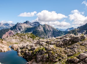
Gothic Basin
4.48.74 mi / 2785 ft gainLooking for a hike that will make you feel like you're in a foreign landscape, but don't have to deal with that far of a drive? Then consider hiking Gothic Basin. This hike is located only 30 miles down the Mountain Loop Highway, which is nearly a hour shorter for people that live in the greater ...Read more -
Granite Falls, Washington
Foggy Lake via Gothic Basin
4.59.78 mi / 3179 ft gainDrive the Mountain Loop Highway to Barlow Pass and park at the pass using your Northwest Forest Pass. (In early or late season, be aware of snow conditions at the pass and, more importantly, along the trail up to Gothic Basin.) From Barlow Pass, start hiking south past the trail gate and in the ...Read more -
Granite Falls, Washington
Climb Del Campo Peak, WA
5.0Begin by parking at Barlow Pass and following the Gothic Basin Trail to Foggy Lake. Most of the trip's mileage is consumed by just getting to Foggy Lake, from here, the summit sits about 3/4 of a mile distant and over a thousand above you.Face the mountain and identify the obvious leftward trendi...Read more -
Granite Falls, Washington
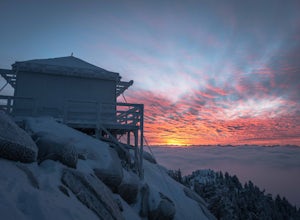
Mount Pilchuck Lookout
4.85.22 mi / 2113 ft gainHike the well-maintained Mount Pilchuck Lookout trail through a variety of terrain: old-growth forest and granite boulder fields. At the top, you'll reach a lookout tower perched on Mount Pilchuck. Pilchuck sits on the western edge of the Cascades, which offers up amazing panoramic views once you...Read more -
Leavenworth, Washington
Hike to Minotaur Lake
5.0This short, steep hike offers rewarding views that is well worth the vertical challenge. Round trip this hike is only 3.5 miles but you will gain 1400 feet elevation in the first mile.The trail starts off with switchbacks that head straight up the hill then about 200 feet from the wilderness boun...Read more -
Granite Falls, Washington
Lake 22
4.65.98 mi / 1434 ft gainIf you're looking for a taste of the Mountain Loop Highway area, but don't have it in you for a longer, steeper journey, look no further than Lake 22. The trail starts out as flat and well-maintained, from the parking lot, before becoming a true mountain rainforest trail. Water and dampness are f...Read more -
Leavenworth, Washington
Hike to the Summit of Rock Mountain, WA
5.011 mi / 4175 ft gainThe trail starts out poorly, following a jeep road under high-tension wires. Shortly, though, the trail begins to switchback up the south face of Rock Mountain and the views, as well as the wildflowers, are remarkable.After switchbacking up the mountain, follow a ridge-line towards the upper basi...Read more -
Granite Falls, Washington
Mt. Dickerman Summit
7.93 mi / 3675 ft gainIn general, this is a strenuous hike or snowshoe at approximately 8 miles round trip with nearly 4000 elevation gain. Be aware of current snow conditions and avalanche risk if heading up in the winter. Do not attempt a winter trip without proper knowledge, skill, and gear. Some previous winter tr...Read more -
Granite Falls, Washington
Hike to Perry Creek Falls & Mount Forgotten Meadows
11.5 mi / 3700 ft gainMost visitors park at this trailhead to hike Dickerman Mountain. Until this spring, so did I. However, don't overlook this stunning valley hike to Perry Creek, Mount Forgotten Meadows, and the scramble up Mount Forgotten!Begin this hike on the Perry Creek trail, which begins on the far left sid...Read more -
Ashford, Washington
Backpack the Wonderland Trail
4.890 mi / 22000 ft gainPossibly one of the greatest loop hikes in the Lower 48, this trail sees a lot of use. You won't be alone out there, but opportunities for solitude are abundant with a little effort. The crowds show up for good reason - it's incredibly beautiful, relatively wild, and about as close to feeling l...Read more -
Ashford, Washington
Snowshoe or Ski to Mazama Ridge
5.06 mi / 900 ft gainThis scenic destination begins at the Paradise parking lot. Head north from the parking area towards Myrtle falls. Make sure to stay left of the Paradise in and cross Edith creek over a footbridge near Myrtle falls. From here, head east towards Mazama ridge by crossing through upper Paradise Vall...Read more -
Ashford, Washington
Snowshoe to Panorama Point Mount Rainier National Park
5.03.2 mi / 1700 ft gainArrive at Longmire in Mount Rainier National park about 9a.m. They open the gate during the late season at this time so you will want to get ahead of the crowd, especially if it is a beautiful day! This time of year it is required to carry chains, so don't forget those. Arrive at Paradise parking...Read more -
Ashford, Washington
Hike to Panorama Point
4.65.4 mi / 1700 ft gainThis 5.4 mile loop hike begins at the Paradise Visitors Center in Mount Rainier National Park. You just follow the skyline trail that begins from the steps with the John Muir quote on them. The hike goes up 1700 feet to its highest point at 7100 feet. From this high up you have some amazing views...Read more -
Ashford, Washington
Winter Camp at Glacier Vista
5.03 mi / 1000 ft gainIt's always a good idea to check the weather, but when it comes to getting a peak at Mt. Rainier you might be better off just showing up and hoping for a miracle. To do this from Seattle, you'll have a 2 hour 20 minute drive down I-5 and WA-167. After a couple turns here and there (you can follow...Read more -
Ashford, Washington
Skyline Loop in Mt. Rainier NP
4.55.65 mi / 1722 ft gainThe trailhead to Skyline Trail is located at the north side of the upper parking lot near the Visitor Center and Paradise Inn. You'll see that it breaks off into many other small trails if you want, as well. However, this 5.5 mile hike alongside Nisqually Glacier is classified by the rangers at...Read more -
Ashford, Washington
Snowshoeing the Nisqually Vista Loop at Mt. Rainier NP
4.01.4 miMt. Rainier rises over 14,410 feet and the views you get from the Paradise area on the South side of the mountain are unparalleled. Paradise is one of the few places in Mt. Rainier National Park that is open to visitors during the winter months for cross country skiing, snowshoeing, sledding, and...Read more

