Rattlesnake Ledge, Washington
Looking for the best photography in Rattlesnake Ledge? We've got you covered with the top trails, trips, hiking, backpacking, camping and more around Rattlesnake Ledge. The detailed guides, photos, and reviews are all submitted by the Outbound community.
Top Photography Spots in and near Rattlesnake Ledge
-
Leavenworth, Washington
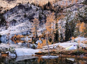
The Enchantments: Stuart Lake Trailhead to Snow Lake Trailhead
5.018.02 mi / 4626 ft gainThere are a couple different ways to tackle this hike through the stunning Central Cascade region. I recommend checking out this handy resource for more detailed info. Bottom line: this is an absolutely amazing hike for people willing to take a little bit of an ass kicking. Aasgard Pass rises 1,...Read more -
Leavenworth, Washington
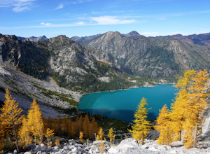
Day Hike the Enchantments
5.018.05 mi / 4675 ft gainStart at the Stuart Lake trailhead, which at 3400' is a full 2000' higher than the Snow Lake trailhead you'll finish at. Put 2.5 easy miles under your feet along Mountaineer Creek before turning left on the trail up to Colchuck Lake. The trail steepens for the next 1.5 miles before popping you ou...Read more -
Leavenworth, Washington
Hike to Lake Stuart
4.89 mi / 1665 ft gainBegin this hike at the Lake Stuart trailhead at the end of Eightmile road just outside of Leavenworth, Washington. The trail follows Mountaineer Creek and leads you across a log bridge over the falls. After the bridge, the trail narrows and steepens through several switchbacks. After 2.2 miles...Read more -
Leavenworth, Washington
Scramble to the Summit of Dragontail Peak
16 mi / 7000 ft gainGetting There From Leavenworth, WA, drive Icicle Creek Road for 8.5 miles until you reach Bridge Creek Campground. Turn left here onto Forest Service Road #7601 signed for the Stuart Lake Trailhead. The pavements ends and the road gains elevation quickly as your car transports you high above the ...Read more -
Leavenworth, Washington
Hike to the Enchantments' Horseshoe Lake
1.016 mi / 6000 ft gainGetting There From Leavenworth, WA, drive Icicle Creek Road for 8.5 miles until you reach Bridge Creek Campground. Turn left here onto Forest Service Road #7601 signed for the Stuart Lake Trailhead. The pavements ends and the road gains elevation quickly as your car transports you high above the ...Read more -
Leavenworth, Washington
Aasgard Pass via Stuart Lake Trail
3.511.15 mi / 4560 ft gain“These fleetingly rare sights offer a recipe for what I call ‘the Quest.’ The Quest is the force that motivates us to travel. It’s putting oneself in the perfect place at the perfect time. It’s the insatiable urge to find that quintessential moment.” - Washington AAA Journal The arrival of “gold...Read more -
Granite Falls, Washington
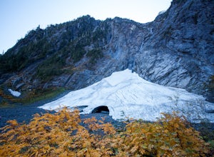
Big Four Ice Caves
4.32.38 mi / 289 ft gainDisclaimer: Hiking into the caves is extremely dangerous as there is potential for the ice to fall. We do not recommend hiking inside of them and if you choose to do so, you're doing it at your own risk. This is a short hike at just 2.3 miles roundtrip with little elevation change. The hike take...Read more -
Ashford, Washington
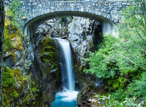
Explore Rainier's Christine and Narada Falls
3.7Driving along Paradise Road on the south side of Mount Rainier, provides a couple of opportunities to view gorgeous waterfalls with a short hike. From the West, the first stop is Christine Falls. There is parking on either side side of the bridge, but the east side is closest to the trail. Desce...Read more -
Granite Falls, Washington
Snowshoe to Coal Lake
13 mi / 1600 ft gainhttps://www.theoutbound.com/wa...Starting out at the Deer Creek gate of Mountain Loop Highway the road is flat and uneventful for the first 2 miles or so, though it does offer some great views of the Big Four as well as a few other peaks and the babbling south fork of the Stillaguamish river. The...Read more -
Ashford, Washington
Hike to Comet Falls
5.0Located on Paradise Road along the south side of Mount Rainier, the Comet Falls Trail follows Van Trump Creek up to the magnificent Comet Falls. The hike is 3.8 miles round trip with 1250' of elevation gain.The trail starts off at 3650' and soon crosses over a bridge above Christine Falls. It qui...Read more -
Leavenworth, Washington
Backpack to Lake Caroline in the Enchantments
5.75 mi / 3100 ft gainFrom Leavenworth, WA head down Icicle Creek road and head to the Eightmile Lake Trailhead.The backpack starts at roughly 3270 feet of elevation and the highest point of the hike is 6300 feet. To start you will hike through a very beautiful and forested area for a while before getting into a burn ...Read more -
Leavenworth, Washington
Eightmile Lake
4.06.76 mi / 1496 ft gainBeginning at the trailhead, fill out a self-issued permit allowing you to stay overnight. Start your trek heading upwards at an elevation of 3300 feet. As you become adapted to the trail, you will start to realize it is maintained and well groomed. In addition, The 1300 feet of elevation gained t...Read more -
Eatonville, Washington
Hike to Gobbler's Knob
4.05 mi / 1500 ft gainEntering the Park from the Southwest Entrance, bear left when you approach the forking Westside Rd. This road has been closed a few miles in due to massive rockfall. When you reach the road closure, just park along the side of the road. In Spring and Summer, you should be able to see plenty of ot...Read more -
Packwood, Washington
Summit Castle Peak, Mount Rainier NP
4.06 mi / 1400 ft gainStart this route at the Narada Falls Parking lot. This route starts by following Stevens Canyon Road until you arrive at Reflection Lakes after 1.5 miles. About halfway along the lakeshore a path breaks off to the right into the forest. This is a popular route so there is often a snowshoe path be...Read more -
Packwood, Washington
Ski Tour to The Castle & Pinnacle Peak
4 mi / 1200 ft gainEnter Mount Rainier National Park via the Nisqually Entrance outside of Ashford. Drive past Longmire and continue heading up towards Paradise. Parking for this trip can be found at Narada Falls. From the Narada Falls parking lot you will head up to the closed for the winter portion of Stevens Ca...Read more -
Cle Elum, Washington
Backpack to Navaho Pass
12 mi / 4220 ft gainThis is a beautiful trail in the Teanaway area, located in Washington State. The trailhead starts along the Stafford Creek Trail and follows the creek for the first couple miles of the trail. There are a number of different types of wildflowers out here that make the first few miles a nice warmup...Read more

