Randle, Washington
Looking for the best hiking in Randle? We've got you covered with the top trails, trips, hiking, backpacking, camping and more around Randle. The detailed guides, photos, and reviews are all submitted by the Outbound community.
Top Hiking Spots in and near Randle
-
Ashford, Washington
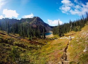
Hike to Upper Palisades Lake
6.6 mi / 1200 ft gainPark at the Sunrise Point parking lot and find the Palisades Trail at the northeast corner of the parking lot. If you bring along a pair of binoculars, you can stop at the first overlook on the left and scan the adjacent mountain slopes for the white dots of mountain goats. Continue down the trai...Read more -
Cougar, Washington
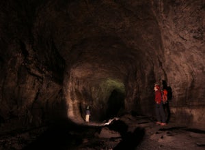
Explore the Ape Caves
4.0As if erupting volcanoes weren't awesome enough, ancient lava flows also left behind these giant, hollow tubes as they cooled. Spend all day exploring deep underground in this 2.5 mile cave.To get there, head to the SOUTH side of Mount Saint Helens. You must pass through the town of Cougar to get...Read more -
Ashford, Washington
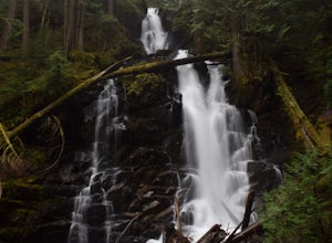
Hike to Rainier NP's Ranger Falls
4.57 miWhen heading to the adventure, stopped at the ranger station in Carbon to get your day pass ($5.00) and then continue on to the trailhead. Park on the road next to the Carbon river around. Start the hike down an old paved road that eventually leads through some trails and then to a gravel road. T...Read more -
Yakima, Washington
Surprise Lake via South Fork Tieton Trail
13 mi / 1549 ft gainGetting There Take Road 1000 to start your hike at Conrad Meadows, which is also where you will park your car, be sure to leave your Northwest Forest Pass properly displayed on the dash of your car before you leave. Surprise Lake trailhead is one of the very few trailheads that starts out on th...Read more -
Carbonado, Washington
Hike the Upper Foothills Trail along the Carbon River
10 mi / 30 ft gainThe upper Foothills Trail from the Fairfax Bridge to Manley Moore can be hiked starting from either end as an "out and back" hike or a "point to point" by shuttling with two vehicles. Starting from the upper end of the trail you begin by walking under the Kolisch Rd. Bridge, which has the Manley...Read more -
Skamania County, Washington
Hike to the Summit of Mount Adams via South Climb
5.012 mi / 6700 ft gainStart by checking in at the Trout Lake Ranger station to pick up a Cascade Volcanoes pass for $10-$15. Continue the South Climb trailhead at the Cloud Cap Campground. Some hikers overnight here for an early start the next day.Sign out a wilderness permit at the trailhead and follow the South Clim...Read more -
Enumclaw, Washington
Crystal Peak Trail
7.49 mi / 2966 ft gainMake sure you are going out on a clear day to catch the best views of the mountains, and bring your camera! From the summit, it’s possible to see six volcanoes spanning two states. Baker, Glacier, Adams, Rainier, St. Helens and Hood wait patiently for you to climb the more-than-moderately steep p...Read more -
Skamania County, Washington
McClellan Falls
1.00.7 mi / 200 ft gainThe trail begins at the parking for McClellan Overlook. Head out of the parking area and cross over the highway before heading onto a faint, unmarked trail. You may have to do a little routefinding, so it's best to download this map before heading out so you can make sure you stay on path. This...Read more -
Carbonado, Washington
Summit Lake
4.56.13 mi / 1499 ft gainSummit Lake, nestled in a small basin just north of Mt. Rainier National Park in the Clearwater Wilderness, has everything a hiker could want in a day-hike or easy overnight backpack. The views, the well-maintained trail, and a perfect distance make this hike a must-do for anybody in the Pacific ...Read more -
Carbonado, Washington
Hike Bearhead Mountain
5.06 mi / 1800 ft gainFormerly the site of an old fire lookout, Bearhead Mountain located in the Clearwater Wilderness, provides great unobstructed views of the north side of Mount Rainier, Little Tahoma, and many other surrounding Cascade mountain peaks. In the summer months you are likely to encounter great wildflow...Read more -
Ariel, Washington
Fly Fish Merrill Lake
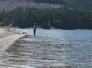
1 mi / 100 ft gainSurrounded by old growth forest, Merrill Lake near Cougar, Washington is the perfect little gem to get in some late summer, mid-elevation mountain lake fishing. The morning and evening hatches are known state wide for the size of fish they attract. There are stories of Eagles even stealing trout ...Read more -
Yakima County, Washington
Mount Adams Circumambulation
35.1 mi / 8881 ft gain***Before you go on this trek, give the Yakama Nation a call and talk to a Ranger to make sure the trail is open to backpackers or hikers.*** 1-509-865-5121 or 1-509-395-3402 There are a few places you can start this adventure, but starting from the South Climb Trail Head and Cold Spring Campgrou...Read more -
Enumclaw, Washington
Hike Grand Park and Lake Eleanor
9 mi / 1100 ft gainPrepare in advance to hold your jaw from dropping. Stunning views of Mt. Rainier await visitors of Grand Park. A quick jaunt through the forest via the trailhead leads first to Lake Eleanor. Well groomed campsites are available for overnight stays.Head past Lake Eleanor and you're on the way to G...Read more -
Enumclaw, Washington
Norse Peak via Silver Creek
7.77 mi / 2405 ft gainStart out in Crystal parking lot A. There is a small and steep trail that heads up the hill labeled as Silver Creek Trail. The trail follows a horse trail for the majority of the route and gets renamed Bullion Basin Trail shortly after you enter the woods, so when it doubt keep following the hoof...Read more -
Skamania County, Washington
Indian Heaven to Blue Lake
4.56.71 mi / 997 ft gainCrowds and mosquitoes were nonexistent as we went a bit early in the season. The trails were all covered in snow, but we were able to do some way finding with a GPS and topo map. 3.5 miles in we found a dry spot next to Blue Lake and set up shop. After dropping off our gear we climbed up Gifford...Read more -
Enumclaw, Washington
Catch the Sunset at Suntop Lookout
5.0Catching a beautiful sunset has never been so easy. This lookout tower is accessible by vehicle. The road is fairly smooth too. No car would have any trouble getting up to the top. The last gate before the lookout tower/peak is about a mile down. The gate does close at 8pm but is ran by voluntee...Read more

