Port Orchard, Washington
Looking for the best hiking in Port Orchard? We've got you covered with the top trails, trips, hiking, backpacking, camping and more around Port Orchard. The detailed guides, photos, and reviews are all submitted by the Outbound community.
Top Hiking Spots in and near Port Orchard
-
King County, Washington
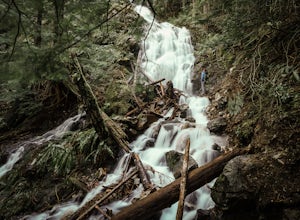
Teneriffe Falls (Kamikaze Falls)
4.55.64 mi / 1732 ft gainThe lesser known Mt Si Rd trail starts off as a relatively flat road. This continues for two miles until you reach the Teneriffe Falls sign. Upon turning right at this junction, the terrain takes a shift and the incline steepens. This is where most of the elevation is gained. The rest of the way...Read more -
Port Angeles, Washington
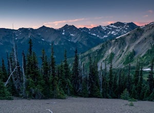
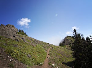
Hike to Elk Mountain from Obstruction Point
5.04 mi / 644 ft gainOlympic National Park is built for someone with a week or more to spare for backpacking deep into the heart of the park's endless miles of wilderness. Between the mountains, the coast, and the rainforest, there is a lot of park to see for someone who is trying to fit their visit into an extended ...Read more -
Port Angeles, Washington
Backpack to Grand Park in the Olympics
5.07.5 mi / 2500 ft gainThe beauty of many of the north coast trails in the Olympic Peninsula is that your car does a lot of the heavy lifting for you. This is certainly true of the Grand Valley Trail, which begins more than a vertical mile above the Strait of Juan de Fuca at the end of the Obstruction Point Road. Six...Read more -
Port Angeles, Washington
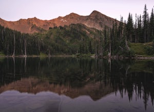
Badger Valley Trail to Grand Pass Trail Loop
4.010.42 mi / 3235 ft gainBadger Valley Trail to Grand Pass Trail Loop Trail is a loop trail that takes you by a lake located near Port Angeles, Washington.Read more -
North Bend, Washington
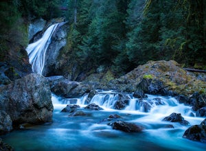
Twin Falls
3.32.51 mi / 778 ft gainFor a portion of this 3-mile hike, you'll trek next to the South Fork Snoqualmie River, so take in the peaceful sound of the river running. Along the trail runs a river, where massive boulders create wading pools of icy water for warm summer days. At 1.5 miles, you'll reach a viewpoint bridge, wh...Read more -
Quinault, Washington
Backpack to Enchanted Valley Chateau
5.031.59 mi / 5052 ft gainThis backpacking trip can easily be done in 2 days, but some people prefer to stretch it out to 3. Luckily there are several different spots to stop and camp, so you can split up the distance however you are the most comfortable. The elevation over the course of the trail is minimal, which means ...Read more -
North Bend, Washington
Mailbox Peak New Trail
4.210.53 mi / 4127 ft gain*Disclaimer this article is in regards to the newly built trail.* For the old trail, head to Hike Mailbox Peak. Just off of exit 34, Mailbox Peak offers a birds-eye view of the surrounding area. This hike begins at a mere 800 ft. above sea level and by the time you are done you are nearly touch...Read more -
Coupeville, Washington
Hike Ebey's Landing
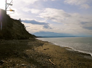
4.5Just walk straight past the restroom to find the start of the trail route. The Bluff trail heads up a set of stairs to the top of the hillside on the right. After climbing the stairs, you come right up on farmland (Ebey's Prairie), with a grassy two-track trail leading up toward the top of the bl...Read more -
North Bend, Washington
Mailbox Peak Old Trail
4.44.96 mi / 3898 ft gainNote this adventure covers the old route. For the updated route, check out Hike Mailbox Peak New Trail. Take exit 34 from I-90. Head north on 468th Ave SE until the intersection with the SE Middle Fork Road. Turn right onto the Middle Fork Road. Follow SE Middle Fork Road 2.2 miles to the stop ...Read more -
Spoon Creek Falls Trail, Washington
Hike Spoon Creek Falls
0.8 mi / 200 ft gainThis is a great low effort, high reward hike that offers several viewpoints along the trail of the falls below before it meanders all the way to the shore of the creek. While it doesn't take long to hike to this spot you can easily spend an entire morning or afternoon exploring everything it has ...Read more -
North Bend, Washington
Hike Mount Washington
4.32.89 mi / 3058 ft gainYou start out at an elevation of about 1200 feet and you gradually make your way up to the top at 4450 feet. You are hiking through forest land the whole time with peaks of a beautiful view to the north every so often. Along the way there are many rock walls which you can climb at, however on our...Read more -
Port Angeles, Washington
Hike to PJ Lake, Olympic National Park
1.63 mi / 692 ft gainA short and scenic trail of tranquility that leads to the secluded Lake PJ, hidden on Hurricane Ridge. Nothing but nature stirs here. The trail, while well-traveled, is far quieter than others in the surrounding area of Olympic. You might see one other hiker. It is lined with wildflowers and in t...Read more -
Carbonado, Washington
Hike the Upper Foothills Trail along the Carbon River
10 mi / 30 ft gainThe upper Foothills Trail from the Fairfax Bridge to Manley Moore can be hiked starting from either end as an "out and back" hike or a "point to point" by shuttling with two vehicles. Starting from the upper end of the trail you begin by walking under the Kolisch Rd. Bridge, which has the Manley...Read more -
Sequim, Washington
Hike Dungeness Spit
3.511 mi / 130 ft gainPark at a the north side of the Dungeness Spit Recreation Area, in the Refuge parking lot. There is a kiosk at the Refuge where you can pay an entrance fee ($3) and check the Tide Table. Only attempt the hike at low tide or the sand spit becomes narrow and you have to climb over logs.Follow the R...Read more -
Port Angeles, Washington
Klahhane Ridge (Switchback Route)
4.05 mi / 1700 ft gainHiking to Klahhane Ridge is a rewarding experience that provides you with sweeping views of the Olympic Mountains. Further access to overnight opportunities is possible if you venture beyond the summit trail. Here’s the scoop: Get an early start. There is a decent amount of parking available at ...Read more -
North Bend, Washington
Hike Pratt Balcony
2.2 miThis one can be a bit tricky to find. The trailhead is unmarked and is a bit hidden around a curve of Middle Fork Road so it is easy to miss. At about 9.80 miles from the junction of 468th St. and Middle Fork Road, look for two signs on the right warning of upcoming gravel patches (probably will ...Read more

