Peshastin, Washington
Top Spots in and near Peshastin
-
Leavenworth, Washington
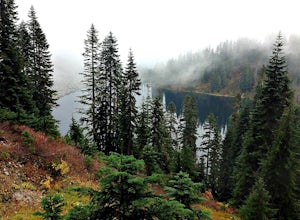
Day Hike to Lake Valhalla
4.57 mi / 1500 ft gainThe Smith Brook trail starts off with several switchbacks, then continues up to Union Gap where it meets the Pacific Crest Trail. Turn south (left) at Union Gap and continue hiking until you reach the gap between Mount Lichtenberg and McCausland, where you get a first glimpse of Lake Valhalla.Jus...Read more -
Easton, Washington
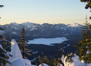
Snowshoe to Amabilis Mountain
9.5 mi / 2100 ft gainTo reach Amabilis Mountain, park at the Cabin Creek Sno Park at Exit 63 off I-90. Take the overpass across the highway to the trailhead and strap on your snowshoes. There's a maze of cross-country ski trails, but you'll want to keep to the right and follow the Berg trail for a quarter mile until ...Read more -
Skykomish, Washington
Hike to Big Heart Lake
5.014.6 mi / 3300 ft gainThis hike takes you past 5 lakes and a few different waterfalls, so if you don't wish to push on to Big Heart, you won't be disappointed! Start at the West Fork Foss River Trailhead, about 2.6 miles past the Necklace Valley Trailhead. The first mile is relatively flat. Once you reach the bridge t...Read more -
Skykomish, Washington
Hike to Foss River and Lakes
4.04.2 mi / 2400 ft gainChoose from Trout Lake (1.6 miles each way with 500 feet of elevation gain), Copper Lake (4.2 miles each way with 2400 feet of elevation gain), or Big Heart Lake at 7.3 miles each way, with 3300 feet elevation gain). There are plenty of camp sites if you decide to go overnight at any of the lakes...Read more -
Skykomish, Washington
Tank Lakes via Necklace Valley
18.94 mi / 4721 ft gainTucked high in the heart of the Alpine Lakes Wilderness, Tank Lakes has everything you could ask for out of a Washington hike. You start low at the Necklace Valley trailhead just south of Skykomish along Highway 2 and meander five miles to a giant log crossing of the East Fork Foss River. From h...Read more -
Skykomish, Washington
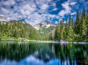
Jade Lake via the Necklace Valley Trail
15.26 mi / 3323 ft gainThis hike is definitely one of our all-time favorites. The first time we did it was in August 2015 and due to the exceptionally mild winter that year, fall was already beginning to show its colors. We wanted to see it again in the springtime when everything was in bloom, so we decided to go again...Read more -
Ellensburg, Washington
Hike Manastash Ridge
4 mi / 1700 ft gainManastash Ridge is a popular hike in Ellensburg, Washington, attracting many locals and students of Central Washington University. While attending school, I climbed the Ridge a handful of times, always with struggle. After making my resolution of 40 hikes in 2015, I decided to tackle this hike fo...Read more -
Snoqualmie Pass, Washington
Lillian Lake
5.08.36 mi / 2969 ft gainWe backpacked our way to Lillian Lake and set up camp. There is a trail that lead around the lake and a trail that leads up to Rampart Lakes and Rachael Lake as well. We found a few more camps spots on Lillian Lake, then we noticed that only ONE other camp spot was being used. If you want peace ...Read more -
Skykomish, Washington
Photograph the Foss River Trestle
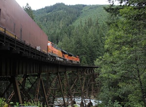
5.0Traveling east from Seattle on Highway 2, take a right hand turn onto Foss River Road (Road 68) just after the township of Skykomish. The pavement ends in 1.1 miles, beyond that be cautious of potholes. Continue along this road for a further 1.3 miles, at which point you will pass under a railroa...Read more -
Skykomish, Washington
Beckler Peak
7.55 mi / 2139 ft gainLooking for a gradual forest hike up to a peak with 360° views of the Cascades? Beckler Peak trail winds through old growth, past rushing waterfalls, and up to a granite summit. From the top, you can see mountains in the Cascades such as Glacier Peak, Mount Baring, Mount Index, Evergreen Mounta...Read more -
Snoqualmie Pass, Washington
Hike to Margaret Lake
6 mi / 1800 ft gainStarting at an elevation of 3,300 feet, begin the hike on a steep gravel road for 1/4 of a mile. Take a left onto a dirt road that will lead to an area of clear cuts and windy switchbacks.As daunting as this may seem, don't be discouraged. On a clear day, the surrounding peaks of Snoqualmie Pass ...Read more -
Snoqualmie Pass, Washington
Hike-In and Camp at Alaska Lake
Driving Directions: From Seattle drive east on I-90 to exit 54 (signed "Hyak"). Turn left (north) under the freeway and right on the frontage road marked "Gold Creek." After about 0.5 mile turn left (north) on Gold Creek Road (Forest Road 4832), and in another 0.5 mile reach a junction. To the le...Read more -
Snoqualmie Pass, Washington
Hike Gold Creek Pond
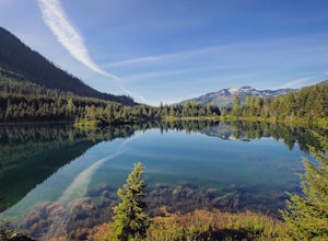
5.01 miThe quintessential family friendly hike, Gold Creek Pond is a simple yet spectacular hike next to Snoqualmie Pass. Easily accessible from the top of the pass (4.5 miles, 12 minute drive), the Gold Creek Pond hike is a simple addition to any itinerary if you're in the area. From Hwy 90, take exit...Read more -
Snoqualmie Pass, Washington
Snowshoe Gold Creek Pond
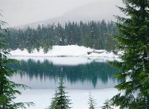
4 mi / 400 ft gainSince the parking lot is not plowed in the winter you have to park along the main road next to the drive way toward the hike. Once to the trial head it is smooth sailing the rest of the hike. When I went the snow was compacted so snowshoes were not necessary but they are very helpful. Once to the...Read more -
North Bend, Washington
Snowshoe Kendall Peak Lakes
9 mi / 2000 ft gainThis hike starts at the Gold Creek sno-park. You need the sno-park and discover pass for this. Park on the side of the road and start hiking up from there. Hike road up and up and up! It's very compact snow (at the moment, that will change fast with new snow coming in). We ended up leaving our sn...Read more -
Skykomish, Washington
Hike to Lake Deer via Lake Dorothy Trailhead
12.6 mi / 1600 ft gainStart off by traveling along Highway 2 and turning towards the Money Creek Campground. Turn off onto Forest Road 6410 and follow that to the Lake Dorothy Trailhead (about 9 miles).This first section of the hike can be pretty crowded on a nice summer day as the trail is very family friendly and it...Read more

