Olympic, Washington
Looking for the best hiking in Olympic? We've got you covered with the top trails, trips, hiking, backpacking, camping and more around Olympic. The detailed guides, photos, and reviews are all submitted by the Outbound community.
Top Hiking Spots in and near Olympic
-
Brinnon, Washington
Hike Lower Big Quilcene River
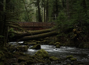
13 mi / 1800 ft gainWhile this hike does not provide any sort of fantastic views, its does provide an easy ~13 mile roundtrip hike from the trailhead to a parking lot for the Upper Big Quilcene Trail which leads to Marmot Pass. Along the way you will cross several bridges, some large and wide, other simple log bridg...Read more -
Port Angeles, Washington
Camp at Fairholme Campground
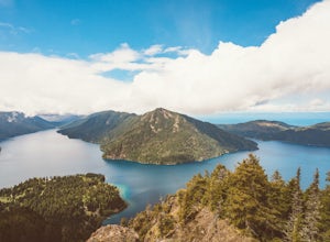
3.0The campground is right at the very north end of Lake Crescent. It has bathroom and potable water, and for just $20 a night I think it is well worth it. Each campsite is equipped with a table and firepit (bring firewood). Open between May and October; first come first serve. As for activities, t...Read more -
Brinnon, Washington
Rocky Brook Falls
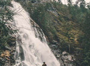
4.80.25 mi / 141 ft gainTo find the falls, head north up Hwy. 101 past Brinnon, Washington and hang a left at Dosewallips Rd. Keep an eye on the mile markers. Right after mile three and crossing a small bridge, there's a parking area on the left side enough for about 6 cars. The hike to Rocky Brook Falls is a short on...Read more -
27662-27664 Olympic Highway, Washington
Hike Falls View Canyon
1.5 mi / 300 ft gainThis hike is located immediately off of Highway 101 in the Falls View Campground. If the campground is closed you can park right outside of the gate (but don't block it) and hike in. Inside the gate you will see 3 paths in front of you, take a left and after about a quarter mile you will reach th...Read more -
Brinnon, Washington
Hike to Mt. Walker North & South Viewpoints
3.04 mi / 2000 ft gainDirections: From the Quilcene Ranger Station drive 4.6 miles south on US 101. Watch for the signs for Mount Walker View Point. Turn left onto Mount Walker Road. The trail head is about a quarter mile up the road with pull over parking on the left side of the road. In the winter and early spring, ...Read more -
Spoon Creek Falls Trail, Washington
Hike Spoon Creek Falls
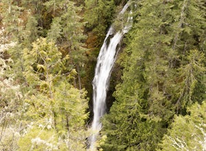
0.8 mi / 200 ft gainThis is a great low effort, high reward hike that offers several viewpoints along the trail of the falls below before it meanders all the way to the shore of the creek. While it doesn't take long to hike to this spot you can easily spend an entire morning or afternoon exploring everything it has ...Read more -
Sequim, Washington
Hike Dungeness Spit
3.511 mi / 130 ft gainPark at a the north side of the Dungeness Spit Recreation Area, in the Refuge parking lot. There is a kiosk at the Refuge where you can pay an entrance fee ($3) and check the Tide Table. Only attempt the hike at low tide or the sand spit becomes narrow and you have to climb over logs.Follow the R...Read more -
Seabeck, Washington
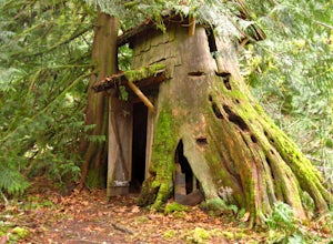
Hike to Guillemont Cove Stump House
4.52.5 miHave you ever been inside a stump house? This is your chance! Just outside of Seabeck, Washington lies a hobbit stump house tucked into a mossy forest on the shores of Guillemont Cove. Drive to Seabeck, turn right onto Miami Beach Road, bear left onto Stavis Bay road and continue for 4.5 miles...Read more -
Bremerton, Washington
Hike the Gold Creek Trail at Green Mountain
4.05 mi / 1000 ft gainThe Gold Creek Trail is one of several trails in the Green Mountain region. Although the trail is intertwined with others, it is almost impossible to start down the wrong path. The trail is well-marked and well-maintained, making this an excellent option for the family. The trail begins at the e...Read more -
Sooke, British Columbia
Hike East Sooke Park
Sitting very close to the southernmost point of Vancouver Island, facing west towards the mouth of the Strait of Juan de Fuca and the open Pacific Ocean, East Sooke Park is a unique and magical place for a hike or trail run. Your first visit will spark the desire to keep returning, to keep explor...Read more -
Forks, Washington
Explore Tide Pools at Kalaloch Beach 4
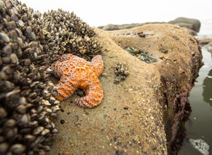
4.51 miParking at Kalaloch Beach 4 provides an easy walk to Olympic National Park's infamous tidal pools. With the correct tide schedule you will be able to explore and see ocean life such as starfish and sea anemones up close and personal. Kalaloch Beach 4 isn't the only place to explore tidal pools. Y...Read more -
Sooke, British Columbia
Hike Whiffin Spit
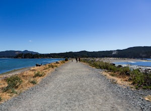
1.5 mi / 0 ft gainLocated in Sooke, between the Sooke Harbour and the Juan de Fuca Strait is Whiffin Spit Park. An easy 2.4km out and back trail with minimal elevation gain that you can walk to the end and back in about an hour. The dog-friendly gravel trail takes you down the spit to the end where you will find a...Read more -
Port Townsend, Washington
Hike to Point Wilson
5.02.5 mi / 0 ft gainThis trail offers amazing views of Mt. Baker, Vancouver Island, the San Juan Islands, and the Cascade Mountains. The Point Wilson trail is located in Fort Worden State Park on the Olympic Peninsula, along the Strait of Juan De Fuca. The trail is 2.5 miles round trip, and is accessible regardless ...Read more -
Victoria, British Columbia
Beacon Hill Park
5.0Beacon Hill Park is the jewel of Victoria's crown. Spanning 200 acres and connecting Downtown to the ocean alongside Dallas Road, Beacon Hill Park is one of the highlights of visiting the Capitol city on Vancouver Islands southern tip. Every corner of the park features unique flora, fauna and p...Read more -
Sooke, British Columbia
Hike Mount Manuel Quimper
The Sooke Hills is a geographic region of low hills with elevations between 350m (Mt. Wells) to a high of 682m (Mt. Empress), located in the area bounded on three sides by Highway 1 to the east, Highway 14 to the south and the Sooke River to the west. Though heavily logged 100+ years ago, in the ...Read more -
Sooke, British Columbia
Hike and Swim at Sooke Potholes
4.2The Sooke Potholes seem to have something for everyone. Those seeking quick and easy beach access can enjoy short, well-groomed trails that lead straight to the pebble beaches from each of this spot’s multiple parking lots. There are also a number of paths leading to viewpoints overlooking the ri...Read more

