Mountlake Terrace, Washington
Top Spots in and near Mountlake Terrace
-
Skykomish, Washington
4.0
4.2 mi
/ 2400 ft gain
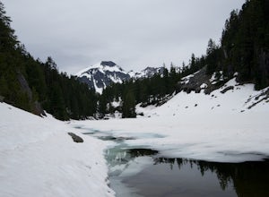
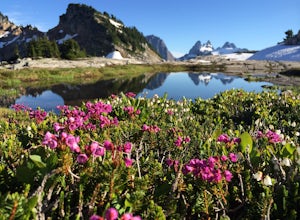
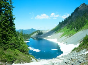
Choose from Trout Lake (1.6 miles each way with 500 feet of elevation gain), Copper Lake (4.2 miles each way with 2400 feet of elevation gain), or Big Heart Lake at 7.3 miles each way, with 3300 feet elevation gain). There are plenty of camp sites if you decide to go overnight at any of the lakes...
Read more
-
Leavenworth, Washington
4.5
2.88 mi
/ 1522 ft gain
This is a relatively short hike, at only 2.6 miles round trip, that takes you up to the nearly 5600 foot summit. The hike may be short but it is extremely steep, gaining 1300ft in the 1.3 miles to the summit, so be prepared for a good leg workout. On the way to the top you will walk through field...
Read more
-
North Bend, Washington
4.4
2.07 mi
/ 331 ft gain
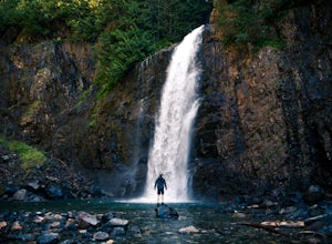
This is an easy 2 mile roundtrip hike that leads to beautiful Franklin Falls. The trail is very well maintained and is easy for even young hikers to travel. The trail goes through the forest and along a gorge as you gain 400 feet in elevation to the falls.
There are a few places you can scramble...
Read more
-
North Bend, Washington
Depending on the road conditions and where you parked, the hike will be somewhere between 5-6 miles roundtrip. I always advise checking the weather and Washington Trail Association trip reports for the latest information.
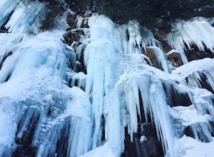
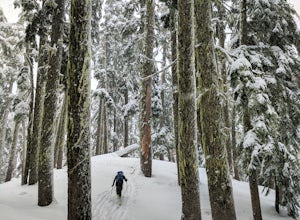
If conditions are ideal, grab your snowshoes and head to the mountains! Yo...
Read more
-
Darrington, Washington
Not for the faint of heart - or those with a fear of heights - Mount Pugh offers some of the most rewarding summit views in the Cascades.Located off the northern end of the Mountain Loop Highway, this is an easy day trip from anywhere in the Puget Sound area. Though finding the trailhead can be t...
Read more
-
Skykomish, Washington
This hike is definitely one of our all-time favorites. The first time we did it was in August 2015 and due to the exceptionally mild winter that year, fall was already beginning to show its colors. We wanted to see it again in the springtime when everything was in bloom, so we decided to go again...
Read more
-
Skykomish, Washington
Tucked high in the heart of the Alpine Lakes Wilderness, Tank Lakes has everything you could ask for out of a Washington hike. You start low at the Necklace Valley trailhead just south of Skykomish along Highway 2 and meander five miles to a giant log crossing of the East Fork Foss River.
From h...
Read more
-
North Bend, Washington
3.5
3.79 mi
/ 932 ft gain
As you begin your hike up to Lodge Lake you will pass through a small forest. After about .5 miles you will come out into the open. Simply follow the path under the chairlifts as you cut across the mountain. In the summer when there is no snow on the ground you can see lots of wildflowers. If you...
Read more
-
North Bend, Washington
The area around Kendall Knob is great for snowshoeing or ski touring. It is particularly nice for ski touring because there are a variety of short tours at varying difficulty and on varying aspects. Skiers or those on snowshoe can begin their trip at the PCT trailhead near the Commonwealth Campgr...
Read more
-
North Bend, Washington
Starting at the Snoqualmie Pass PCT trailhead, you start hiking through an old growth forest. This hike has a nice gradual incline with views starting near a talus field. Late June, early July wildflowers are growing like crazy along the trail. This field offers a up close view of Mt. Rainier alo...
Read more
-
North Bend, Washington
5.0
9.2 mi
/ 2800 ft gain
Kendall Peak is an easily accessible summit hike just off of Exit 52 of I-90 that offers spectacular 360-degree views of the entire Snoqualmie range. You’ll start out in the PCT parking lot where you’ll need a NW Forest Pass to park, or pay the daily fee. A permanent bathroom and backcountry acce...
Read more
-
North Bend, Washington
There are quite a few ways up Guye Peak ranging from a simple walk up to multiple pitches of technical rock climbing. Both of the routes described here start from the PCT parking lot north of exit 52 of I-90 at Snoqualmie Pass. Some of the scrambling described would be treacherous in wet or sno...
Read more
-
North Bend, Washington
The West Ridge of Thomson is rated 5.6 and is 4-5 pitches depending on how you break it up. The East Ridge is some spicy 4th class and although people do scramble it, it is recommend to use a rope on the descent.
The Approach
Starting at the PCT trail-head you have two options. You can take the ...
Read more
-
Skykomish, Washington
Looking for a gradual forest hike up to a peak with 360° views of the Cascades? Beckler Peak trail winds through old growth, past rushing waterfalls, and up to a granite summit. From the top, you can see mountains in the Cascades such as Glacier Peak, Mount Baring, Mount Index, Evergreen Mounta...
Read more
-
Anacortes, Washington
To start this hike, jump on trail 215 for a short distance of about a 1/4 mile. From here, continue until you cross trail 320 and head left onto it. Stay on 320 until you come across trail 230.Take 230 uphill (resembles an old fire road) toward the ravine just above a creek. From here, head onto ...
Read more
-
Snoqualmie Pass, Washington
Start off on the extremely rough Forest Service 9070 road. Follow this for just over 4 miles until you see a sign for trail #1348 on the right. There is only enough room for a couple cars at the trailhead.You start off climbing right away, covering 800 feet of elevation in the first 0.80 miles of...
Read more

