Moran State Park, Washington
Top Spots in and near Moran State Park
-
Coquitlam, British Columbia
Important: if you are planning on bringing a dog, and they are skittish around loud noises make sure to keep them leashed. This trail is beside the gun club and can spook dogs. You stop hearing the guns once you reach the powerline roadTo reach the trailhead, follow Harper Road until you reach th...
Read more
-
Vancouver, British Columbia
Located on UBC Vancouver campus, Wreck Beach is the only nude beach in Canada. It is a popular destination for students and the public, and is home to the best sunsets seen in Vancouver.To get to the beach, there is a descent of approximately 500 stairs, so be cautious - going down means having t...
Read more
-
Vancouver, British Columbia
Start at either end of Stanley Park, running directly along the pacific ocean on the seawall path. I prefer to run from Coal Harbour to south towards English Bay - a better view, and you can stop at sunset beach for a post-run drink!
Read more
-
Maple Ridge, British Columbia
An hour outside of downtown Vancouver lies the beautiful 150,000 acre Provincial Park of Golden Ears. The park has a myriad of hikes and adventures all with varying degrees of difficulty. The Spirea Nature Trail likely clocks in as one easiest amongst the dozens within the park. However, don’t le...
Read more
-
Deming, Washington
Located just outside the town of Glacier, WA and 40 minutes prior to Mount Baker Ski area, sits the Horseshoe Bend Trail. A simple and straightforward 6 mile out and back route.
To get here, take Hwy 542 towards the direction of Mount Baker. About 4 miles after you pass through the town of Glacie...
Read more
-
North Vancouver, British Columbia
Only 30 minutes from downtown Vancouver, Deep Cove is a great place to paddle in tranquil ocean waters. You can rent ocean kayaks, canoes and stand-up paddle boards from Deep Cove Kayak.The bay in front of the community is one of the few in Indian Arm that has both a sheltering shape and the shal...
Read more
-
North Vancouver, British Columbia
Setting out from Deep Cove’s pebble shoreline, it only takes a few minutes before you are away from small village and paddling the calm waters of this gorgeous arm. Seals can be frequently spotted as you follow the path of off oceanfront homes, some living off the grid, deeper into the mountains....
Read more
-
-
North Vancouver, British Columbia
3.8
2.4 mi
/ 328.1 ft gain
Deep Cove is a cozy little town located at the base of Mt. Seymour, lying on the shores of the Indian Arm which is a branch of the Burrard Inlet in North Vancouver. In autumn, the tree-lined streets glow orange in the sunlight and the sailboats, kayakers and paddleboarders fill the harbour with ...
Read more
-
North Vancouver, British Columbia
From the last field at inter city park, continue walking down the road to the Lynn Canyon trail. Follow the trail up the wooden boardwalks and to the first open area on the trail. When you can see the creek to your left, head down to the creek. To get to this particular swimming hole, you will ha...
Read more
-
Anmore, British Columbia
This hike begins near the parking lot of Buntzen Lake. The trailhead will read "Halvor Lunden Trail,” named after the man who made it. This part of the trail is well marked, however as you continue along the loop it gets less and less worn, making things more difficult, but also more natural.The ...
Read more
-
Maple Ridge, British Columbia
About one hour outside of Vancouver, Golden Ears Provincial Park is a great escape for hiking and paddling opportunities. The massive drive-in campgrounds are usually full for most of the summer, but deep into the lake's wilderness are marine spots for backcountry camping. Get your backcountry pe...
Read more
-
Anmore, British Columbia
Buntzen Lake is located in a beautiful recreation area just north of Port Moody. Although the lake is man-made and maintained by BC Hydro, the surrounding area is full of forests, nice beach areas, and many trails for hiking including the Buntzen Lake Trail, which loops around the lake.Beginning ...
Read more
-
Vancouver, British Columbia
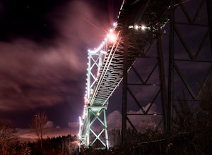
Park at the parking lot at Prospect point in Stanley Park to begin your photography adventure. The first photo opp is from the walkway on the Lions Gate, at about the middle of the bridge and looking to the left towards the Seawall. This is the perfect sunset spot.Once it gets dark, head to the b...
Read more
-
Concrete, Washington
4.5
7.64 mi
/ 2100 ft gain
This place is really the stuff of fairy tales.
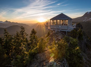
Where else can you find a tiny cabin with 360-degree views of stunning mountain scenery? To the west, you can see all the way to Bellingham and the Puget Sound. To the south and east lie the jagged North Cascades. And the entire northern horizon is ...
Read more
-
Concrete, Washington
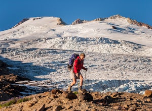
Begin at the Park Butte trailhead, trail 603. Hike past the first Scott Paul trail sign a few hundred feet from the trailhead. Continue on and cross appropriately name Rocky Creek heading up on the Park Butte Trail. Continue up the Park Butte trail passing the Scott Paul trail again at about 4,50...
Read more

